East Side of the West
Tom Schweich
|
East Side of the West | Collector's List for Tom Schweich Page 10 |
Tom Schweich | |
 |
|
Field Notes:
Coll. No. 3600, 12 Jun 2026.
|
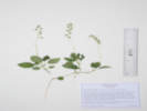
Name List: Anemonastrum canadense
3600. Anemonastrum canadense (L.) Mosyakin.
(39.2130,-105.3510,WGS 1984) with Rosa acicularis sayi
6/12/2026
North Twin Creek, Jefferson County, Colorado.
(Undist.
)
|
Field Notes:
Coll. No. 3601, 12 Jun 2026.
|
Name List: Geum macrophyllum var. perincisum
3601. Geum macrophyllum Willd. var. perincisum (Rydb.) Raup.
(39.2143,-105.3513,WGS 1984) streamside, in willow and aspen, with Dasophora fruticosa
6/12/2026
North Twin Creek, Jefferson County, Colorado.
(Undist.
)
|
Field Notes:
Coll. No. 3602, 12 Jun 2026.
|
Name List: Carex leptalea
3602. Carex leptalea Wahlenberg.
Openings in shaded, narrow streamside wetland among willows, aspens, and river birch, post-holed by cows, with Carex interior, another Carex (eaten leaves, no inflorescence). On a right branch of North Twin Creek, about 900 m. upstream of the F. R. 211 crossing of North Twin Creek, 6.8 mi. west and south on F. R. 211 from its north end at County Road 126, 11.6 km. southwest of Deckers. (39.2142,-105.3514,WGS 1984) About 28 m. downstream from Coll. No. 3439.3, 2 July 2025, KHD85968; also seen on the main branch of North Twin Creek. Within the perimeter of the Hayman Fire (2002), though this area mapped as low intensity; vegetated only on the creek, forest not re-established away from creek.
6/12/2026
North Twin Creek, Jefferson County, Colorado.
(Undist.
)
|
Field Notes:
Coll. No. 3603, 12 Jun 2026.
|
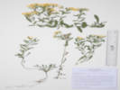
Name List: Erigeron flagellaris
3603. Erigeron flagellaris A. Gray.
tangle of small plants in a small patch, about 2 m. by 3 m., east-facing dru slope partially shaded by aspens that are in the creek. (39.2142,-105.3513,WGS 1984)
6/12/2026
North Twin Creek, Jefferson County, Colorado.
(Undist.
)
|
Field Notes:
Coll. No. 3604, 12 Jun 2026.
|
Name List: Bromus
3604. Bromus L.
Ridge between North Twin Creek and its northern tributary (39.2144,-105.3520,WGS 1984) Artemisia frigida, Arctostaphylos uva-ursi, Verbascum thapsus, Drymocallis fissa
6/13/2026
North Twin Creek, Jefferson County, Colorado.
(Undist.
)
|
Field Notes:
Coll. No. 3605, 12 Jun 2026.
|
Name List: Undetermined
3605. Undetermined.
(39.2151,-105.3535,WGS 1984) banks of streamside- openings in river birch
6/12/2026
North Twin Creek, Jefferson County, Colorado.
(Undist.
)
|
Field Notes:
Coll. No. 3606, 12 Jun 2026.
|
Name List: Sedum lanceolatum
3606. Sedum lanceolatum Torr.
(39.2152,-105.3544,WGS 1984) very sparse Douglas fir and ponderosa pine forest floor
6/12/2026
North Twin Creek, Jefferson County, Colorado.
(Undist.
)
|
Field Notes:
Coll. No. 3607, 12 Jun 2026.
|
Name List: Erigeron divergens
3607. Erigeron divergens Torr. & A. Gray.
lvs entire, ray fls white (39.2148,-105.3541,WGS 1984)
6/12/2026
North Twin Creek, Jefferson County, Colorado.
(Undist.
)
|
Miscellaneous Notes on the Colorado Flora:
Saxifraga bronchialis austromontana.
Field Notes:
Coll. No. 3608, 12 Jun 2026.
|
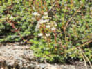
Name List: Saxifraga bronchialis var. austromontana
3608. Saxifraga bronchialis L. var. austromontana (Wiegand) Piper.
dotted petals (39.2141,-105.3530,WGS 1984) side of disintegrating outcrop of Pikes Peak granite
6/12/2026
North Twin Creek, Jefferson County, Colorado.
(Undist.
)
|
Field Notes:
Coll. No. 3609, 12 Jun 2026.
|
Name List: Aletes anisatus
3609. Aletes anisatus (A. Gray) W. L. Theob. & C. C. Tseng.
10-12 plants, grus behind outcrop (39.2140,-105.3529,WGS 1984) Artemisia sp., Drymocallis fissa, Rubus idaea, Carex inops heliophila
6/12/2026
North Twin Creek, Jefferson County, Colorado.
(Undist.
)
|
Field Notes:
Coll. No. 3610, 12 Jun 2026.
|
Name List: Undetermined
3610. Undetermined.
(39.2098,-105.3483,WGS 1984)
6/12/2026
North Twin Creek, Jefferson County, Colorado.
(Undist.
)
|
Field Notes:
Coll. No. 3611, 12 Jun 2026.
|
Name List: Ceanothus fendleri
3611. Ceanothus fendleri A. Gray.
(39.2087,-105.3458,WGS 1984)
6/12/2026
North Twin Creek, Jefferson County, Colorado.
(Undist.
)
|
Field Notes:
Coll. No. 3612, 22 Jun 2026.
|
Name List: Undetermined
3612. Undetermined.
lowest slope just above willows in watercourse (39.7597,-105.2397,WGS 1984)
6/22/2026
Magpie Gulch, Jefferson County, Colorado.
(Undist.
)
|
Field Notes:
Coll. No. 3613, 22 Jun 2026.
|
Name List: Hordeum
3613. Hordeum Wild Barley.
(39.7596,-105.2403,WGS 1984)
6/22/2026
Magpie Gulch, Jefferson County, Colorado.
(Undist.
)
|
Field Notes:
Coll. No. 3614, 22 Jun 2026.
|
Name List: Juncus
3614. Juncus L.
(39.7596,-105.2403,WGS 1984)
6/22/2026
Magpie Gulch, Jefferson County, Colorado.
(Undist.
)
|
Field Notes:
Coll. No. 3615, 22 Jun 2026.
|
Name List: Carex
3615. Carex L.
(39.7596,-105.2403,WGS 1984)
6/22/2026
Magpie Gulch, Jefferson County, Colorado.
(Undist.
)
|
Field Notes:
Coll. No. 3616, 22 Jun 2026.
|
Name List: Undetermined
3616. Undetermined.
(39.7596,-105.2402,WGS 1984)
6/22/2026
Magpie Gulch, Jefferson County, Colorado.
(Undist.
)
|
Field Notes:
Coll. No. 3617, 26 Jun 2026.
|
Name List: Linaria vulgaris
3617. Linaria vulgaris Mill.
Weed:
CO DofA, List: B.
(39.2067,-105.3500,WGS 1984)
6/26/2026
Twin Creek, Jefferson County, Colorado.
(Undist.
)
|
Field Notes:
Coll. No. 3618, 26 Jun 2026.
|
Name List: Geranium richardsonii
3618. Geranium richardsonii Fisch. & Trautv.
flowers white (39.2070,-105.3503,WGS 1984) stream bank, open shade
6/27/2026
Twin Creek, Jefferson County, Colorado.
|
Field Notes:
Coll. No. 3619, 26 Jun 2026.
|
Name List: Galium triflorum
3619. Galium triflorum Michx.
(39.2102,-105.3554,WGS 1984) cascade
6/26/2026
Twin Creek, Jefferson County, Colorado.
(Undist.
)
|
Field Notes:
Coll. No. 3619.1, 26 Jun 2026.
|
Name List: Veronica
3619.1 Veronica .
(39.2102,-105.3554,WGS 1984) cascade
6/26/2026
Twin Creek, Jefferson County, Colorado.
(Undist.
)
|
Field Notes:
Coll. No. 3620, 26 Jun 2026.
|
Name List: Chamerion angustifolium
3620. Chamerion angustifolium (L.) Holub.
(39.2098,-105.3548,WGS 1984) base of boulders
6/26/2026
Twin Creek, Jefferson County, Colorado.
(Undist.
)
|
Field Notes:
Coll. No. 3621, 3 Aug 2026.
|
Name List: Hymenoxys richardsonii var. floribunda
3621. Hymenoxys richardsonii (Hook.) Cockerell var. floribunda (A. Gray) Parker.
In a the mouth of a small canyon on the north side of Salt Creek, about 4.3 miles west on F. R. 435 “Salt Creek Road” from its origin at US Highway 285, 113 km. southwest of Golden. (38.9535,-106.0331,WGS 1984) Mixed forest and dry open places depending on slope aspect with: Juniperis communis, Pinus aristata, Pseudotsuga menziesii, Artemisia frigida, Ericameria parryi, Frasera speciosa, and Dasiphora fruticosa.
8/3/2026
Salt Creek, Park County, Colorado.
(d: CS(158)
, d: FLD(161)
, d: EIU(159)
)
|
Field Notes:
Coll. No. 3622, 3 Aug 2026.
|
Name List: Marchantia
3622. Marchantia L.
Near the mouth of a small canyon on the north side of Salt Creek, about 4.3 miles west on F. R. 435 “Salt Creek Road” from its origin at US Highway 285, 113 km. southwest of Golden. (38.9535,-106.0331,WGS 1984) Post-holed narrow stream wetland. Mixed forest and dry open places depending on slope aspect with: Juniperis communis, Pinus aristata, Pseudotsuga menziesii, Artemisia frigida, Ericameria parryi, Frasera speciosa, and Dasiphora fruticosa.
8/3/2026
Salt Creek, Park County, Colorado.
(KHD
)
|
Field Notes:
Coll. No. 3623, 3 Aug 2026.
|
Name List: Epilobium hornemannii
3623. Epilobium hornemannii Rchb.
Near the mouth of a small canyon on the north side of Salt Creek, about 4.3 miles west on F. R. 435 “Salt Creek Road” from its origin at US Highway 285, 113 km. southwest of Golden. (38.9535,-106.0331,WGS 1984) Post-holed narrow stream wetland. Mixed forest and dry open places depending on slope aspect with: Juniperis communis, Pinus aristata, Pseudotsuga menziesii, Artemisia frigida, Ericameria parryi, Frasera speciosa, and Dasiphora fruticosa.
8/3/2026
Salt Creek, Park County, Colorado.
(KHD
)
|
Comments: 10/26/2026, Coll. No. 3623, 3 Aug 2026, characters observed: Perennial plants to 15 cm.; Stems, scraggly hairs in lines decurrent with connate bases of leaves above, not glandular; Leaves, opposite, bases connate, petioles 1 mm., blade 18 mm. × 8 mm. wide, ovate to elliptic, distinct lateral veins glabrous, barely dentate; Pedicels slender; Sepals, 3 mm., fused at base, very few short hairs in the sinus between sepals; Petals, #4, 4 mm., white, tip notched; Capsule, to 35 mm., glabrous; Seeds, 1.2 mm., papillate, some adaxially longitudinally grooved, though not by rows of papillae.
Miscellaneous Notes on the Colorado Flora:
Ericameria parryi parryi.
Colorado, Pike-San Isabel Forest, Forest Road 435:
at crooked cyn.
Field Notes:
Coll. No. 3624, 3 Aug 2026.
|
Name List: Ericameria parryi var. parryi
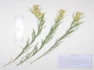
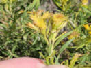
3624. Ericameria parryi (A. Gray) G. L. Nesom & G. I. Baird var. parryi.
Leaves ≥ infl, minutely stipitate-glandular. Small canyon, north of Salt Creek, and Pike-San Isabel National Forest Road 435 "Salt Creek Road," 4.4 mi. by road west of US Highway 285, 6.7 km. northwest of Antero Junction. (38.9537,-106.0334,WGS 1984) Dry slope above barely seeping creek, with Pinus aristata, P. contorta, Pseudotsuga menziesii, Artemisia frigida, A. tridentata ssp. vaseyana, and Hymenoxis richardsonii var. floribunda.
8/3/2026
Salt Creek, Park County, Colorado.
(d: CS(158)
, d: EIU(159)
, d: REGIS(160)
, Undist.
)
|
Field Notes:
Coll. No. 3625, 3 Aug 2026.
|
Name List: Artemisia frigida
3625. Artemisia frigida Willd.
Dry, sunny places in a small canyon, north of Salt Creek, and Pike-San Isabel National Forest Road 435 "Salt Creek Road," 4.4 mi. by road west of US Highway 285, 6.7 km. northwest of Antero Junction. (38.9538,-106.0334,WGS 1984) Mixed forest and dry open places depending on slope aspect with: Juniperis communis, Pinus aristata, Pseudotsuga menziesii, Artemisia frigida, Ericameria parryi, Frasera speciosa, and Dasiphora fruticosa.
8/3/2026
Salt Creek, Park County, Colorado.
(COLO
, CS
, REGIS
)
|
Field Notes:
Coll. No. 3626, 3 Aug 2026.
|
Name List: Artemisia tridentata ssp. vaseyana
3626. Artemisia tridentata Nutt. ssp. vaseyana (Rydb.) Beetle.
3-5 dm. tall, inflorescence flat-topped. Dry, sunny places in a small canyon, north of Salt Creek, and Pike-San Isabel National Forest Road 435 "Salt Creek Road," 4.4 mi. by road west of US Highway 285, 6.7 km. northwest of Antero Junction. (38.9538,-106.0334,WGS 1984) Mixed forest and dry open places depending on slope aspect with: Juniperis communis, Pinus aristata, Pseudotsuga menziesii, Artemisia frigida, Ericameria parryi, Frasera speciosa, and Dasiphora fruticosa.
8/3/2026
Salt Creek, Park County, Colorado.
(CAS
, COLO
, CS
, EIU
)
|
Field Notes:
Coll. No. 3626, 3 Aug 2026.
|
Name List: Artemisia ludoviciana ssp. ludoviciana
3627. Artemisia ludoviciana Nutt. ssp. ludoviciana.
Leaves entire or shallowly lobed on upper portion. Dry, partly-sunny south-facing slope above a small canyon, about 500 m. north of Salt Creek, and Pike-San Isabel National Forest Road 435 "Salt Creek Road," 4.4 mi. by road west of US Highway 285, 7.0 km. northwest of Antero Junction. (38.9568,-106.0337,WGS 1984) Mixed forest and dry open places depending on slope aspect with: Juniperis communis, Pinus aristata, Pseudotsuga menziesii, Artemisia frigida, Ericameria parryi, Frasera speciosa, and Dasiphora fruticosa. Both varieties ludoviciana and incompta have been collected along Salt Creek.
8/3/2026
Salt Creek, Park County, Colorado.
(EIU
, FLD
, REGIS
)
|
|
Name List: Pinus aristata
3628. Pinus aristata Engelm.
(38.9537,-106.0309,WGS 1984)
8/3/2026
Salt Creek, Park County, Colorado.
(Undist.
)
|
Field Notes:
Coll. No. 3629, 4 Aug 2026.
|
Name List: Senecio bigelovii var. hallii
3629. Senecio bigelovii A. Gray var. hallii A. Gray.
Thick fibrous-rooted caudices, short tomentose proximally and long multicellular flocose throughout, heads nodding, rayless. Right bank of North Fork of Lake Creek, 57 m. southeast of the historical location of Brumley, 10.7 miles on Colorado State Highway 82 generally west of Twin Lakes, 136 km. southwest of Golden. (39.0892,-106.5423,WGS 1984) Rooted in deep sand on bank of creek. Full sun. Collected with Agoseris aurantiaca.
8/4/2026
Brumley, Lake County, Colorado.
(FLD
, KHD
, OBI
, UCR
)
|
Comments: 10/30/2026, Coll. No. 3657, 23 Oct 2026, characters observed: Perennial, to 22 cm., rhizomatous; Leaves, opposite, bases connate, ternately dissected into linear segments; Heads, borne singly on peduncles, 11 mm.; Phyllaries, 2 series, similar, 7 mm., flat, gland-dotted, strigose; Receptacle, epaleate; Flowers, of 2 kinds; Rays, blade 4 mm., >disk flowers; Pappus, scales, 1.8 mm.; Cypselae, gland-dotted.
Field Notes:
Coll. No. 3630, 4 Aug 2026.
|
Name List: Agoseris aurantiaca var. purpurea
3630. Agoseris aurantiaca (Hooker) Greene var. purpurea (A. Gray) Cronquist.
Phyllaries imbricate, broad, some mucronate, some obtuse; Flower color a faded pinkish-orange when collected, purple when dry. Right bank of North Fork of Lake Creek, 57 m. southeast of the historical location of Brumley, 10.7 miles on Colorado State Highway 82 generally west of Twin Lakes, 136 km. southwest of Golden. (39.0892,-106.5423,WGS 1984) Rooted in deep sand on bank of creek. Full sun. Collected with Senecio bigelovii var. hallii. Brumley was a stage station on the route across Independence Pass.
8/4/2026
Brumley, Lake County, Colorado.
(OBI
)
|
Field Notes:
Coll. No. 3631, 4 Aug 2026.
|
Name List: Galium boreale
3631. Galium boreale L.
Slope on the right bank of North Fork of Lake Creek, 30 m. northwest of the historical location of Brumley, 10.7 miles on Colorado State Highway 82 generally west of Twin Lakes, 136 km. southwest of Golden. (39.0896,-106.5431,WGS 1984) Growing in Dasiphora fruticosa in a meadow with Campanula parryi and Gentiana parryi. Brumley was a stage station on the route across Independence Pass.
8/4/2026
Brumley, Lake County, Colorado.
(CAS
, KHD
, OBI
, UCR
)
|
Field Notes:
Coll. No. 3632, 4 Aug 2026.
|
Name List: Campanula parryi
3632. Campanula parryi A. Gray.
Slope on the right bank of North Fork of Lake Creek, 30 m. northwest of the historical location of Brumley, 10.7 miles on Colorado State Highway 82 generally west of Twin Lakes, 136 km. southwest of Golden. (39.0896,-106.5431,WGS 1984) In a meadow with Gentiana parryi, Dasiphora fruticosa, Galium boreale, and Danthonia intermedia. Brumley was a stage station on the route across Independence Pass.
8/4/2026
Brumley, Lake County, Colorado.
(FLD
)
|
Field Notes:
Coll. No. 3633, 4 Aug 2026.
|
Name List: Gentiana parryi
3633. Gentiana parryi Engelm.
Slope on the right bank of North Fork of Lake Creek, 70 m. northwest of the historical location of Brumley, 10.7 miles on Colorado State Highway 82 generally west of Twin Lakes, 136 km. southwest of Golden. (39.0897,-106.5435,WGS 1984) In a meadow with Campanula parryi, Dasiphora fruticosa, Galium boreale, and Danthonia intermedia. Brumley was a stage station on the route across Independence Pass.
8/4/2026
Brumley, Lake County, Colorado.
(CAS
, FLD
, REGIS
)
|
Field Notes:
Coll. No. 3634, 4 Aug 2026.
|
Name List: Vicia americana
3634. Vicia americana Willd.
Climbing in Dasiphora fruticosa. Slope on the right bank of North Fork of Lake Creek, about 84 m. north of the historical location of Brumley, 10.7 miles on Colorado State Highway 82 generally west of Twin Lakes, 136 km. southwest of Golden. (39.0902,-106.5426,WGS 1984) Meadow between the creek and forest. Brumley was a stage station on the route across Independence Pass.
8/4/2026
Brumley, Lake County, Colorado.
(FLD
, UCR
)
|
Field Notes:
Coll. No. 3635, 4 Aug 2026.
|
Name List: Callitriche palustris
3635. Callitriche palustris L.
Still water in small cove on right bank of North Fork of Lake Creek, about 70 m. northeast of the historical location of Brumley, 10.7 miles on Colorado State Highway 82 generally west of Twin Lakes, 136 km. southwest of Golden. (39.0900,-106.5424,WGS 1984) Brumley was a stage station on the route across Independence Pass.
8/4/2026
Brumley, Lake County, Colorado.
(KHD
)
|
Field Notes:
Coll. No. 3635.1, 4 Aug 2026.
|
Name List: Sagina saginoides
3635.1 Sagina saginoides (L.) H. Karst.
Right bank of North Fork of Lake Creek, about 70 m. northeast of the historical location of Brumley, 10.7 miles on Colorado State Highway 82 generally west of Twin Lakes, 136 km. southwest of Golden. (39.0900,-106.5424,WGS 1984) Several plants growing in the mud at the waterline of a small cove with still water, collected with Callitriche palustris. Brumley was a stage station on the route across Independence Pass.
8/4/2026
Brumley, Lake County, Colorado.
(KHD
)
|
Field Notes:
Coll. No. 3636, 4 Aug 2026.
|
Name List: Betula glandulosa
3636. Betula glandulosa Michx.
Rooted in the bank of the creek. Right bank of North Fork of Lake Creek, about 45 m. northeast of the historical location of Brumley, 10.7 miles on Colorado State Highway 82 generally west of Twin Lakes, 136 km. southwest of Golden. (39.0896,-106.5424,WGS 1984) Brumley was a stage station on the route across Independence Pass.
8/4/2026
Brumley, Lake County, Colorado.
(KHD
, OBI
)
|
Field Notes:
Coll. No. 3637, 5 Aug 2026.
|
Name List: Bistorta vivipara
3637. Bistorta vivipara (L.) Delarbre.
Past flowering. Wetland in a small ravine 427 m. southeast of the GNIS point of Lily Lake, 12.55 km. north northwest of Leadville, 108 km. southwest of Golden. (39.3493,-106.3641,WGS 1984) Spring about 20 meters below the level of Lily Lake and possibly fed therefrom.
8/5/2026
Lily Lake, Lake County, Colorado.
(FLD
)
|
Field Notes:
Coll. No. 3637.1, 5 Aug 2026.
|
Name List: Mitella pentandra
3637.1 Mitella pentandra Hook.
Past flowering, leaf margins mucronate toothed, pedicels 2-3.8 mm. Wetland in a small ravine 427 m. southeast of the GNIS point of Lily Lake, 12.55 km. north northwest of Leadville, 108 km. southwest of Golden. (39.3493,-106.3641,WGS 1984) Spring about 20 meters below the level of Lily Lake and possibly fed therefrom.
8/5/2026
Lily Lake, Lake County, Colorado.
(KHD
)
|
Field Notes:
Coll. No. 3638, 5 Aug 2026.
|
Name List: Orthilia secunda
3638. Orthilia secunda (L.) House.
Past flowering; leaves scattered over bottom third of stem; styles 5-6 mm., straight. Wetland in a small ravine 427 m. southeast of the GNIS point of Lily Lake, 12.55 km. north northwest of Leadville, 108 km. southwest of Golden. (39.3492,-106.3642,WGS 1984) Spring about 20 meters below the level of Lily Lake and possibly fed therefrom.
8/5/2026
Lily Lake, Lake County, Colorado.
(FLD
)
|
Field Notes:
Coll. No. 3638.2, 5 Aug 2026.
|
Name List: Undetermined
3638.2 Undetermined.
(39.3492,-106.3642,WGS 1984)
8/5/2026
Lily Lake, Lake County, Colorado.
(Undist.
)
|
Field Notes:
Coll. No. 3640, 5 Aug 2026.
|
Name List: Undetermined
3640. Undetermined.
(39.3493,-106.3644,WGS 1984)
8/5/2026
Lily Lake, Lake County, Colorado.
(Undist.
)
|
Field Notes:
Coll. No. 3639, 5 Aug 2026.
|
Name List: Swertia perennis
3640. Swertia perennis L.
(39.3492,-106.3643,WGS 1984)
8/5/2026
Lily Lake, Lake County, Colorado.
(Undist.
)
|
Field Notes:
Coll. No. 3640.1, 5 Aug 2026.
|
Name List: Carex nebrascensis
3640.1 Carex nebrascensis Dewey.
(39.3493,-106.3644,WGS 1984)
8/5/2026
Lily Lake, Lake County, Colorado.
(Undist.
)
|
Field Notes:
Coll. No. 3640.2, 5 Aug 2026.
|
Name List: Carex occidentalis
3640.2 Carex occidentalis L. H. Bailey.
(39.3493,-106.3644,WGS 1984)
8/5/2026
Lily Lake, Lake County, Colorado.
(Undist.
)
|
Field Notes:
Coll. No. 3641, 6 Aug 2026.
|
Name List: Elymus trachycaulus
3641. Elymus trachycaulus (Link) Gould ex Shinners.
(39.2982,-106.3159,WGS 1984)
8/6/2026
Unnamed Gulch on Forest Road 189, Lake County, Colorado.
(Undist.
)
|
Field Notes:
Coll. No. 3642, 6 Aug 2026.
|
Name List: Undetermined
3642. Undetermined.
(39.2981,-106.3158,WGS 1984)
8/6/2026
Unnamed Gulch on Forest Road 189, Lake County, Colorado.
(Undist.
)
|
Miscellaneous Notes on the Colorado Flora:
Ericameria parryi parryi.
Colorado, Pike-San Isabel National Forest, Forest Road 189:
on the road.
Field Notes:
Coll. No. 3643, 6 Aug 2026.
|
Name List: Ericameria parryi var. parryi
3643. Ericameria parryi (A. Gray) G. L. Nesom & G. I. Baird var. parryi.
Leaves ≥ infl., minutely stipitate-glandular. Along Pike-San Isabel National Forest Road 189, about 1 km. east of County Road 18 “East Tennessee Road,” 7.37 km. north northwest of the GNIS location of Leadville. (39.2987,-106.3164,WGS 1984) Openings in aspen forest, mixed with patches of mountain big sagebrush and willows.
8/6/2026
Unnamed Gulch on Forest Road 189, Lake County, Colorado.
(d: KHD(152)
, d: UCR(155)
, d: OBI(154)
, Undist.
)
|
Field Notes:
Coll. No. 3644, 14 Aug 2026.
|
Name List: Daucus carota
3644. Daucus carota L.
(39.8859,-105.2630,WGS 1984) with Cicorium intybus, Cirsium arvense, Plantago lanceolata, Rosa arkansana, Bromus inermis
8/14/2026
Ranson/Edwards Homestead Open Space Park, Jefferson County, Colorado.
(Undist.
)
|
Field Notes:
Coll. No. 3645, 14 Aug 2026.
|
Name List: Helianthus pauciflorus ssp. subrhomboideus
3645. Helianthus pauciflorus Nutt. ssp. subrhomboideus (Rydb.) O. Spring & E. Schilling.
Small colony south side of watercourse, few in flower. 1.7 miles west on CO Highway 72 "Coal Creek Canyon Road" from its intersection with CO Highway 93, 0.9 miles generally north on Plainview Road, then 430 m. west northwest across the field; 15.1 km. north northwest of Golden. (39.8866,-105.2669,WGS 1984) Open grassy field, also collected here: Asclepias viridiflora, Helianthus pumilis, Madia glomerata, Mentha arvensis, Mirabilis linearis, Linaria dalmatica, and Muhlenbergia montana.
8/14/2026
Ranson/Edwards Homestead Open Space Park, Jefferson County, Colorado.
(TAS Plastic
)
|
Field Notes:
Coll. No. 3646, 14 Aug 2026.
|
Name List: Helianthus annuus
3646. Helianthus annuus L.
Beside Plainview Road, 1.7 miles west on CO Highway 72 "Coal Creek Canyon Road" from its intersection with CO Highway 93, then 0.6 miles generally north on Plainview Road; 14.5 km. north northwest of Golden. (39.8816,-105.2640,WGS 1984) Roadside gravel, also collected nearby Liatris punctata, Xanthium strumarium, Chamaesyce serpyllifolia, Amorpha fruticosa, Mirabilis nyctaginea, and Fallopia convolvulus.
8/14/2026
Ranson/Edwards Homestead Open Space Park, Jefferson County, Colorado.
(TAS Plastic
)
|
Park County Road 58:
at Coll. No. 3647.
Field Notes:
Coll. No. 3647, 28 Aug 2026.
|
Name List: Ericameria parryi var. parryi
3647. Ericameria parryi (A. Gray) G. L. Nesom & G. I. Baird var. parryi.
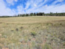
Some leaves > inflorescence; leaves, to 65 mm., minutely stipitate-glandular; flowers intense yellow. Along Park County Road 58 about 250 m. west of US Highway 285, 1.6 miles north of Kenosha Pass, Park County, Colorado. (39.4332,-105.7618,WGS 1984) Gentle, south-facing upper montane opening dominated by short grasses and sparse shrubs, about mid-way between the wetlands of Hoosier Creek and lodgepole pine (Pinus contorta) forest canopy.
8/29/2026
Hoosier Creek, Park County, Colorado.
(d: CAS(156)
, d: CS(158)
, d: COLO(157)
, TAS
)
|
Field Notes:
Coll. No. 3648, 2 Sep 2026.
|
Name List: Brickellia grandiflora
3648. Brickellia grandiflora (Hook.) Nutt.
About 250 meters upstream of Goose Creek where Twin Creek passes through a short, narrow canyon, 7.6 miles west and south on Forest Road 211 "Goose Creek Road" from its intersection with County Road 126 "Deckers Road," 64 km. south of Golden. (39.1961,-105.3435,WGS 1984) Nestled between small granite outcrops, with Artemisia frigida, Rosa sp., and Rubus idaeus var. strigosus.
9/2/2026
Twin Creek, Jefferson County, Colorado.
(d: EIU(159)
, d: REGIS(160)
, d: FLD(161)
, KHD
)
|
Field Notes:
Coll. No. 3649, 2 Sep 2026.
|
Name List: Humulus neomexicanus
3649. Humulus neomexicanus (A. Nelson & Cockerell) Rydb.
About 250 meters upstream of Goose Creek where Twin Creek passes through a short, narrow canyon, 7.6 miles west and south on Forest Road 211 "Goose Creek Road" from its intersection with County Road 126 "Deckers Road," 64 km. south of Golden. (39.1957,-105.3430,WGS 1984) In boulders just above the creek, climbing over both down and live trees, with Betula occidentalis, Acer glabrum, Verbascum thapsus, Cirsium arvense and a Thalictrum sp. cf. T. sparsiflorum. Mixed burned and live mature Douglas fir and ponderosa pines suggest the Hayman Fire (2002) may have burned with low to medium intensity here.
9/2/2026
Twin Creek, Jefferson County, Colorado.
(d: CAS(156)
, d: REGIS(160)
, Undist.
)
|
Field Notes:
Coll. No. 3649.1, Thalictrum sp..
|
Name List: Thalictrum
3649.1 Thalictrum L.
About 250 meters upstream of Goose Creek where Twin Creek passes through a short, narrow canyon, 7.6 miles west and south on Forest Road 211 "Goose Creek Road" from its intersection with County Road 126 "Deckers Road," 64 km. south of Golden. (39.1957,-105.3430,WGS 1984) Leaning or scrambling on Humulus neomexicanus in boulders just above the creek, with Betula occidentalis, Acer glabrum, Verbascum thapsus, and Cirsium arvense. Resembles T. sparsiflorum, but insufficient mature fruit/leaf material to distinguish confidently from T. fendleri.
9/2/2026
Twin Creek, Jefferson County, Colorado.
(Undist.
)
|
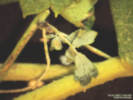
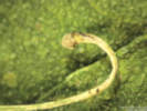
Comments: 9/24/2026, Coll. No. 3649.1, 2 September 2026, Twin Creek, Jefferson County, Colorado, USA, elevation 2282 meters (7487 feet), an accidental collection, a small stem, leaning or scrambling through Humulus neomexicana, only vegetative, post flower and fruit, nodes have one compound leaf, a small vegetative shoot, and an slender 16-18 mm. appendage terminating in a rounded/capitate structure possibly a recurved pedicel; leaves alternate but nodes can be closely spaced giving the appearance of opposite leaves, petiole 4-5 mm., leaflets 3+, leaflet 7 mm. by 5 mm. wide, lobes 3, possibly more lobes forming but indistinct OR once serrate, veins palmate, lobe margins entire, slightly revolute, minutely stipitate-glandular. Dried leaves with a bluish (abaxial) to purplish (adaxial) cast. Resembles T. sparsiflorum, but insufficient mature fruit/leaf material to distinguish confidently from T. fendleri.
Field Notes:
Coll. No. 3650, 2 Sep 2026.
|
Name List: Mentha arvensis
3650. Mentha arvensis L.
Flowers in dense axillary clusters at the nodes. About 250 meters upstream of Goose Creek where Twin Creek passes through a short, narrow canyon, 7.6 miles west and south on Forest Road 211 "Goose Creek Road" from its intersection with County Road 126 "Deckers Road," 64 km. south of Golden. (39.1958,-105.3432,WGS 1984) In creek with Veronica americana.
9/2/2026
Twin Creek, Jefferson County, Colorado.
(COLO
, FLD
)
|
Field Notes:
Coll. No. 3651, 2 Sep 2026.
|
Name List: Symphyotrichum laeve var. geyeri
3651. Symphyotrichum laeve (L.) Á. Löve & D. Löve var. geyeri (A. Gray) G.L. Nesom.
Rooted in bank of creek. with Mentha arvensis and Veronica americana. About 250 meters upstream of Goose Creek where Twin Creek passes through a short, narrow canyon, 7.6 miles west and south on Forest Road 211 "Goose Creek Road" from its intersection with County Road 126 "Deckers Road," 64 km. south of Golden. (39.1959,-105.3434,WGS 1984) Brickellia grandiflora, Betula occidentalis, Humulus neomexicanus, Cornus sericea, Ribes cereum, R. inerme, Prunus virginiana, Rubus idaeus, Acer glabrum, Carex inops ssp. heliopila, and C. occidentalis. Mixture of burned and live mature Douglas fir and ponderosa pines suggest the Hayman Fire (2002) may have burned with low to medium intensity here.
9/2/2026
Twin Creek, Jefferson County, Colorado.
(CS
, EIU
, FLD
, OBI
)
|
Field Notes:
Coll. No. 3652, 2 Sep 2026.
|
Name List: Heterotheca foliosa
3652. Heterotheca foliosa (Nutt.) Shinners.
Heads subtended by leafy bracts that exceed the involucre. Along cow/horse trails, about 100 m. northwest of the crossing of North Twin Creek by F. R. 211, 6.8 mi. west and south on F. R. 211 from its north end at County Road 126, 11.7 km. southwest of Deckers. (39.2088,-105.3459,WGS 1984) Forest floor, tall ponderosa pine and Douglas fir that appear to have survived the Hayman Fire (2002).
9/2/2026
North Twin Creek, Jefferson County, Colorado.
(d: UCR(155)
, d: OBI(154)
, d: COLO(157)
, KHD
)
|
Magpie Gulch Trail, Golden, Jefferson County, Colorado:
at New Loveland Mine Park.
Field Notes:
Coll. No. 3653, 7 Sep 2026.
|
Name List: Cenchrus longispinus
3653. Cenchrus longispinus (Hack.) Fern.
One plant found, summer annual grass, native to Colorado, but the sharp-spined burs limit usability of public park space. Approximate center of park, in mowed verge of natural area adjacent to sidewalk, in a strip about 1 m. wide by 9 m. long, 1.02 km. (geodesic) northwest of the GNIS location of Golden. (39.7585,-105.2326,WGS 1984) Found first at DeLong Park in 2022, then at this location in New Loveland Mine Park in 2024.
9/7/2026
New Loveland Mine Park, Jefferson County, Colorado.
(TAS
)
|
Field Notes:
Coll. No. 3654, 1 Oct 2026.
|
Name List: Rhamnus cathartica
3654. Rhamnus cathartica L.
Weed:
CO DofA, List: Unlisted.
In fruit. On the right bank of the creek between creek and Kinney Run Trail, 185 m. upstream of Eagleridge Drive and about 530 m. downstream of Tripp Road, 2.88 km. south of the GNIS location of Golden. (39.7299,-105.2155,WGS 1984) One tree among many Crataegus sp. (formerly known as C. succulenta). Other occurrences of R. cathartica are both up- and down-stream on Kinney Run and upstream on a tributary in JCPOS Apex Park.
10/1/2026
Kinney Run Open Space, City of Golden, Jefferson County, Colorado.
(d: COLO(157)
, d: CS(158)
, d: FLD(161)
, Undist.
)
| | |||||||||||||||||||||||||||||||||||||