
 |
Detailed Area Plant List for County, Lake County, United States.
Edited by Tom Schweich
This list is assembled from personal collections, herbarium vouchers, and published lists. For California, much of the data is provided by the participants of the Consortium of California Herbaria as indicated by a single dagger “†.” Their web site is at: (http://ucjeps.berkeley.edu/consortium/). For Colorado, much of the data is provided by the Southwest Environmental Information Network as indicated by a double dagger “‡,” which web site is found at (http://swbiodiversity.org). See their respective websites for copyright information and recommended citation formats.
For a complete list of Locations included in this Area List, see the Locations Included section, below.
For a check list, please see: Check List for County, Lake County, United States.
Dryopteridaceae
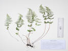
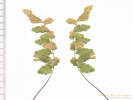
Cystopteris fragilis (L.) Bernh. Brittle Bladderfern. CalPhotos. Jepson eFlora. SEINet Taxon.
Plants, terrestrial, to 35 cm.; Fronds, petiole scales very sparse, widest at middle, bipinnately compound + lobed, abaxial surface glabrous, margins flat; Sori, between midrib and leaflet margin, round, indusium hood-like at base then divided into filiform segments. (Described from Coll. No. 2890, 20 July 2022.)
- Brumley,
About 140 m. above the highway in a rock pile of hummocky terrain (avalanche chute?) with a few small willows.
About ½ mile north of Brumley on the east side of the highway, about 12 road miles on Colorado Highway 82 generally west from Twin Lakes, Lake County, Colorado; 175 km. southwest of Golden.
Tom Schweich 2890.
20 Jul 2022.
(
CS201808‡
KHD79752‡
OBI183829‡
UCR300274‡
)
.
Apiaceae
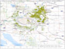
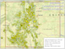
Cymopterus lemmonii (J. M. Coult. & Rose) Dorn. (Syn: Pseudocymopterus montanus (A. Gray) J. M. Coult. & Rose ) Alpine False Springparsley. CalPhotos. Jepson eFlora. SEINet Taxon.
Perennial herb, to 15 cm., glabrous throughout, except very slightly scabrous at top of peduncle and on ribs of some rays; Pseudoscape, absent; Leaves, basal and cauline, 40 mm. × 25 mm. wide, obovate, compound, leaflets, #7, ultimate divisions narrowly lanceolate; Inflorescence, compound umbel; Involucre, bracts, 1.7 mm., linear (but not pinnafitid); Rays, ascending-spreading, ±equal; Involucel, bractlets green, inconspicuous, 1 mm.; Corolla, petals, #5, 1 mm. × 0.6 mm. wide, yellow; Stamens, #5; Filaments, recurved; Ovary, glabrous; Stylopodium, absent (?); Fruit, unknown. (Described from Coll. No. 1469, 29 June 2016)
- Evans Gulch, Southeast-facing open slope with mostly forbs. Mosquito Range, middle section of Evans Gulch, near Conley Lakes and the Diamond Mine, 4.6 mi. by road east of the GNIS location of Leadville. Tom Schweich 1469. 29 Jun 2016. ( CAS EIU OBI83317‡ ) Sunny open southeast-facing slope. Middle section of Evans Gulch, near Conley Lakes and the Diamond Mine, 4.6 mi. by road east of the GNIS location of Leadville. Tom Schweich 3135. 20 Jul 2023. ( KHD 82085‡ UCR308396‡ ) .
- Unnamed Gulch on Forest Road 189, South side of the gulch on the edges of an open aspen forest. Along Forest Road 189, about 1 km. east of County Road 18 “East Tennessee Road,” 5.69 km. (geodesic) north northwest of the GNIS location of Leadville. Tom Schweich 3126. 19 Jul 2023. ( COLO ) .
- West Tennessee Creek,
Collected with Potentilla gracilis var. fastigiata, Danthonia intermedia, and Phleum alpunum.
Former meander of West Tennessee Creek, 575 m. (geodesic) southeast of Lily Lake, 12.3 km. (geodesic) north northwest of Leadville.
Tom Schweich 3102.3
18 Jul 2023.
(
KHD87648‡
)
.
.

0 records found in tblPhotographs for photo: WeberWAW2012
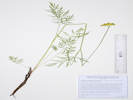
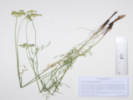
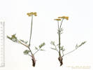
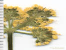
Ligusticum tenuifolium S. Watson, Proc. Amer. Acad. Arts 14: 293 (1879), nom. illeg. (Syn: L. filicinum S. Watson, Proc. Amer. Acad. Arts 11: 140 (1876) var. tenuifolium Mathias & Constance, Bull. Torrey Bot. Club 68: 123 (1941) ) Slender Ligusticum. CalPhotos. Jepson eFlora. SEINet Taxon. Known mostly from the Rocky Mountains of Colorado, the Uintah Mountain of Utah, and the Rocky Mountains of Idaho-Montana. Described by Sereno Watson from collections by Hall & Habour and Wolf & Rothrock.
- Brumley,
Water-saturated soil in willow thicket along former creek channels.
Near the site of the stagecoach stop of Brumley, about 11 miles generally west on CO State Highway 82 from the town of Twin Lakes, Lake County, 27.8 km. southwest of Leadville, 135 km. southwest of Golden.
Tom Schweich 3329.
23 Jul 2024.
(
Undist.
)
.
.
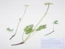

Oxypolis fendleri (A. Gray) Heller. Fendler's Cowbane. CalPhotos. Jepson eFlora. SEINet Taxon.
- Brumley, Shaded bank of creek. Brumley was a stage stop on the route across Independence Pass. Along the bank of the North Fork of Lake Creek, opposite the Sno-Tel station, about 11 road miles generally west on Colorado Highway 82 from the town of Twin Lakes, 175 km. southwest of Golden. Tom Schweich 2713. 18 Aug 2021. ( COLO2707339‡ KHD75284‡ OBI183793‡ ) .
- Unnamed Gulch on Forest Road 189,
South of the road in willow thicket, on bank of creek.
Along Forest Road 189, about 1 km. east of County Road 18 “East Tennessee Road,” 5.69 km. (geodesic) north northwest of the GNIS location of Leadville.
Tom Schweich 3120.
19 Jul 2023.
(
Undist.
)
Bank of small creek in willows, also here: Cardamine cordifolia and Bistorta vivipara.
About 100 m. southwest of Forest Road 189, about 1 km. west of County Road 18 “East Tennessee Road,” 7.37 km. north northwest of the GNIS location of Leadville. Openings in aspen forest, mixed with patches of big sagebrush and willows.
Tom Schweich 3348.1
24 Jul 2024.
(
Undist.
)
.
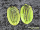
Asteraceae
Achillea millefolium L. (Syn: A. lanulosa Nutt. , A. m. L. var. alpicola (Rydb.) Garrett , A. m. L. var. lanulosa (Nutt.) Piper , A. m. L. var. occidentalis DC. ) Common Yarrow. CalPhotos. Jepson eFlora. SEINet Taxon.
Perennial herb to 50 cm.;; Leaves alternate, tendrils absent, finely dissected, aromatic when fresh; Inflorescence, heads enclosed by an involucre, in flat-topped clusters; Phyllaries in 2+ series; Receptacles bearing scale-like bracts (paleate); Perianth in 2 or more whorls, parts in 5s; Phyllaries in 2+ series, not all subtending ray flowers; Flowers open, bisexual, two kinds, some with strap-shaped corollas; Petals fused into a tube; Ray flowers, white, lobe ovate; Disc flowers, white; Stamens = in number to corolla lobes; Ovary inferior. Pistils, 1 per flower (Described from Coll. No. 482, 30 Nov 2011, and Coll. No. 1023, 24 Jul 2013).
- Brumley, Open spot among short (1 m.) willows, with Taraxacum ceratophorum, Geum triflorum, and Phleum alpinum. Near the site of the stagecoach stop of Brumley, about 11 miles generally west on CO State Highway 82 from the town of Twin Lakes, Lake County, 135 km. southwest of Golden. Tom Schweich 3321. 23 Jul 2024. ( Undist. ) .
- Unnamed meadow on Forest Road 109, East end of meadow, edges of the forest, also collected here: Astragalus alpinus, Vicia americana, Leptosiphon nuttallii, nearby: Campanula parryi, and Collomia linearis. Southern part of the ridge that includes Mount Zion and Buckeye Peak, about 2.7 road miles north of Leadville, access to Forest Road 109 from US Highway 24, 140 km. southwest of Golden. Tom Schweich 2604. 15 Jul 2021. ( COLO2718468‡ ) .
- Unnamed Gulch on Forest Road 189,
Also nearby in and around a small aspen grove: Agoseris aurantica, Vicia americana, Orthocarpus luteus, Pedicularis parryi, Androsace septentrionalis, and Anticlea elegans.
Along Forest Road 189, about 1 km. west of County Road 18 “East Tennessee Road,” 7.37 km. north northwest of the GNIS location of Leadville. Openings in aspen forest, mixed with patches of big sagebrush and willows.
Tom Schweich 3340.
24 Jul 2024.
(
Undist.
)
.
.
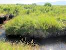
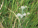
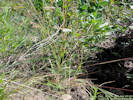
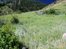
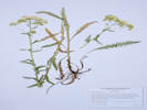
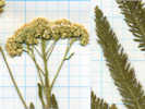
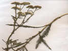
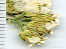
Agoseris aurantiaca (Hook.) Greene. Orange-Flower Goat-Chicory. CalPhotos. Jepson eFlora. SEINet Taxon.
- Unnamed Gulch on Forest Road 189, Tom Schweich 3815. 7/24/2024. . .
Agoseris aurantiaca (Hooker) Greene var. aurantica. Orange-Flower Goat-Chicory. CalPhotos. Jepson eFlora. SEINet Taxon.
- Unnamed Gulch on Forest Road 189,
Also nearby in and around a small aspen grove: Achillea millefolium, Vicia americana, Orthocarpus luteus, Pedicularis parryi, Androsace septentrionalis, and Anticlea elegans.
Along Forest Road 189, about 1 km. west of County Road 18 “East Tennessee Road,” 7.37 km. north northwest of the GNIS location of Leadville. Openings in aspen forest, mixed with patches of big sagebrush and willows.
Tom Schweich 3341.
24 Jul 2024.
(
Undist.
)
Openings in sagebrush with Taraxacum ceratophorum, and Geum triflorum.
About 70 m. southwest of Forest Road 189, about 1 km. west of County Road 18 “East Tennessee Road,” 7.37 km. north northwest of the GNIS location of Leadville. Openings in aspen forest, mixed with patches of big sagebrush and willows.
Tom Schweich 3346.
24 Jul 2024.
(
Undist.
)
.
.
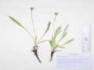
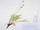
Agoseris aurantiaca (Hooker) Greene var. purpurea (A. Gray) Cronquist. Orange-Flower Goat-Chicory. CalPhotos. Jepson eFlora. SEINet Taxon.
- West Tennessee Creek,
Open ground, nine plants seen, not showy, easy to overlook.
Distances measured from GNIS point features.
Along an old, closed forest road on the north side of West Tennessee Creek, 770 m. southeast of Lily Lake, 16.0 km. north northwest of Leadville.
Tom Schweich 2875.
19 Jul 2022.
(
KHD00078235‡
)
.
.

Agoseris glauca (Pursh) Raf. var. dasycephala (Torr. & A. Gray) Jeps. (Syn: A. pubescens Rydb. ) Pale Goat-Chicory. CalPhotos. Jepson eFlora. SEINet Taxon.
- Unnamed Gulch on Forest Road 189,
Between the road and the creek to the south, open shrubland with Artemisia tridentata, Eriogonum umbellatum, and Dasophora fritucosa.
Along Forest Road 189, about 1 km. east of County Road 18 “East Tennessee Road,” 5.69 km. (geodesic) north northwest of the GNIS location of Leadville.
Tom Schweich 3116.
19 Jul 2023.
(
Undist.
)
.
.

Anaphalis margaritacea (L.) Bentham & Hooker. Western Pearly Everlasting. CalPhotos. Jepson eFlora. SEINet Taxon.
- Brumley,
Older part of the bar with a little more vegetation.
Brumley was a stage stop on the route across Independence Pass.
Sandy abandoned oxbow of the North Fork of Lake Creek, about 145 m. north of the Sno-Tel station road turnoff from the highway, about 11 road miles generally west on Colorado Highway 82 from the town of Twin Lakes, 175 km. southwest of Golden.
Tom Schweich 2725.
18 Aug 2021.
(
COLO2706281‡
KHD00076203‡
OBI183786‡
)
.
.
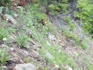
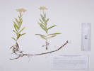

Antennaria rosea Greene. Rosy Pussytoes. CalPhotos. Jepson eFlora. SEINet Taxon.
Perennial herb, to 9 cm., stoloniferous 4-5 cm., forming loose mats in wet muddy soil, all sixteen plants collected pistillate (gynoecious?); Leaves, simple, white tomentose both sides, basal, 35 mm. × 9 mm wide, oblanceolate, cauline, 11-13 mm., linear; Inflorescence, >> basal leaves; Involucre, 5.5-7.0 mm.; Bracts (phyllaries), 5.0-6-5 mm. × 1.1-0.7 mm. wide, green at base, purplish band in middle, tips, white, scarious. (Described from Coll. No. 1083, 25 April 2015).
- Brumley, Grassy areas between the highway and willows above North Fork of Lake Creek, with Achillea millefolium, Symphyotrichum foliaceum var. apricum, Taraxacum ceratophorum, Geum triflorum, and Phleum alpinum. Near the site of the stagecoach stop of Brumley, about 11 miles generally west on CO State Highway 82 from the town of Twin Lakes, Lake County, 27.8 km. southwest of Leadville, 135 km. southwest of Golden. Tom Schweich 3328. 23 Jul 2024. ( Undist. ) .
- North Fork West Tennessee Creek, Dry rocky opening in lodgepole pine forest. Also collected here: Eriogonum umbellatum var. majus, Androsace septentrionalis, Collomia linearis, and Solidago multiradiata. About 300 m. east of Lily Lake, along Pike-San Isabel Forest Road 131, 2.6 road miles west of US Highway 24, 140 km. southwest of the GNIS location of Golden. Tom Schweich 2591. 13 Jul 2021. ( COLO2704260‡ Golden ) .
- West Tennessee Creek,
Near base of slope above former meander of West Tennessee Creek, with Artemisia borealis, Leptosiphon nuttallii and Arenaria congesta.
Coordinates estimated from GoogleEarth. Distances measured from GNIS point features.
Edge of forest on west-facing slope above West Tennessee Creek, 588 m. (geodesic) southeast of Lily Lake, 12.3 km. (geodesic) north northwest of Leadville.
Tom Schweich 3101.1
18 Jul 2023.
.
.
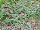
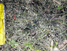
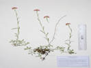
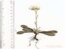
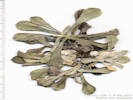
Arnica cordifolia Hook. Heart-Leaf Leopardbane. CalPhotos. Jepson eFlora. SEINet Taxon.
- Lily Lake,
Several involucres partially eaten.
East side of Lily Lake, on a low gravely ridge that is probably a lateral or medial moraine, near the end of the Pike-San Isabel Forest Road 131, 2.8 road miles west of US Highway 24, 140 km. southwest of the GNIS location of Golden.
Tom Schweich 2579.
12 Jul 2021.
(
KHD00075209‡
OBI183719‡
)
.
.
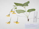

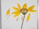
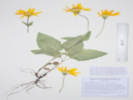
Arnica mollis Hook. Cordilleran Leopardbane. CalPhotos. Jepson eFlora. SEINet Taxon.
- North Fork West Tennessee Creek,
Mixed pine forest and abandoned beaver dams.
Tennesee Creek Basin, 8.2 mi. north of Leadville, then 2.4 mi. generally west on County Road 9 and Forest Road 131, not quite to Lily Lake, 12.5 km. north northeast of the GNIS location of Leadville.
Tom Schweich 2006.
25 Jul 2018.
(
KHD00069229‡
OBI148133‡
UCR ‡
)
Subalpine forest beside the creek, deep shade.
About 250 m. northeast of Lily Lake, near the current end of Pike-San Isabel Forest Road 131, 2.6 road miles west of US Highway 24, 140 km. southwest of the GNIS location of Golden.
Tom Schweich 2708.
17 Aug 2021.
(
COLO2707313‡
Golden
)
.
.
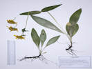
Arnica parryi A. Gray. Nodding Leopardbane. CalPhotos. Jepson eFlora. SEINet Taxon.
- North Fork West Tennessee Creek,
Mixed pine forest and abandoned beaver dams.
Tennesee Creek Basin, 8.2 mi. north of Leadville, then 2.4 mi. generally west on County Road 9 and Forest Road 131, not quite to Lily Lake, 12.5 km. north northeast of the GNIS location of Leadville.
Tom Schweich 2010.
25 Jul 2018.
(
COLO02347631‡
CS
KHD00069230‡
OBI158421‡
UC
UCR ‡
)
Subalpine forest beside road; soil is very likely glacial till.
About 125 m. east of Lily Lake, at the current end of Pike-San Isabel Forest Road 131, 2.6 road miles west of US Highway 24, 140 km. southwest of the GNIS location of Golden.
Tom Schweich 2706.
17 Aug 2021.
(
KHD00075281‡
)
.
.
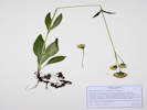
Artemisia borealis Pall. ssp. borealis. (Syn: A. campestris L. var. purshii (Besser ex Hook.) Cronquist , Oligosporus groenlandicus (Hornemann) Á. Löve & D. Löve ) Boreal Wormwood. CalPhotos. Jepson eFlora. SEINet Taxon.
- West Tennessee Creek,
Dry gravelly slope under a pine.
Distances measured from GNIS point features.
Edge of forest on west-facing slope above West Tennessee Creek, 870 m. southeast of Lily Lake, 15.9 km. north northwest of Leadville.
Tom Schweich 2881.
19 Jul 2022.
(
KHD00079102‡
OBI183825‡
)
Near base of slope above former meander of West Tennessee Creek, with Leptosiphon nuttallii and Arenaria congesta.
Coordinates estimated from GoogleEarth. Distances measured from GNIS point features.
Edge of forest on west-facing slope above West Tennessee Creek, 588 m. (geodesic) southeast of Lily Lake, 12.3 km. (geodesic) north northwest of Leadville.
Tom Schweich 3101.
18 Jul 2023.
(
Undist.
)
.
.
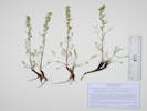
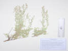
Artemisia tridentata Nutt. Big Sagebrush. CalPhotos. Jepson eFlora. SEINet Taxon.
- Unnamed Gulch on Forest Road 189, Tom Schweich 2942. 7/21/2022. . .
Artemisia tridentata Nutt. ssp. vaseyana (Rydb.) Beetle. Mountain Big Sagebrush. CalPhotos. Jepson eFlora. SEINet Taxon.
- Unnamed Gulch on Forest Road 189,
In patches among willows and aspen, with Taraxacum ceratophorum, Eriocoma lettermanii, Festuca idahoensis, and Festuca thurberi.
About 50 m. southwest of Forest Road 189, about 1 km. west of County Road 18 “East Tennessee Road,” 7.37 km. north northwest of the GNIS location of Leadville. Openings in aspen forest, mixed with patches of big sagebrush and willows.
Tom Schweich 3344.
24 Jul 2024.
(
Undist.
)
.
.
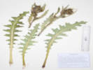
Cirsium parryi (A. Gray) Petr. Parry's Thistle. CalPhotos. Jepson eFlora. SEINet Taxon.
- Brumley,
Grassy areas between the highway and willows above North Fork of Lake Creek, with Achillea millefolium, Symphyotrichum foliaceum var. apricum, Taraxacum ceratophorum, Geum triflorum, and Phleum alpinum.
Near the site of the stagecoach stop of Brumley, about 11 miles generally west on CO State Highway 82 from the town of Twin Lakes, Lake County, 135 km. southwest of Golden.
Tom Schweich 3325.
23 Jul 2024.
(
Undist.
)
.
.
Erigeron . Fleabane. CalPhotos. Jepson eFlora. SEINet Taxon.
- Brumley,
Brumley was a stage stop on the route across Independence Pass.
Sandy abandoned oxbow of the North Fork of Lake Creek, about 130 m. north of the Sno-Tel station road turnoff from the highway, about 11 road miles generally west on Colorado Highway 82 from the town of Twin Lakes, 175 km. southwest of Golden.
Tom Schweich 2724.
18 Aug 2021.
(
Golden
)
.
.
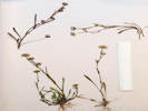

Erigeron glacialis (Nutt.) A. Nelson. Glacial Daisy. CalPhotos. Jepson eFlora. SEINet Taxon.
Perennial herb, 50 cm., caudex, taprooted; Stem, proximal stem glabrous to distal stem pilose; Leaves, alternate, largest, petiole 60 mm. to sessile distally, blade 120 mm. × 30 mm. wide, reduced distally, oblanceolate, to ovate distally, entire, glabrous to sparsely pilose distally, especially on veins, margins, ciliate; Inflorescence, #1-3 per stem, showy, flat-topped, >leaves; Peduncles, 40-70 mm.; Involucre, 11 mm. × 20 mm. wide, hemispheric; Phyllaries, 3± series, 8 mm. × 1 mm. wide, green with purple tips, glandular, margins, flat; Flowers, 2 kinds; Ray flowers, #30-40, tube 3 mm. + blade 11 mm. × 2.5 mm. wide, coiling, blue, fertile; Disk flowers, many, tube 3.5 mm. + lobes, 0.5 mm., expanding slightly, yellow, bisexual; Pappus, single series, many, well-developed, capillary bristles, 2.4-3.6 mm.; Anther, 1.5 mm., base rounded; Cypsela, 1.8 mm. × 0.3 mm. wide, compressed front to back, brown, hirsute, no beak. (Described from Coll. No. 2005, 25 July 2018.)
- Lily Lake, Also collected here: Potentilla gracilis var. fastigiata, Arctostaphylos uva-ursi, Penstemon procerus, Erigeron glacialis. and Taraxacum officinale. North side of Lily Lake, at the edge of a wetland formed by North Fork West Tennessee Creek, near the end of the Pike-San Isabel Forest Road 131, 2.8 road miles west of US Highway 24, 140 km. southwest of the GNIS location of Golden. Tom Schweich 2584. 13 Jul 2021. ( COLO2706216‡ Golden ) .
- North Fork West Tennessee Creek,
Mixed pine forest and abandoned beaver dams.
Variety glacialis if infraspecific names are to be applied.
Tennesee Creek Basin, 8.2 mi. north of Leadville, then 2.4 mi. generally west on County Road 9 and Forest Road 131, not quite to Lily Lake, 12.5 km. north northeast of the GNIS location of Leadville.
Tom Schweich 2005.
25 Jul 2018.
(
KHD00069212‡
OBI148135‡
UC
UCR ‡
)
.
.
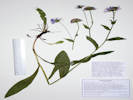
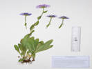
Erigeron subtrinervis Rydb. ex Porter & Britton. Threenerve Daisy. CalPhotos. Jepson eFlora. SEINet Taxon.
- Chalk Creek, Along Chalk Creek, National Forest Road 134, off Colorado Highway 91, 13.3 km. northeast of the GNIS location of Leadville. Tom Schweich 1988. 23 Jul 2018. ( CS KHD00069214‡ OBI170959‡ UC UCR ‡ ) .
- Unnamed Gulch on Forest Road 189,
Openings in aspen forest, surrounded by big sagebrush and willows.
Along Forest Road 189, about 1 km. west of County Road 18 “East Tennessee Road,” 7.37 km. north northwest of the GNIS location of Leadville.
Tom Schweich 2896.
21 Jul 2022.
(
KHD00078707‡
OBI183835‡
)
.
.
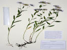

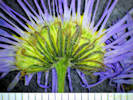
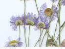
Erigeron ursinus D. C. Eaton. Bear River Fleabane. CalPhotos. Jepson eFlora. SEINet Taxon.
- Unnamed meadow on Forest Road 109,
Toward the northeast edge of meadow, also collected hearby: Geum triflorum, Astragalus alpinus, Vicia americana, and Leptosiphon nuttallii.
Southern part of the ridge that includes Mount Zion and Buckeye Peak, about 2.7 road miles north of Leadville, access to Forest Road 109 from US Highway 24, 140 km. southwest of Golden.
Tom Schweich 2607.
15 Jul 2021.
(
KHD00076202‡
)
.
.
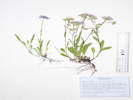
Helianthella quinquenervis (Hook.) A. Gray. Five-Nerve Little Sunflower. CalPhotos. Jepson eFlora. SEINet Taxon.
Perennial herb, to 80 cm., rhizomatous; Stem, proximal glabrous to distal tangled multicellular hairy; Leaves, all cauline (some very proximally cauline), opposite, petiole, 35 mm., blade 110 mm. × 27 mm. wide, mid-cauline the largest, elliptic, entire, sparsely short hairy throughout, eglandular; Inflorescence, heads, 1 terminal, sometimes a smaller pair in upper axils, showy, >leaves, ±nodding; Peduncles (axillary), 70 mm.; Involucre, 15 mm. × 33 mm. wide, spheric; Phyllaries, 3± series, 28 mm. × 6 mm. wide, green flat, margin, ciliate; Receptacle, paleate; Palea, 11 mm. × 2.5 mm. wide, scarious, soft; Flowers, 2 kinds; Ray flowers, #20-24, tube 5 mm. + blade 23 mm. × 6 mm. wide, yellow, sterile; Disk flowers, many, tube 1.5 mm. + throat 3 mm. + lobes 0.5 mm., throat expanding abruptly, yellow; Pappus, disk flowers only, two types, 1.0 mm. scales in an outer ring, 2.5 mm. #2 awn-like scales; Cypsela, 7.4 mm. × 3 mm. wide, obovate, compressed side-to-side, black, hairy. (Described from Coll. No. 1990, 23 Jul 2018.)
- Chalk Creek, Along Chalk Creek, National Forest Road 134, off Colorado Highway 91, 13.3 km. northeast of the GNIS location of Leadville. Tom Schweich 1990. 23 Jul 2018. ( KHD00068684‡ OBI158902‡ UC UCR ‡ ) .
- Unnamed Gulch on Forest Road 189,
Openings in aspen forest, mixed with patches of big sagebrush and willows.
Along Forest Road 189, about 1 km. west of County Road 18 “East Tennessee Road,” 7.37 km. north northwest of the GNIS location of Leadville.
Tom Schweich 2903.
21 Jul 2022.
(
Undist.
)
.
.
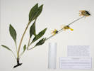
Heterotheca pumila (Greene) Semple. Alpine False Goldenaster. CalPhotos. Jepson eFlora. SEINet Taxon.
Perennial herb, 12 cm.; Stem, purplish, short and long multicellular hairs, glandular; Leaves, cauline, alternate, well-distributed along stem, petiole, 10 mm., blade, 25 mm. × 4 mm. wide, reduced distally, oblanceolate, hairy and somewhat glandular, margin, entire, slightly revolute; Inflorescence, heads, 1 per stem, showy, >leaves; Involucre, 7 mm. × 10 mm. wide, bowl-shaped, glandulo-hispid; Phyllaries, 3+ series, 3.3-7 mm. × 0.6-1.2 mm. wide, prominent mid-vein, green center, scarious margins; Receptacle, epaleate; Flowers, 2 kinds; Ray flowers, #6-8, tube 4.5 mm. + blade 8.5 mm. × 2 mm. wide, yellow, fertile; Disk flowers, many, tube 4.5 mm. + lobes 0.5 mm., yellow, open; Pappus, many, 2 series, both ray and disk flowers, bristles, 0.9, 5.0 mm., barbelate; Cypsela, 2.5-3.0 mm. × 0.7 mm. wide, brown, hairy. (Described from Coll. No. 1986, 23 July 2018.)
- Chalk Creek, Along Chalk Creek, National Forest Road 134, off Colorado Highway 91, 13.3 km. northeast of the GNIS location of Leadville. Tom Schweich 1986. 23 Jul 2018. ( KHD00068683‡ OBI158899‡ UCR ‡ ) .
- West Tennessee Creek,
First terrace above creek, sunny and dry, with Arenaria sp. and Erigeron sp.
Lowest terrace above West Tennessee Creek, 588 m. (geodesic) southeast of Lily Lake, 12.3 km. (geodesic) north northwest of Leadville.
Tom Schweich 3105.
18 Jul 2023.
(
Undist.
)
.
.
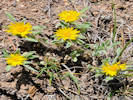
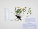

Oreochrysum parryi (A. Gray) Rydb. Goldenrod. CalPhotos. Jepson eFlora. SEINet Taxon.
- Brumley,
One of three “goldenrods” growing together, the others are Solidago multiradiata and S. simplex.
Brumley was a stage stop on the route across Independence Pass.
Subalpine forest on a bank between the access road to the Sno-Tel station and the highway, about 11 road miles generally west on Colorado Highway 82 from the town of Twin Lakes, 175 km. southwest of Golden.
Tom Schweich 2717.
18 Aug 2021.
(
COLO2706307‡
KHD00075285‡
OBI183792‡
)
.
.
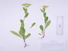
Packera crocata (Rydb.) W. A. Weber & A. Love. Saffron Ragwort. CalPhotos. Jepson eFlora. SEINet Taxon.
- Brumley, Brumley was a stage stop on the route across Independence Pass. On a terrace beside the North Fork of Lake Creek, between Twin Lakes and Independence Pass, about 11 mi. generally west on Colorado Highway 82 from the town of Twin Lakes. Tom Schweich 1997. 24 Jul 2018. ( OBI124861‡ UCR ‡ ) .
- West Tennessee Creek,
Also collected here: Caltha chionophila.
In a meadow just north of West Tennessee Creek, 580 m. southwest of Lily Lake, 12.6 km. northwest of the GNIS location of Leadville.
Tom Schweich 3107.
18 Jul 2023.
(
KHD ‡
OBI
)
.
.
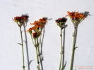
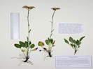

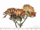
Senecio crassulus A. Gray, Proc. Amer. Acad. Arts. 19: 54. 1883. Mountain Meadow Ragwort. CalPhotos. Jepson eFlora. SEINet Taxon.
Coll. No. 3332, 23 July 2024, characters observed: Perennial herb, 37 cm., caudex button-like, eglandular; Stem, glabrous; Leaves, alternate, petiole 43 mm., blade 75 mm. × 22 mm. wide, reduced distally, oblanceolate, mid-vein abaxially broad and margined, margin subtly dentate, few enlarged cells with a central cell larger (glandular?); Inflorescence, heads, 3-4 per stem, >leaves, erect; Peduncles, 4, 35, 50, 55 mm.; Involucre, 8 mm. × 8 mm. wide, cylindric; Phyllaries, 1 series, 6 mm. × 1.2 mm. wide, eglandular, tips, acute, black; Receptacle, epaleate; Flowers, 2 kinds Ray flowers, #13-15, tube 3.3 mm. + blade 9 mm. × 4 mm. wide, yellow, fertile; Disk flowers, many, tube 7 mm. + lobes 1 mm., yellow; Pappus, many well-developed capillary bristles, 5.5 mm., ±equal; Style, 2-branched; Cypsela, 2.0-2.6 mm. × 1 mm. wide, light brown, glabrous;
- Brumley,
Bank above North Fork of Lake Creek, full sun in a thicket of low-growing willows.
Near the site of the stagecoach stop of Brumley, about 11 miles generally west on CO State Highway 82 from the town of Twin Lakes, Lake County, 27.8 km. southwest of Leadville, 135 km. southwest of Golden.
Tom Schweich 3332.
23 Jul 2024.
(
Undist.
)
.
.
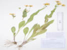
Senecio integerrimus Nutt. Columbia Ragwort. CalPhotos. Jepson eFlora. SEINet Taxon.
- Evans Gulch,
Southeast-facing open slope with mostly forbs.
Var. exaltatus (Nutt.) Cronquist if infraspecific taxa are to be recognized.
Mid-section of Evans Gulch, near Conley Lakes and the Diamond Mine, 4.6 mi. by road east of the GNIS location of Leadville.
Tom Schweich 1476.
29 Jun 2016.
(
CAS
EIU
OBI83351‡
UC
)
.
.
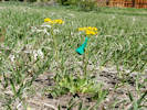
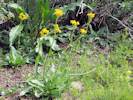
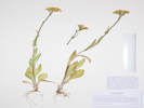
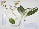
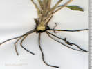
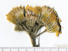
Senecio triangularis Hook. Arrowleaf Ragwort. CalPhotos. Jepson eFlora. SEINet Taxon. Also collected in the Mono Lake basin.
Perennial herb, to 80 cm., in shaded streamside, not strongly scented; Root and caudex unknown; Petiole 100 mm.; Leaves alternate, largest 100 mm. x 60 mm., distributed along stem gradually becoming smaller, ovate, base truncate, margin toothed, adaxial surface sticky with glandular exudate, glands inconspicuous; Inflorescence gen. flat-topped, 10-15 flowers; Phyllaries, in 1-series, few short narrow outer phyllaries, tips dark brown macroscopically; Receptacle palea 0; Flowers of 2 kinds, both ray and disk; Pappus of bristles (no scales or needle-like awns), well developed on ray and disk flowers; Ray flowers yellow, exceeding involucre (Described from Coll. No. 874, 23 June 2013).
- North Fork West Tennessee Creek, Mixed pine forest and abandoned beaver dams. Tennesee Creek Basin, 8.2 mi. north of Leadville, then 2.4 mi. generally west on County Road 9 and Forest Road 131, not quite to Lily Lake, 12.5 km. north northeast of the GNIS location of Leadville. Tom Schweich 2003. 25 Jul 2018. ( OBI148139‡ UCR ‡ ) Subalpine forest beside the creek, deep shade. About 250 m. northeast of Lily Lake, near the current end of Pike-San Isabel Forest Road 131, 2.6 road miles west of US Highway 24, 140 km. southwest of the GNIS location of Golden. Tom Schweich 2707. 17 Aug 2021. ( COLO2706067‡ KHD00075282‡ ) .
- West Tennessee Creek,
With Veratrum californicum, Pedicularis racemosa, and Viola sp.
Meadow in a small valley between West Tennessee Creek and Lily Lake, 400 m. southwest of Lily Lake, 12.8 km. northwest of the GNIS location of Leadville.
Tom Schweich 3109.
18 Jul 2023.
(
Undist.
)
.
.
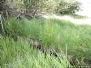
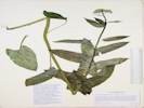
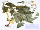
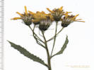
Solidago missouriensis Nutt. Missouri Goldenrod. CalPhotos. Jepson eFlora. SEINet Taxon.
Perennial herb, to 35-40 cm., generally glabrous throughout; Leaves, basal, unknown, cauline, alternate, petiole 10-45 cm. + blade 100 mm. × 21-22 mm. wide, reduced above, oblanceolate, margin, sparsely scabrous proximally, serrate distally, glabrous, prominently 3(5)-nerved; Inflorescence, crowded panicle; Pedicels, 1 mm.; Bracts, #2, 1.8 mm.; Involucre, 3.0-4.5 mm. × 3-5 mm. wide, obconic; Phyllaries, 2+ series, 2.2-3.5 mm. × 1 mm. wide, graduated, green, margin chartaceous, veins 1; Receptacle, epaleate, conic; Flowers, 2 kinds; Rays, #12, fertile, tube 2 mm. + blade 2.2 mm., yellow; Disk flower, #12, tube 2.8 mm. + lobes 0.7 mm. = 3.5 mm., yellow; Pappus, capillary bristles, 3.0 mm.; Cypsela, 0.4-0.6 mm., glabrous-sparsely hairy. Described from Coll. No. 1255, 26 Jul 2015, and Coll. No. 1519, 29 Jul 2016. Distinguished in part by its glabrous characters and presence of 3 prominent nerves on leaves. Jepson eFlora notes that S. missouriensis Nutt. Is misapplied to S. spectabilis (D. C. Eaton) A. Gray. FNANM states that, in the west, it can be similar to smaller plants of S. spectabilis (13 Sep 2014).
- North Fork West Tennessee Creek,
Open shade next to a wetland formed by the creek.
About 125 m. northeast of Lily Lake, at the current end of Pike-San Isabel Forest Road 131, 2.6 road miles west of US Highway 24, 140 km. southwest of the GNIS location of Golden.
Tom Schweich 2701.
17 Aug 2021.
(
OBI183394‡
)
.
.
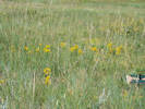
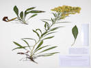
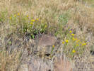
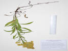
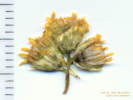
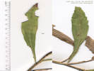
Solidago multiradiata Aiton. Rocky Mountain Goldenrod. CalPhotos. Jepson eFlora. SEINet Taxon.
Perennial herb, 18 cm., rhizomatous; Stem, proximal glabrous to distal glandular-hairy; Leaves, cauline, alternate, proximal petiole winged distinctly ciliate, distal apparently sessile (subclasping?), petiole, 40 mm., blade, 40 mm. × 10 mm. wide, narrowly oblanceolate, entire, margins, finely ciliate; Inflorescence, heads 15-20 per stem, not showy, triangular, >leaves; Involucre, 4 mm. × 7.5 mm. wide, ovoid; Phyllaries, #3± series, lower, slightly less than rest of involucre, few hairs similar to those on peduncles, mid-vein tan, body green, margin scarious, margins, flat, tip, acute; Flowers, 2 kinds; Ray flowers, #24-30, tube 2.5 mm. + blade 2.5 mm. × 1 mm. wide, yellow, fertile; Disk flowers, many, tube 3 mm. + lobes 0.7 mm., throat expanding, yellow; Pappus, many, well-developed capillary bristles, 3 mm., ±equal; Cypsela, 1 mm., brown, sparsely hairy. (Described from Coll. No. 1992, 24 July 2018.)
- Brumley, Variety scopulorum A. Gray in Ackerfield (2015), but infraspecific names not recognized by FNANM. Brumley was a stage stop on the route across Independence Pass. On a terrace beside the North Fork of Lake Creek, between Twin Lakes and Independence Pass, about 11 mi. generally west on Colorado Highway 82 from the town of Twin Lakes. Tom Schweich 1992. 24 Jul 2018. ( KHD00068670‡ OBI158904‡ UCR ‡ ) One of three “goldenrods” growing together, the others are Oreochrysum parry and Solidago simplex. Brumley was a stage stop on the route across Independence Pass. Subalpine forest on a bank between the access road to the Sno-Tel station and the highway, about 11 road miles generally west on Colorado Highway 82 from the town of Twin Lakes, 175 km. southwest of Golden. Tom Schweich 2719. 18 Aug 2021. ( COLO2706315‡ ) .
- North Fork West Tennessee Creek,
Mixed pine forest and abandoned beaver dams.
Tennesee Creek Basin, 8.2 mi. north of Leadville, then 2.4 mi. generally west on County Road 9 and Forest Road 131, not quite to Lily Lake, 12.5 km. north northeast of the GNIS location of Leadville.
Tom Schweich 2009.
25 Jul 2018.
(
KHD00068672‡
OBI170962‡
UC
UCR ‡
)
Dry rocky opening in lodgepole pine forest.
Variety scopulorum per Ackerfield (2015) though infraspecific names are not widely recognized.
About 300 m. east of Lily Lake, along Pike-San Isabel Forest Road 131, 2.6 road miles west of US Highway 24, 140 km. southwest of the GNIS location of Golden.
Tom Schweich 2589.
13 Jul 2021.
(
COLO2706125‡
Golden
)
.
.
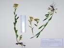
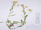
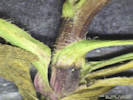
Solidago simplex Kunth. Sticky Goldenrod. CalPhotos. Jepson eFlora. SEINet Taxon.
- Brumley,
One of three “goldenrods” growing together, the others are Oreochrysum parry and Solidago multiradiata.
Brumley was a stage stop on the route across Independence Pass.
Subalpine forest on a bank between the access road to the Sno-Tel station and the highway, about 11 road miles generally west on Colorado Highway 82 from the town of Twin Lakes, 175 km. southwest of Golden.
Tom Schweich 2718.
18 Aug 2021.
(
Golden
)
.
.

Symphyotrichum foliaceum (DC.) G. L. Nesom var. apricum (A. Gray) G. L. Nesom. Parry's Aster. CalPhotos. Jepson eFlora. SEINet Taxon.
- Brumley, Open spot among short (1 m.) willows, with Achillea millefolium, Taraxacum ceratophorum, Geum triflorum, and Phleum alpinum. Near the site of the stagecoach stop of Brumley, about 11 miles generally west on CO State Highway 82 from the town of Twin Lakes, Lake County, 135 km. southwest of Golden. Tom Schweich 3322. 23 Jul 2024. ( Undist. ) .
- Evans Gulch,
Sunny open southeast-facing slope.
Middle section of Evans Gulch, near Conley Lakes and the Diamond Mine, 4.6 mi. by road east of the GNIS location of Leadville.
Tom Schweich 3138.
20 Jul 2023.
(
KHD00080563‡
)
.
.

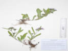
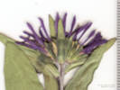
Symphyotrichum foliaceum (DC.) G. L. Nesom var. parryi (D. C. Eaton) G. L. Nesom. Parry's Aster. CalPhotos. Jepson eFlora. SEINet Taxon.
Perennial herb, to 12 cm., long rhizomatous; Stem, proximal glabrate, hairy in lines decurrent from leaf bases, hairy in inflorescence; Leaves, basal and cauline, alternate, petiole 20 mm. + blade 90 mm. × 22 mm. wide, reduced distally, entire, ciliate, tips, rounded; Inflorescence, heads 1-4 per stem, ≥leaves; Involucre, 8 mm. × 12 mm. wide, hemispheric; Phyllaries, graduated, 3±-series, chartaceous base to tip green, eglandular, margins, flat, somewhat ciliate, tip, acute, some reflexed(?); Receptacle, epaleate; Flowers, of 2 kinds; Ray flowers, many, tube 2 mm. + blade 10 mm. × 1.7 mm. wide, white, some tinged lavender, fading to lavender, fertile; Disk flowers, many, tube 4.5 mm. + lobes 0.5 mm., yellow; Pappus, many, bristles, 3.0-3.7 mm., ±equal; Cypsela, 2.5 mm. × 0.5 mm. wide, light brown, sparsely hairy (Described from Coll. No. 2728, 18 Aug 2021).
- Brumley,
Somewhat older and more vegetated portion of the sandy bar.
Brumley was a stage stop on the route across Independence Pass.
Sandy abandoned oxbow of the North Fork of Lake Creek, about 145 m. north of the Sno-Tel station road turnoff from the highway, about 11 road miles generally west on Colorado Highway 82 from the town of Twin Lakes, 175 km. southwest of Golden.
Tom Schweich 2728.
18 Aug 2021.
(
KHD00075262‡
OBI183785‡
)
.
.
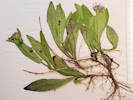
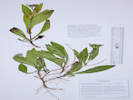
Taraxacum ceratophorum (Ledeb.) DC. Northern Dandelion. CalPhotos. Jepson eFlora. SEINet Taxon.
- Brumley, Nearly bare ground beside a clump of willows, with Achillea millefolium, Symphyotrichum foliaceum var. apricum, Taraxacum ceratophorum, Geum triflorum, and Phleum alpinum. See also Robert M. King, #11520 BRYV137683, MO1732166, Near the site of the stagecoach stop of Brumley, about 11 miles generally west on CO State Highway 82 from the town of Twin Lakes, Lake County, 135 km. southwest of Golden. Tom Schweich 3324. 23 Jul 2024. ( Undist. ) .
- Unnamed Gulch on Forest Road 189,
Openings in sagebrush.
About 45 m. southwest of Forest Road 189, about 1 km. west of County Road 18 “East Tennessee Road,” 7.37 km. north northwest of the GNIS location of Leadville. Openings in aspen forest, mixed with patches of big sagebrush and willows.
Tom Schweich 3342.
24 Jul 2024.
(
Undist.
)
.
.
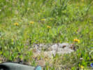
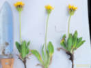
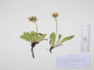
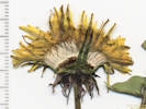
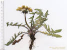
Taraxacum officinale F. H. Wigg. (Syn: T. laevigatum (Willd.) DC. ) Common Dandelion. CalPhotos. Jepson eFlora. SEINet Taxon.
- Lily Lake, Also collected here: Bistorta bistortoides, Potentilla gracilis var. fastigiata, Arctostaphylos uva-ursi, Penstemon procerus, and Erigeron glacialis. North side of Lily Lake, on sloping ground down to North Fork West Tennessee Creek, near the end of the Pike-San Isabel Forest Road 131, 2.8 road miles west of US Highway 24, 140 km. southwest of the GNIS location of Golden. Tom Schweich 2582. 13 Jul 2021. ( OBI183689‡ ) .
- West Tennessee Creek,
Tom Schweich 2934.
7/19/2022.
.
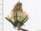
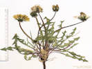
Boraginaceae
Mertensia ciliata (Torr.) G. Don. Tall Fringed Bluebells. CalPhotos. Jepson eFlora. SEINet Taxon.
- Brumley, On the bank of the creek, also collected here: Gentiana parryi, Chamerion angustifolium, and Aconitum columbianum, On the bank of Lake Creek, beside the access road to the Sno-Tel station, about 11 road miles generally west on Colorado Highway 82 from the town of Twin Lakes, 175 km. southwest of Golden. Tom Schweich 2884. 20 Jul 2022. ( Undist. ) .
- North Fork West Tennessee Creek,
Low slope in lodgepole pine forest.
About 400 m. east of Lily Lake, along Pike-San Isabel Forest Road 131, 2.6 road miles west of US Highway 24, and 10.8 road miles north northwest of Leadville, 140 km. southwest of the GNIS location of Golden.
Tom Schweich 2596.
13 Jul 2021.
(
COLO2718245‡
KHD00075380‡
OBI183708‡
)
.
.


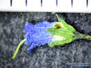
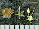
Phacelia sericea (Graham ex Hook.) A. Gray. Silky Phacelia. CalPhotos. Jepson eFlora. SEINet Taxon.
- Evans Gulch,
In gravel of valley bottom land.
Also collected here: Penstemon hallii A. Gray. Probably var. sericea if infraspecific taxa are recognized.
Junction of County Road 3 and 3B, 2.8 mi. east of Leadville on County Road 3.
Tom Schweich 1481.
29 Jun 2016.
(
CAS
OBI83349‡
UC
)
.

Brassicaceae
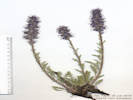
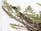
Boechera grahamii (Lehm.) Windham & Al-Shehbaz. Graham's Rockcress. CalPhotos. Jepson eFlora. SEINet Taxon.
- West Tennessee Creek,
First terrace above creek, sunny and dry, with Arenaria sp. and Erigeron sp.
Lowest terrace above West Tennessee Creek, 588 m. (geodesic) southeast of Lily Lake, 12.3 km. (geodesic) north northwest of Leadville.
Tom Schweich 3104.
18 Jul 2023.
(
KHD ‡
)
.
.

Boechera stricta (Graham) Al-Shebaz. (Syn: Arabis drummondii A. Gray ) Drummond's Rockcress. CalPhotos. Jepson eFlora. SEINet Taxon.
Perennial herb, 40 cm. to 55 cm., glabrous except basal leaves; Stem, single, erect, leafy, glabrous; Leaves, basal and cauline, basal, simple, petiole, 10 mm., transition unclear, blade, 23 mm. × 3 mm. wide, oblanceolate, hairs, dolabriform, cauline, sessile, basally lobed, 0.8-1.5 mm., 23 mm. × 3.5 mm. wide, lanceolate, margin entire; Inflorescence, raceme, 25 mm. × 12.5 mm. wide, elongating in fruit; Flowers, radial; Sepals, #4, 1 row, 5 mm. × 1 mm. wide, elliptic, color green, glabrous; Petals, 9 mm. × 1.8 mm. wide, spoon-shaped, margin entire, color lavender (when dry); Fruit, mature, 60 mm. × 1 mm. wide, appressed to rachis, glabrous. (Described from Coll. No. 1952, 20 June 2018.)
- Unnamed meadow on Forest Road 109, Toward the northeast edge of meadow, also collected hearby: Ranunculus cardiophylla, Geum triflorum, Astragalus alpinus, Vicia americana, and Leptosiphon nuttallii. Southern part of the ridge that includes Mount Zion and Buckeye Peak, about 2.7 road miles north of Leadville, access to Forest Road 109 from US Highway 24, 140 km. southwest of Golden. Tom Schweich 2608. 15 Jul 2021. ( COLO2718443‡ KHD00075390‡ OBI183795‡ ) .
- Unnamed Gulch on Forest Road 189,
Small slope, damp areas amongst willows, with Descurainia incisa.
Coll. Nos. 3347.1, 3349, & 3350, made within 30 m. of each other, are the same taxon.
About 90 m. southwest of Forest Road 189, about 1 km. west of County Road 18 “East Tennessee Road,” 7.37 km. north northwest of the GNIS location of Leadville. Openings in aspen forest, mixed with patches of big sagebrush and willows.
Tom Schweich 3347.1
24 Jul 2024.
(
Undist.
)
Sunny opening in willow thicket.
Coll. Nos. 3347.1, 3349, & 3350, made within 30 m. of each other, are the same taxon.
About 100 m. south of Forest Road 189, about 1 km. west of County Road 18 “East Tennessee Road,” 7.37 km. north northwest of the GNIS location of Leadville. Openings in aspen forest, mixed with patches of big sagebrush and willows.
Tom Schweich 3349.
24 Jul 2024.
(
Undist.
)
Sunny opening in willow thicket.
Coll. Nos. 3347.1, 3349, & 3350, made within 30 m. of each other, are the same taxon.
About 95 m. south of Forest Road 189, about 1 km. west of County Road 18 “East Tennessee Road,” 7.37 km. north northwest of the GNIS location of Leadville. Openings in aspen forest, mixed with patches of big sagebrush and willows.
Tom Schweich 3350.
24 Jul 2024.
(
Undist.
)
.
.
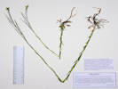
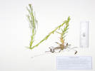
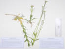
Cardamine cordifolia A. Gray. (Syn: C. cardiophylla Rydb. nom. Illeg. ) Heartleaf Bittercress. CalPhotos. Jepson eFlora. SEINet Taxon.
- Brumley, Among creekside willows on bank of a former channel of North Fork of Lake Creek. Near the site of the stagecoach stop of Brumley, about 11 miles generally west on CO State Highway 82 from the town of Twin Lakes, Lake County, 27.8 km. southwest of Leadville, 135 km. southwest of Golden. Tom Schweich 3331. 23 Jul 2024. ( Undist. ) .
- North Fork West Tennessee Creek, Growing on the bank of creek with Micranthes odontoloma. Right bank of North Fork of West Tennessee Creek, 530 m. east northeast of Lily Lake, 12.7 km. north northwest of the GNIS location of Leadville. Tom Schweich 3114. 18 Jul 2023. ( KHD ‡ ) .
- Unnamed Gulch on Forest Road 189,
Bank of small creek in willows.
About 100 m. southwest of Forest Road 189, about 1 km. west of County Road 18 “East Tennessee Road,” 7.37 km. north northwest of the GNIS location of Leadville. Openings in aspen forest, mixed with patches of big sagebrush and willows.
Tom Schweich 3348.
24 Jul 2024.
(
Undist.
)
.
.
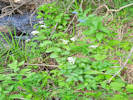

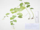
Descurainia incisa (Engelm.) Britton ssp. incisa. (Syn: D. incisa (Engelm.) Britton ssp. viscosa Rydb.) G. Mulligan ) Mountain Tansymustard. CalPhotos. Jepson eFlora. SEINet Taxon.
- Unnamed Gulch on Forest Road 189,
Small slope, damp areas amongst willows.
About 90 m. southwest of Forest Road 189, about 1 km. west of County Road 18 “East Tennessee Road,” 7.37 km. north northwest of the GNIS location of Leadville. Openings in aspen forest, mixed with patches of big sagebrush and willows.
Tom Schweich 3347.
24 Jul 2024.
(
Undist.
)
.
.
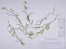
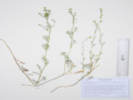
Descurainia sophia (L.) Webb. Tansy Mustard. CalPhotos. Jepson eFlora. SEINet Taxon.
Annual, 30 cm. (to 50 cm. when growing among grasses), not scapose; Tap root; Stem simple at base, branched distally; Hairs many-branched; Leaves basal 0, cauline compound, 2-3 pinnately dissected, sessile, not basally lobed, sagittate, or clasping; Inflorescence not bracted; Pedicel, in fruit diverging 30–45°; Petals yellow, 2.5 mm.; Ovary linear; Stigma ±entire (there are clearly two separate segments of the stigma that are receptive, but there is no central cleft between them); Fruit (7-15 mm.) -25 mm., linear (not fusiform or club-shaped), glabrous, not appressed; Septum veined Seeds, multiseriate (Described from Coll. Nos. 404, 854, and 935).
- Unnamed meadow on Forest Road 109,
East end of meadow, near road. Also collected here: Vicia americana, Leptosiphon nuttallii, nearby: Campanula parryi, and Collomia linearis.
Southern part of the ridge that includes Mount Zion and Buckeye Peak, about 2.7 road miles north of Leadville, access to Forest Road 109 from US Highway 24, 140 km. southwest of Golden.
Tom Schweich 2602.
15 Jul 2021.
(
KHD00075393‡
OBI183798‡
)
.
.
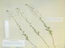
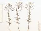
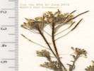
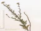
Erysimum capitatum (Hook.) Greene. Sanddune Wallflower. CalPhotos. Jepson eFlora. SEINet Taxon.
Perennial or at least biennial, 16 cm. 25-45 cm., hairs dolabriform throughout; Root, tap; Stems, erect, leafy, proximal not woody hairs as above; Leaves, basal and cauline, basal, petiole, indistinct, ±10 mm., + blade, 50-100 mm. × 2.5-3 mm. wide, narrowly oblanceolate, margin 1-3 shallowly pinnate dentate, cauline, nearly sessile, 42 mm. × 2.5 mm. wide, ±linear, margin, entire, reduced distally; Inflorescence, raceme 130 mm. × 45 mm. wide, not bracted; Pedicels, 3-6 mm., elongating as flower matures, ascending; Flowers, radial; Sepals, #4, rows, 1, 7 mm. × 1-1.5 mm. wide, narrow and wide pairs opposite, lateral pair basally saccate; Petals, claw, 10-11 mm. + blade 6-9 mm. × 4-6 mm. wide, spoon-shaped, margin, entire, color, yellow, orange; Stamens, #6, 11 & 15 mm., tetradynamous (2 short, 4 long); Anthers, 4.5 mm.; Ovary, 4 mm.; Style, 9 mm.; Stigma, capitate; Fruit, 17-34 mm. × 1 mm. wide, 4-angled, ascending, hairy as above; Seeds, unknown (Described from Coll. Nos. 206, 1835, & 2306).
- Brumley,
About 60 m. above the highway on hummocky treeless slope that may be an avalanche chute.
About ½ mile north of Brumley on the east side of the road, about 12 road miles on Colorado Highway 82 generally west from Twin Lakes, Lake County, Colorado; 175 km. southwest of Golden.
Tom Schweich 2888.1
20 Jul 2022.
(
Undist.
)
.
.
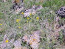
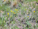
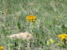
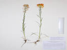
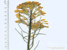
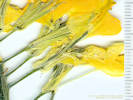
Rorippa alpina (S. Watson) Rydb. Alpine Yellow Cress. CalPhotos. Jepson eFlora. SEINet Taxon.
Perennial terrestrial herb, erect, 5 cm. to 20 cm. tall, with caudex, glabrous throughout; Leaves, basal, withered, cauline, petiole, 20 mm., blade 35 mm. × 20 mm. wide, lyrate, with 2 or 4 lobes, toothed ¾ to mid-rib, tip, rounded; Inflorescence, raceme, elongating; Sepals, #4, 1.7 mm. × 0.6 mm. wide, ovate, green; Petals, 1.6 mm. × 0.5 mm. wide, spoonshaped, margin, entire, yellow; Fruit, 3 mm. × 0.7 mm. wide, >3× longer than wide, ascending, uninflated, glabrous; Ovules (seeds), at least #7. (Described from Coll. No. 2002, 25 July 2018.)
- North Fork West Tennessee Creek,
Mixed pine forest and abandoned beaver dams.
Tennesee Creek Basin, 8.2 mi. north of Leadville, then 2.4 mi. generally west on County Road 9 and Forest Road 131, not quite to Lily Lake, 12.5 km. north northeast of the GNIS location of Leadville.
Tom Schweich 2002.
25 Jul 2018.
(
KHD00068462‡
OBI162800‡
UCR ‡
)
.
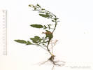
Campanulaceae
Campanula parryi A. Gray. Parry's Bellflower. CalPhotos. Jepson eFlora. SEINet Taxon.
- Unnamed meadow on Forest Road 109,
Southern part of the ridge that includes Mount Zion and Buckeye Peak, about 2.7 road miles north of Leadville, access to Forest Road 109 from US Highway 24, 140 km. southwest of Golden.
Tom Schweich 2598.
15 Jul 2021.
(
KHD00075531‡
OBI183712‡
UCR294673‡
)
.
.
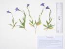
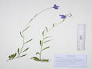
Campanula rotundifolia L. (=Campanula petiolata A. DC.) Harebell. CalPhotos. Jepson eFlora. SEINet Taxon.
Perennial herb, to 40 cm.; Leaves, basal, ?, cauline, alternate, ±lance-linear, 52 mm. × 2.5 mm. wide; Inflorescence, solitary and loose racemes; Pedicel, 9 mm.; Calyx, tube 2.5 mm. + 5 lobes 2.5 mm. = 5.0 mm.; Corolla, 13 mm, blue-purple; Capsule, nodding, 5.5 mm. × 4.5 mm. wide, opening by pores near the base. Described from Coll. No. 1246, 24 July 2015.
- Brumley, About 140 m. above the highway on hummocky slope (avalanche chute?) with a few small willows. About ½ mile north of Brumley on the east side of the highway, about 12 road miles on Colorado Highway 82 generally west from Twin Lakes, Lake County, Colorado; 175 km. southwest of Golden. Tom Schweich 2889. 20 Jul 2022. ( Undist. ) .
- Chalk Creek,
Along Chalk Creek, National Forest Road 134, off Colorado Highway 91, 13.3 km. northeast of the GNIS location of Leadville.
Tom Schweich 1987.
23 Jul 2018.
(
KHD00069225‡
OBI158900‡
UCR ‡
)
.
Caprifoliaceae
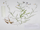
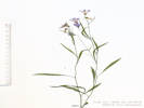
Linnaea borealis L. var. longiflora Torr. Twinflower. CalPhotos. Jepson eFlora. SEINet Taxon.
- Lily Lake, Western shore of Lily Lake, sprawling over forest floor at base of trees, 12.9 km. northwest of the GNIS location of Leadville. Tom Schweich 3113. 18 Jul 2023. ( KHD ‡ ) . .
Lonicera involucrata (Richardson) Banks ex Spreng. Twinberry Honeysuckle. CalPhotos. Jepson eFlora. SEINet Taxon.
- Unnamed Gulch on Forest Road 189,
South of the road in willow thicket, streamside.
Along Forest Road 189, about 1 km. east of County Road 18 “East Tennessee Road,” 5.69 km. (geodesic) north northwest of the GNIS location of Leadville.
Tom Schweich 3121.
19 Jul 2023.
(
KHD ‡
)
.
.
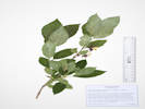
Valeriana acutiloba Rydb. Sharpleaf Valerian. CalPhotos. Jepson eFlora. SEINet Taxon.
- North Fork West Tennessee Creek, Partial shade around the edges of dense lodgepole pine forest. About 300 m. east of Lily Lake, along Pike-San Isabel Forest Road 131, 2.6 road miles west of US Highway 24, and 10.9 road miles north northwest of Leadville, 140 km. southwest of the GNIS location of Golden. Tom Schweich 2593. 13 Jul 2021. ( COLO2706059‡ KHD00075198‡ OBI183707‡ ) .
- West Tennessee Creek,
Tom Schweich 2936.
7/19/2022.
.
.
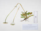
Valeriana edulis Nuttall var. edulis. Tobacco Root. CalPhotos. Jepson eFlora. SEINet Taxon.
Perennial herb, to 60 cm.; Stem, glabrous; Leaves, basal, petiole 11 cm. + blade 15 cm. × 2.6 cm. wide, narrowly obovate, cauline, in 2 pairs, pinnafitid, segments narrow; Inflorescence, panicle (definitely not a corymb); Flowers, perfect; Corolla, tube 2 mm. + lobes 1.2 mm., white, somewhat hairy proximal outside; Stamens, ±exserted; Fruit, unknown (Described from Coll. No. 1474, 29 Jun 2016).
- Evans Gulch,
Southeast-facing open slope with mostly forbs.
Variety edulis if infraspecific taxa are recognized.
Mosquito Range, mid-section of Evans Gulch, near Conley Lakes and the Diamond Mine, 4.6 mi. by road east of the GNIS location of Leadville.
Tom Schweich 1474.
29 Jun 2016.
(
CAS
EIU
OBI83353‡
)
.
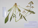
Caryophyllaceae
Arenaria lanuginosa (Michx.) Rohrb. var. saxosa (A. Gray) Zarucchi, R. L. Hartman & Rabeler. Spreading Sandwort. CalPhotos. Jepson eFlora. SEINet Taxon.
- West Tennessee Creek,
Bare soil with a few trees on bench above the flood plain of the creek.
Distances measured from GNIS point features.
Along an old, closed forest road on the north side of West Tennessee Creek, 740 m. southeast of Lily Lake, 16.0 km. north northwest of Leadville.
Tom Schweich 2877.1
19 Jul 2022.
(
KHD00078234‡
)
.
.
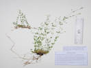
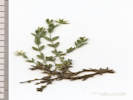
Cerastium arvense L. ssp. strictum Gaudin. (Syn: Cerastium strictum L ) Field Chickweed. CalPhotos. Jepson eFlora. SEINet Taxon.
Common early-flowering perennial, to 20 cm.; Leaves, opposite, broadly linear, 15 mm. × 3 mm. wide, stipules absent, tufts of leaves in lower axils; Sepals free; Petals >> sepals, white, notched; Styles (4)5.
- Adelaide,
Roadside in Stray Horse Gulch, along County Road 2A, just south of County Road 1, 3 km. east southeast of the GNIS location of Leadville.
Tom Schweich 1479.
29 Jun 2016.
(
CAS
EIU
OBI83303‡
)
.
.

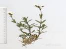
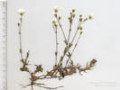
Eremogone congesta (Nutt.) Ikonn. var. congesta. Ball-Head Matted Sandwort. CalPhotos. Jepson eFlora. SEINet Taxon.
- Brumley, Brumley was a stage stop on the route across Independence Pass. Subalpine forest on a bank between the access road to the Sno-Tel station and the highway, about 11 road miles generally west on Colorado Highway 82 from the town of Twin Lakes, 175 km. southwest of Golden. Tom Schweich 2715. 18 Aug 2021. .
- North Fork West Tennessee Creek, Dry rocky opening in lodgepole pine forest. Also collected nearby: Eriogonum umbellatum var. majus, Androsace septentrionalis, Collomia linearis, Antennaria rosea, and Solidago multiradiata. Variety congesta if infraspecific names are to be applied. About 300 m. east of Lily Lake, along Pike-San Isabel Forest Road 131, 2.6 road miles west of US Highway 24, and 10.9 road miles north northwest of Leadville, 140 km. southwest of the GNIS location of Golden. Tom Schweich 2594. 13 Jul 2021. ( COLO2718237‡ KHD00075533‡ OBI183713‡ ) .
- West Tennessee Creek, Nearly bare soil on bench above creek. Distances measured from GNIS point features. Along an old, closed forest road on the north side of West Tennessee Creek, 740 m. southeast of Lily Lake, 16.0 km. north northwest of Leadville. Tom Schweich 2877. 19 Jul 2022. ( Undist. ) . .
Eremogone fendleri (A. Gray) Ikonnikov. (Syn: Arenaria fendleri A. Gray ) Fendler's Sandwort. CalPhotos. Jepson eFlora. SEINet Taxon.
Perennial herb, tufted, to 30 cm.; Stem, proximal glabrous, distal short glandular hairy “peg-like hairs”; Leaves, mostly basal, cauline, stipules absent, opposite, 50 mm. × 0.5 mm. wide, linear to needle-like, erect to appressed, margin finely scabrous, tip small spinulose; Inflorescence, open cyme; Pedicels, 3-8 mm.; Sepals, #5 distinct, 4.5-5.0 mm. × 1 mm. wide, glandular hairy (or stipitate glandular); Petals, white, 5 mm., entire; Stamens, #10; Anthers, purple; Styles, #3. Described from Coll. No. 1270, 1374, and 2372.
- Evans Gulch,
Sunny open southeast-facing slope.
Middle section of Evans Gulch, near Conley Lakes and the Diamond Mine, 4.6 mi. by road east of the GNIS location of Leadville.
Tom Schweich 3133.
20 Jul 2023.
(
Undist.
)
.
.
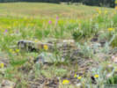
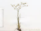
Silene menziesii Hook. (Syn: S. m. Hook. ssp. dorrii (Kellogg) C. L. Hitchc. & Maguire ) Menzies' Campion. CalPhotos. Jepson eFlora. SEINet Taxon.
Perennial of forest floor, to 10 cm.,
rhizomatous;
Leaves,
cauline,
opposite,
sessile,
31 mm. × 7 mm. wide,
adaxially glabrous, abaxially short curved hairs,
margin entire, ciliate, purple;
Flowers,
upper axils,
pedicel, 8 mm., glandular;
Calyx,
tube 5 mm. + lobes (#5) 1.7 mm.,
veins, #10,
glandular;
Hypanthium (??), disk-like (??)
Carphophore, 1 mm.;
Petals,
9 mm. × 3 mm. wide, clawed?, notched,
white fading to light yellow,
united at base (??);
Anthers,
#10?, didymous?, white, inserted;
Ovary,
superior,
3 mm. × 1.8 mm.,
Styles, #3, exserted
(Described from Coll. No. 3352, 25 July 2024).
- North Fork West Tennessee Creek,
Open lodgepole forest floor, with Vaccinium scoparium.
Hillslope between Lily Lake and North Fork West Tennessee Creek, about 425 m. east of Lily Lake, and 520 m. northwest of the crossing of FR 131 by the Colorado Trail, 12.2 km. north northwest of Leadville, 108 km. west southwest of Golden.
Tom Schweich 3352.
25 Jul 2024.
(
Undist.
)
.
.
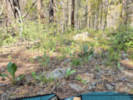
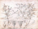
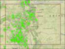


Spergularia rubra (L.) J. Presl & C. Presl. Red Sand Spurry. CalPhotos. Jepson eFlora. SEINet Taxon.
Annual; Leaves opposite, 2-ranked, simple, awl-like; Inflorescence terminal; Sepals 5, free; Petals 5, free, magenta; Stamens 10 in 2 series of 5; Ovary superior; Stigmas 3, partly fused; Seed 0.6 mm., dark brown (Described from Coll. No. 912, 28 Oct 2012).
- North Fork West Tennessee Creek,
Dry rocky opening in lodgepole pine forest. Also collected here: Androsace septentrionalis.
One of six little annuals collected here. Appears to be first Lake County collection.
About 300 m. east of Lily Lake, along Pike-San Isabel Forest Road 131, 2.6 road miles west of US Highway 24, 140 km. southwest of the GNIS location of Golden.
Tom Schweich 2590.5
13 Jul 2021.
.
.
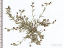
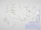
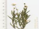
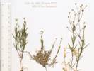
Stellaria longipes Goldie ssp. longipes. (Syn: S. l. Goldie var. l. ) Longstalk Starwort. CalPhotos. Jepson eFlora. SEINet Taxon.
Perennial herb, to 20 cm.; spreading by rhizomes, without tuber-like thickening or vertical fleshy root; Leaves opposite; Stipules 0; Inflorescence panicle; Flowers 4-9(10); Pedicels ascending; Sepals free; Petals 2-lobed, > sepals; Fruit a capsule, ovoid (turns wetting solution purple); Seed many, 0.8 mm, ovoid, light brown, slightly rugose (Described from Coll. No. 862, 23 Jun 2012).
- North Fork West Tennessee Creek,
Dry rocky opening in lodgepole pine forest. Also collected here: Polygonum aviculare, Spergularia rubra, Gayophytum decipiens, Androsace septentrionalis, Collomia linearis, and Antennaria rosea.
One of six little annuals collected here.
About 300 m. east of Lily Lake, along Pike-San Isabel Forest Road 131, 2.6 road miles west of US Highway 24, 140 km. southwest of the GNIS location of Golden.
Tom Schweich 2590.6
13 Jul 2021.
.
Crassulaceae
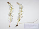
Rhodiola rhodantha (A. Gray) Jacobsen. Queen's Crown. CalPhotos. Jepson eFlora. SEINet Taxon.
- North Fork West Tennessee Creek, Mixed pine forest and abandoned beaver dams. Tennesee Creek Basin, 8.2 mi. north of Leadville, then 2.4 mi. generally west on County Road 9 and Forest Road 131, not quite to Lily Lake, 12.5 km. north northeast of the GNIS location of Leadville. Tom Schweich 2004. 25 Jul 2018. ( KHD00069197‡ OBI148165‡ UCR ‡ ) .
- West Tennessee Creek,
Tom Schweich 2938.
7/19/2022.
.
Elaeagnaceae
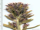
Shepherdia canadensis (L.) Nutt. Russet Buffalo-Berry. CalPhotos. Jepson eFlora. SEINet Taxon.
- North Fork West Tennessee Creek, Lodgepole pine forest, also collected nearby: Vaccinium scoparium. Hillslope between Lily Lake and North Fork West Tennessee Creek, about 550 m. east of Lily Lake, and 675 m. northwest of the crossing of FR 131 by the Colorado Trail. Tom Schweich 3351. 25 Jul 2024. ( Undist. ) .
- West Tennessee Creek,
Low shrub under trees of open forest.
Distances measured from GNIS point features.
Along an old, closed forest road on the north side of West Tennessee Creek, 740 m. southeast of Lily Lake, 15.9 km. north northwest of Leadville.
Tom Schweich 2878.
19 Jul 2022.
(
KHD00078233‡
OBI183840‡
)
.
Ericaceae
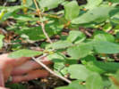
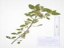
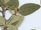
Arctostaphylos uva-ursi (L.) Sprengel. (Syn: Arctostaphylos uva-ursi (L.) Sprengel ssp. adenotricha (Fernald & J.F.Macbr.) Calder & Roy L.Taylor ) Bearberry. CalPhotos. Jepson eFlora. SEINet Taxon.
- Lily Lake,
Also collected here: a Potentilla sp., Arctostaphylos uva-ursi, Penstemon procerus, Erigeron glacialis. and Taraxacum officinale.
North side of Lily Lake, at the edge of a wetland formed by North Fork West Tennessee Creek, near the end of the Pike-San Isabel Forest Road 131, 2.8 road miles west of US Highway 24, 140 km. southwest of the GNIS location of Golden.
Tom Schweich 2585.
13 Jul 2021.
(
Golden
)
.
.
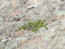
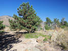
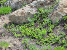
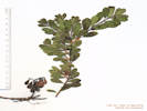
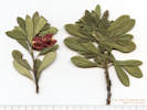
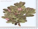
Orthilia secunda (L.) House. Sidebells Wintergreen. CalPhotos. Jepson eFlora. SEINet Taxon.
- Lily Lake,
Wet lodgepole pine forest floor with Pyrola asarifolia.
About 15 m. into the lodgepole pine forest from the east shore of Lily Lake, at the end of Pike-San Isabel National Forest Road 131, 12.8 km. north northwest of Leadville, 108 km. west southwest of Golden.
Tom Schweich 3354.
24 Jul 2024.
(
Undist.
)
.
.

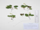
Pyrola asarifolia Michx. (Syn: Pyrola rotundifolia L. ssp. asarifolia (Michx.) A. Löve ) Liverleaf Wintergreen. CalPhotos. Jepson eFlora. SEINet Taxon.
- Lily Lake,
Wet lodgepole pine forest floor with Orthilia secunda.
About 15 m. into the lodgepole pine forest from the east shore of Lily Lake, at the end of Pike-San Isabel National Forest Road 131, 12.8 km. north northwest of Leadville, 108 km. west southwest of Golden.
Tom Schweich 3354.1
25 Jul 2024.
(
KHD
)
.
.
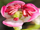
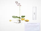

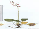

Pyrola chlorantha Sw. Green-Flowered Wintergreen. CalPhotos. Jepson eFlora. SEINet Taxon.
- North Fork West Tennessee Creek,
Shaded forest with little to no understory.
Distances measured from GNIS point features.
Between West Tennessee Creek and its North Fork, near the intersection of a closed forest road and the Colorado Trail, 1.12 km. southeast of Lily Lake, 15.7 km. north northwest of Leadville.
Tom Schweich 2882.
19 Jul 2022.
(
KHD00078230‡
)
.
.
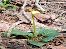

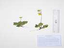
Vaccinium cespitosum Michx. Dwarf Blueberry. CalPhotos. Jepson eFlora. SEINet Taxon.
- Evans Gulch,
South-facing slope in full sun, above Evans Gulch, at the end of County Road 3, 6.33 km.(geodesic) east northeast of the GNIS location of Leadville.
Tom Schweich 3139.
20 Jul 2023.
(
KHD ‡
)
.
.
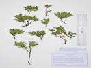
Vaccinium scoparium Leiberg ex Coville. Grouse Whortleberry. CalPhotos. Jepson eFlora. SEINet Taxon.
- Lily Lake, Rocky top of hill between West Tennessee Creek and Lily Lake. Primary ground cover here in lodgepole pine forest with no middlestory. Ridge south of Lily Lake on Lily Lake Loop trail, 230 m. south of Lily Lake, 12.7 km (geodesic) northwest of Leadville. Tom Schweich 3112. 18 Jul 2023. ( KHD ‡ ) .
- North Fork West Tennessee Creek,
Gentle slope near top of hill with lodgepole forest.
Hill between Lily Lake and North Fork West Tennessee Creek, about 375 m. east of Lily Lake, and 560 m. northwest of the crossing of FR 131 by the Colorado Trail.
Tom Schweich 3353.
25 Jul 2024.
(
Undist.
)
.
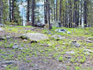
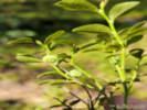
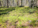
Fabaceae
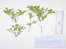
Astragalus alpinus L. Alpine Milkvetch. CalPhotos. Jepson eFlora. SEINet Taxon.
Perennial herb, to 12 cm., caulescent, hairs basifixed; Leaves, cauline, stipules, 5 mm., connate opposite petiole, alternate, to 80 mm., compound, leaflets, #21, 5 mm. × 3 mm. wide, ovate; Calyx, tube 2 mm. + lobes 1 mm. mostly black hairy, few white hairs; Flowers, spreading to deflexed; Banner, 5 mm + 4 mm. reflexed, blue; Wings, 8 mm. yellowish-white, apex obtuse; Keel, 8.5 mm., > wings, blue distally; Fruit, unknown. (Described from Coll. No 1471, 29 June 2016).
- Brumley, Brumley was a stage stop on the route across Independence Pass. On a terrace beside the North Fork of Lake Creek, between Twin Lakes and Independence Pass, about 11 mi. generally west on Colorado Highway 82 from the town of Twin Lakes. Tom Schweich 1991. 24 Jul 2018. ( KHD00069185‡ OBI158903‡ UC UCR ‡ ) .
- Evans Gulch, Southeast-facing open slope with mostly forbs. Mosquito Range, middle section of Evans Gulch, near Conley Lakes and the Diamond Mine, 4.6 mi. by road east of the GNIS location of Leadville. Tom Schweich 1471. 29 Jun 2016. ( EIU OBI83354‡ ) .
- Unnamed meadow on Forest Road 109, East end of meadow, near road, on top of a turnout road drainage berm, also collected here: Vicia americana, Leptosiphon nuttallii, nearby: Campanula parryi, and Collomia linearis. Southern part of the ridge that includes Mount Zion and Buckeye Peak, about 2.7 road miles north of Leadville, access to Forest Road 109 from US Highway 24, 140 km. southwest of Golden. Tom Schweich 2603. 15 Jul 2021. ( KHD00075392‡ OBI183799‡ ) .
- Unnamed Gulch on Forest Road 189, Tiny little Astragalus in sunny opening of willow thicket, beside game trail; between the road and the creek to the south. Along Forest Road 189, about 1 km. east of County Road 18 “East Tennessee Road,” 5.69 km. (geodesic) north northwest of the GNIS location of Leadville. Tom Schweich 3131. 19 Jul 2023. ( KHD ‡ ) .
- West Tennessee Creek,
Common on forest floor.
Along an old, closed forest road on the north side of West Tennessee Creek, 0.94 km. southeast of Lily Lake, 15.9 km. north northwest of Leadville.
Tom Schweich 2871.
19 Jul 2022.
(
Undist.
)
.
.
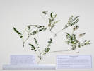
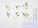
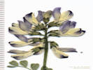
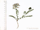
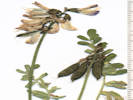
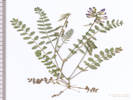
Lupinus argenteus Pursh var. rubricaulis (Greene) S.L. Welsh. Silvery Lupine. CalPhotos. Jepson eFlora. SEINet Taxon.
Perennial herb, to 70 cm., caulescent, erect; Stem, not winged, hairs basifixed; Leaves, compound, palmate, stipules, free, 4 mm., petiole, 25-60 mm., blade, largest, 60 mm. × 100 mm. wide, leaflets, #7, largest, 57 mm. × 17 mm. wide, margin, entire, petiole and abaxial surface short straight appressed hairs, adaxial glabrous; Inflorescence, raceme, 30+ flowers, bract, 4 mm., pedicels, 0-4.5 mm. as flowers mature, Calyx, asymmetric, 4.5 mm., hairs simple; Flower, zygomorphic, banner, 8 mm., reflexed distal ⅔ (±3 mm. from tip), giving shallowly gaping appearance, back has a few hairs, wings, claw, 2.5 mm., + blade 8 mm. = 10.5 mm., keel, 9.6 mm., glabrous throughout, white to dark blue, tip erect; Ovary, 4 mm. × 0.7 mm. wide, glabrous. (Described from Coll. No. 1954, 20 June 2018.)
- Chalk Creek, Along Chalk Creek, National Forest Road 134, off Colorado Highway 91, 13.3 km. northeast of the GNIS location of Leadville. Tom Schweich 1984. 23 Jul 2018. ( KHD00069189‡ OBI158897‡ UCR ‡ ) .
- Unnamed Gulch on Forest Road 189,
South side of the gulch on the edges of an open aspen forest.
Along Forest Road 189, about 1 km. east of County Road 18 “East Tennessee Road,” 5.69 km. (geodesic) north northwest of the GNIS location of Leadville.
Tom Schweich 3128.
19 Jul 2023.
(
Undist.
)
.
.
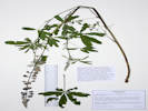
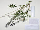
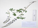
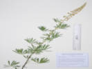
Lupinus caespitosus Nutt. var. utahensis (S. Watson) B. J. Cox. (Syn: L. aridus Douglas var. utahensis S. Watson , L. lepidus Douglas ssp. caespitosus (Nuttall) Detling , L. lepidus Douglas ex Lindl. var. utahensis (S. Watson) C. L. Hitchc. ) Utah Lupine. CalPhotos. Jepson eFlora. SEINet Taxon.
- West Tennessee Creek,
Common on forest floor.
Along an old, closed forest road on the north side of West Tennessee Creek, 0.94 km. southeast of Lily Lake, 15.9 km. north northwest of Leadville.
Tom Schweich 2872.
19 Jul 2022.
(
KHD00078236‡
OBI183832‡
)
.
.
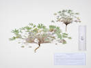
Oxytropis deflexa (Pall.) DC. var. sericea Torr. & A. Gray. Nodding Locoweed. CalPhotos. Jepson eFlora. SEINet Taxon.
- Unnamed Gulch on Forest Road 189,
Full sun, openings in willow thicket just south of the creek.
Along Forest Road 189, about 1 km. east of County Road 18 “East Tennessee Road,” 5.69 km. (geodesic) north northwest of the GNIS location of Leadville.
Tom Schweich 3129.
19 Jul 2023.
(
KHD ‡
)
.
.
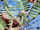

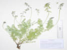
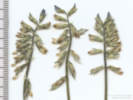
Oxytropis splendens Douglas ex Hook. Showy Locoweed. CalPhotos. Jepson eFlora. SEINet Taxon.
- Evans Gulch,
Sunny open southeast-facing slope.
Middle section of Evans Gulch, near Conley Lakes and the Diamond Mine, 4.6 mi. by road east of the GNIS location of Leadville.
Tom Schweich 3137.
20 Jul 2023.
(
Undist.
)
.
.
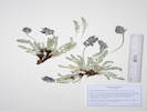
Trifolium parryi A. Gray. Parry's Clover. CalPhotos. Jepson eFlora. SEINet Taxon.
- Lily Lake,
Lodgepole pine forest, also collected here, Penstemon whippleanus.
Northeast of Lily Lake, near the (current) end of the Pike-San Isabel Forest Road 131, 2.7 road miles west of US Highway 24, 140 km. southwest of the GNIS location of Golden.
Tom Schweich 2586.
13 Jul 2021.
(
COLO2706141‡
KHD00075210‡
OBI183728‡
)
.
.
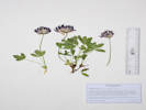
Trifolium repens L. White Clover. CalPhotos. Jepson eFlora. SEINet Taxon.
- North Fork West Tennessee Creek,
Right along the road in partial shade of subalpine forest; soil here is probably glacial till.
About 125 m. east of Lily Lake, at the current end of Pike-San Isabel Forest Road 131, 2.6 road miles west of US Highway 24, 140 km. southwest of the GNIS location of Golden.
Tom Schweich 2705.
17 Aug 2021.
(
COLO2706414‡
KHD00075280‡
OBI183774‡
)
.
.
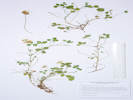
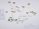
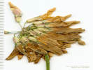
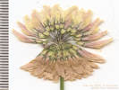
Vicia americana Willd. var. americana. American Vetch. CalPhotos. Jepson eFlora. SEINet Taxon.
Perennial herb, to 30 cm.; Stem, not winged; Leaves, stipules, 3 mm. × 10 mm. wide, lobed, not connate, nectary 0; cauline, compound, odd-pinnate, leaflets #8, + forked tendril; Inflorescence, raceme, 4-5 flowered, pedicel 17 mm.; Flowers, zygomorphic, 20 mm.; Style, round, ring of hairs below stigma; Legume, stipe 5 mm. + body 20 mm. × 3 mm. wide + persistent style 2 mm. (Described from Coll. No. 1387, 1 June 2016).
- Unnamed meadow on Forest Road 109, East end of meadow, near road. Also collected here: Leptosiphon nuttallii, nearby: Campanula parryi, and Collomia linearis. Southern part of the ridge that includes Mount Zion and Buckeye Peak, about 2.7 road miles north of Leadville, access to Forest Road 109 from US Highway 24, 140 km. southwest of Golden. Tom Schweich 2601. 15 Jul 2021. ( COLO2718377‡ Golden OBI183700‡ ) .
- Unnamed Gulch on Forest Road 189,
Twining on small willow stems and aspen branches, with Agoseris aurantica, Orthocarpus luteus, Pedicularis parryi, Androsace septentrionalis, and Anticlea elegans.
Infraspecific names are not accepted by current Colorado florae.
Along Forest Road 189, about 1 km. west of County Road 18 “East Tennessee Road,” 7.37 km. north northwest of the GNIS location of Leadville. Openings in aspen forest, mixed with patches of big sagebrush and willows.
Tom Schweich 3339.
24 Jul 2024.
(
Undist.
)
.
Gentianaceae
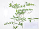
Frasera speciosa Griseb. (Syn: Swertia radiata (Kellogg) Kuntze ) Elkweed. CalPhotos. Jepson eFlora. SEINet Taxon.
- Brumley, Tom Schweich 2940. 7/20/2022. .
- Leadville,
Colorado, Lake, Near Leadville.
L. M. Schedin and N. T. Schedin 710.
1917.
(
RM97800‡
)
.
[
Year of collection estimated from similar-numbered collections for this collector.
]
.
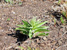
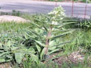
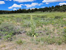
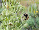
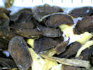
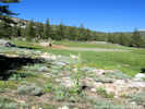
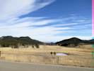
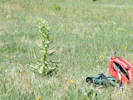
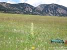
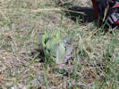
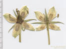
Gentiana parryi Engelm. (Syn: Pneumonanthe parryi (Engelmann) Greene ) Parry's Gentian. CalPhotos. Jepson eFlora. SEINet Taxon.
Perennial herb to 35 cm.; Leaves cauline; Bracts 25 mm x 10-12 mm wide; Corolla blue, 35 mm., distinctly tubular, tube broad, plicate; Anthers not spirally twisted (Described from Coll. No. 323, keyed 1 Jan 2013).
- Brumley,
Openings between willows, mostly sunny.
Brumley was a stage stop on the route across Independence Pass.
Banks of the North Fork of Lake Creek, opposite the Sno-Tel station road turnoff from the highway, about 11 road miles generally west on Colorado Highway 82 from the town of Twin Lakes, 175 km. southwest of Golden.
Tom Schweich 2722.
18 Aug 2021.
(
COLO2706232‡
KHD00075399‡
OBI183789‡
)
.
.
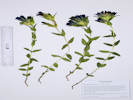
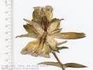
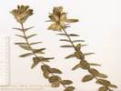
Gentianopsis thermalis (Kuntze) Iltis. (Syn: G. detonsa (Rottb.) Ma var. elegans (A. Nelson) N. Holmgren ) Rocky Mountain Fringed Gentian. CalPhotos. Jepson eFlora. SEINet Taxon.
- Brumley,
Partially revegetated sandy bar.
Brumley was a stage stop on the route across Independence Pass.
Sandy abandoned oxbow of the North Fork of Lake Creek, about 130 m. north of the Sno-Tel station road turnoff from the highway, about 11 road miles generally west on Colorado Highway 82 from the town of Twin Lakes, 175 km. southwest of Golden.
Tom Schweich 2723.
18 Aug 2021.
(
COLO2706273‡
KHD00075286‡
OBI183788‡
)
.
.
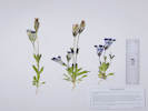
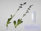
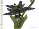
Swertia perennis L. Felwort. CalPhotos. Jepson eFlora. SEINet Taxon.
- Brumley, Brumley was a stage stop on the route across Independence Pass. On a terrace beside the North Fork of Lake Creek, between Twin Lakes and Independence Pass, about 11 mi. generally west on Colorado Highway 82 from the town of Twin Lakes. Tom Schweich 2000.1 24 Jul 2018. ( OBI162756‡ UCR ‡ ) .
- North Fork West Tennessee Creek,
In forest beside North Fork of West Tennessee Creek, also here Aconitum columbianum.
Tom Schweich 2391.
8/17/2021.
.
Grossulariaceae
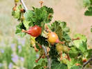
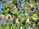
Ribes cereum Douglas. Wax Currant. CalPhotos. Jepson eFlora. SEINet Taxon.
- Brumley,
Tom Schweich 2941.
7/20/2022.
.
Lentibulariaceae
Utricularia . CalPhotos. Jepson eFlora. SEINet Taxon.
- North Fork West Tennessee Creek, In a still-water pond connected the the creek. About 200 m. north northeast of Lily Lake, at the current end of Pike-San Isabel Forest Road 131, 2.6 road miles west of US Highway 24, 140 km. southwest of the GNIS location of Golden. Tom Schweich 2699. 17 Aug 2021. ( Deferred. ) .
Linaceae
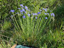
Linum lewisii Pursh. (Syn: Adenolinum lewisii (Pursh) A. Löve & D. Löve ) Prairie Blue Flax. CalPhotos. Jepson eFlora. SEINet Taxon.
- Brumley,
About 60 m. above the highway on hummocky treeless slope that may be an avalanche chute.
About ½ mile north of Brumley on the east side of the road, about 12 road miles on Colorado Highway 82 generally west from Twin Lakes, Lake County, Colorado; 175 km. southwest of Golden.
Tom Schweich 2888.
20 Jul 2022.
(
OBI183830‡
)
.
.
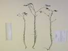
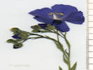
Linum perenne L. (Syn: Adenolinum perenne (L.) Rchb. ) Blue Flax. CalPhotos. Jepson eFlora. SEINet Taxon.
Weber & Wittmann (2012) distinguish between L. perenne and L. lewisii with the character of heterostyly in which some plants have styles longer than stamens and others with styles shorter than stamens. They apply homostyly to L. lewisii noting that the styles and stamens are approximately equal. My plants (Coll. No. 1383) consistently have styles longer than stamens. The key in Ackerfield (2015), based on plant structure and overall shape is not helpful because of the range of characters observed with this collection.
- Unnamed Gulch on Forest Road 189, Openings in willow thicket near creek. Along Forest Road 189, about 1 km. east of County Road 18 “East Tennessee Road,” 5.69 km. (geodesic) north northwest of the GNIS location of Leadville. Tom Schweich 3119. 19 Jul 2023. ( KHD ‡ ) .
Nymphaceae
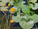
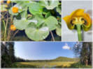
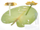
Nuphar polysepala Engelm. Rocky Mountain Pond-Lily. CalPhotos. Jepson eFlora. SEINet Taxon.
- Lily Lake,
Tom Schweich 3352.
7/18/2023.
Northeast shore of Lily Lake, accessed by way of National Forest Road 131, 12.9 km. northwest of Leadville, 108 km. southwest of Golden.
Tom Schweich 3355.
25 Jul 2024.
(
Undist.
)
.
Onagraceae
Chamerion angustifolium (L.) Holub. (Syn: Epilobium a. L , Epilobium angustifolium L var. intermedium ) Fireweed. CalPhotos. Jepson eFlora. SEINet Taxon.
- Brumley,
Brumley was a stage stop on the route across Independence Pass.
Banks of the North Fork of Lake Creek, opposite the Sno-Tel station road turnoff from the highway, about 11 road miles generally west on Colorado Highway 82 from the town of Twin Lakes, 175 km. southwest of Golden.
Tom Schweich 2721.
18 Aug 2021.
(
Golden
)
.
.
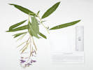
Epilobium ciliatum Raf. Fringed Willowherb. CalPhotos. Jepson eFlora. SEINet Taxon.
- Brumley, Somewhat older and more vegetated portion of the sandy bar. Brumley was a stage stop on the route across Independence Pass. Sandy abandoned oxbow of the North Fork of Lake Creek, about 125 m. north of the Sno-Tel station road turnoff from the highway, about 11 road miles generally west on Colorado Highway 82 from the town of Twin Lakes, 175 km. southwest of Golden. Tom Schweich 2726. 18 Aug 2021. ( OBI183787‡ ) .
- North Fork West Tennessee Creek,
Mixed pine forest and abandoned beaver dams.
Tennesee Creek Basin, 8.2 mi. north of Leadville, then 2.4 mi. generally west on County Road 9 and Forest Road 131, not quite to Lily Lake, 12.5 km. north northeast of the GNIS location of Leadville.
Tom Schweich 2008.
25 Jul 2018.
(
KHD00069140‡
OBI148164‡
UCR ‡
)
.
.
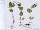
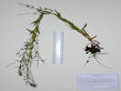
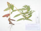
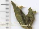
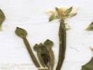
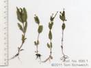
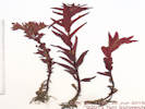
Gayophytum decipiens H. Lewis & Szweyk. Deceptive Groundsmoke. CalPhotos. Jepson eFlora. SEINet Taxon.
- North Fork West Tennessee Creek,
Dry rocky opening in lodgepole pine forest.
One of six little annuals collected here, others are Androsace septentrionalis, Collomia linearis, and Spergularia rubra.
About 300 m. east of Lily Lake, along Pike-San Isabel Forest Road 131, 2.6 road miles west of US Highway 24, 140 km. southwest of the GNIS location of Golden.
Tom Schweich 2590.1
13 Jul 2021.
(
KHD00076205‡
)
.
.
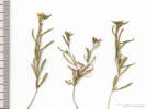
Gayophytum racemosum Torr. & A. Gray. Blackfoot Groundsmoke. CalPhotos. Jepson eFlora. SEINet Taxon. Known from the Front Range of Colorado, west to the Sierra Nevada and Klamath Mountains. Decribed by Torrey & A. Gray (1838) from collections by Nuttall on the elevated plains of the Rocky Mountains near the Black-Foot River.
- Unnamed Gulch on Forest Road 189, Growing in an outlet ditch that was freshly bladed in 2023, with Collomia linearis and Polygonum polygaloides ssp. kelloggii. Along Pike-San Isabel National Forest Road 189, about 1 km. west of County Road 18 “East Tennessee Road,” 7.37 km. north northwest of the GNIS location of Leadville. Openings in aspen forest, mixed with patches of big sagebrush and willows. Tom Schweich 3333. 24 Jul 2024. ( Undist. ) . .
Gayophytum ramosissimum Torr. & A. Gray. Pinyon Groundsmoke. CalPhotos. Jepson eFlora. SEINet Taxon.
- Tennessee Pass,
United States, Colorado, Lake, Tenn. Pass. near Leadville. [Tennessee Pass]
De Alton Saunders
24 Jun 1893.
(
NEB103607‡
NEB103608‡
NEB103610‡
)
.
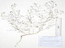
Orobanchaceae
Castilleja miniata Hook. Giant Red Indian Paintbrush. CalPhotos. Jepson eFlora. SEINet Taxon.
- Evans Gulch,
Southeast-facing open slope with mostly forbs.
Mosquito Range, middle section of Evans Gulch, near Conley Lakes and the Diamond Mine, 4.6 mi. by road east of the GNIS location of Leadville.
Tom Schweich 1467.
29 Jun 2016.
(
CAS
EIU
OBI83319‡
)
.
.
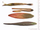
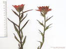
Castilleja sulphurea Rydb. Sulphur Indian Paintbrush. CalPhotos. Jepson eFlora. SEINet Taxon.
- Brumley, Brumley was a stage stop on the route across Independence Pass. On a terrace beside the North Fork of Lake Creek, between Twin Lakes and Independence Pass, about 11 mi. generally west on Colorado Highway 82 from the town of Twin Lakes. Tom Schweich 2000. 24 Jul 2018. ( OBI162804‡ UCR ‡ ) .
- Evans Gulch, Sunny open southeast-facing slope. Middle section of Evans Gulch, near Conley Lakes and the Diamond Mine, 4.6 mi. by road east of the GNIS location of Leadville. Tom Schweich 3132. 20 Jul 2023. ( KHD ‡ ) .
- North Fork West Tennessee Creek,
Partially shaded low place in lodgepole pine forest. Also collected nearby: Eriogonum umbellatum var. majus, Eremogone congesta, Androsace septentrionalis, Collomia linearis, Antennaria rosea, and Solidago multiradiata.
About 300 m. east of Lily Lake, along Pike-San Isabel Forest Road 131, 2.6 road miles west of US Highway 24, and 10.9 road miles north northwest of Leadville, 140 km. southwest of the GNIS location of Golden.
Tom Schweich 2595.
13 Jul 2021.
(
COLO2718252‡
KHD00075532‡
)
.
.
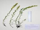
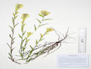
Orthocarpus luteus Nutt. Yellow Owls Clover. CalPhotos. Jepson eFlora. SEINet Taxon.
- Unnamed Gulch on Forest Road 189,
Openings in aspen forest, mixed with patches of big sagebrush and willows.
Along Forest Road 189, about 1 km. west of County Road 18 “East Tennessee Road,” 7.37 km. north northwest of the GNIS location of Leadville.
Tom Schweich 2904.
21 Jul 2022.
(
Undist.
)
.
.
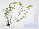
Pedicularis groenlandica Retz. Elephanthead Lousewort. CalPhotos. Jepson eFlora. SEINet Taxon.
- Brumley, Brumley was a stage stop on the route across Independence Pass. On a terrace beside the North Fork of Lake Creek, between Twin Lakes and Independence Pass, about 11 mi. generally west on Colorado Highway 82 from the town of Twin Lakes. Tom Schweich 1996. 24 Jul 2018. ( CS KHD00069220‡ OBI124859‡ UC UCR ‡ ) Common on edge of slough (former channel of the creek). Brumley was a stage stop on the route across Independence Pass. Edge of slough beside the North Fork of Lake Creek, near the access road to the Sno-Tel station, about 11 road miles generally west on Colorado Highway 82 from the town of Twin Lakes, 175 km. southwest of Golden. Tom Schweich 2891. 20 Jul 2022. ( Undist. ) .
- Unnamed Gulch on Forest Road 189, Muddy, wet places in willow thicket, south of the road and the creek. Along Forest Road 189, about 1 km. east of County Road 18 “East Tennessee Road,” 5.69 km. (geodesic) north northwest of the GNIS location of Leadville. Tom Schweich 3123. 19 Jul 2023. ( KHD ‡ ) .
- West Tennessee Creek,
Marshy area under forest trees.
Distances measured from GNIS point features.
At the end of an old, closed forest road on the north side of West Tennessee Creek, 720 m. south of Lily Lake, 16.1 km. north northwest of Leadville.
Tom Schweich 2879.
19 Jul 2022.
(
Undist.
)
Tom Schweich 2937.
7/19/2022.
.
.
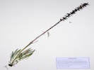
Pedicularis parryi A. Gray. Parry's Lousewort. CalPhotos. Jepson eFlora. SEINet Taxon.
- Unnamed Gulch on Forest Road 189,
Openings in aspen forest, mixed with patches of big sagebrush and willows.
Along Forest Road 189, about 1 km. west of County Road 18 “East Tennessee Road,” 7.37 km. north northwest of the GNIS location of Leadville.
Tom Schweich 2905.
21 Jul 2022.
(
KHD00078711‡
OBI183836‡
)
.
.
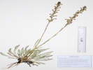
Pedicularis racemosa Douglas ex Benth. ssp. alba Pennell. Sickletop Lousewort. CalPhotos. Jepson eFlora. SEINet Taxon.
- West Tennessee Creek,
With Veratrum californicum, Senecio triangularis in the meadow, and Viola sp. in the forest.
Edge of lodgepole pine forest beside a meadow between West Tennessee Creek and Lily Lake, 400 m. southwest of Lily Lake, 12.8 km. northwest of the GNIS location of Leadville.
Tom Schweich 3110.
18 Jul 2023.
(
KHD ‡
)
.
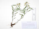
Phrymaceae
Erythranthe tilingii (Regel) G.L. Nesom. (Syn: Mimulus tilingii Regel ) Tiling's Monkeyflower. CalPhotos. Jepson eFlora. SEINet Taxon.
- Brumley,
Brumley was a stage stop on the route across Independence Pass.
On a terrace beside the North Fork of Lake Creek, between Twin Lakes and Independence Pass, about 11 mi. generally west on Colorado Highway 82 from the town of Twin Lakes.
Tom Schweich 1995.
24 Jul 2018.
(
OBI124857‡
UCR ‡
)
.
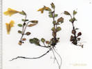
Plantaginaceae
Linaria vulgaris Mill. Butter and Eggs. Weed: CO DofA, List: B. CalPhotos. Jepson eFlora. SEINet Taxon.
- West Tennessee Creek, Disturbed area along Pike-San Isabel National Forest Road 131, 1.4 miles by road generally west from US Highway 24, 15 km. northwest of Leadville, 139 km. southwest of Golden. Tom Schweich 2711. 17 Aug 2021. ( KHD00075283‡ OBI183773‡ ) . .
Penstemon hallii A. Gray. Hall's Beardtongue. CalPhotos. Jepson eFlora. SEINet Taxon.
- Evans Gulch,
In gravel of valley bottom land.
Junction of County Road 3 and 3B, 2.8 mi. east of Leadville on County Road 3.
Tom Schweich 1482.
29 Jun 2016.
(
OBI83348‡
)
.
.
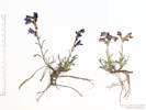
Penstemon procerus Douglas ex Graham var. procerus. Pincushion Beardtongue. CalPhotos. Jepson eFlora. SEINet Taxon.
- Lily Lake, Also collected here: Bistorta bistortoides, Arctostaphylos uva-ursi, Erigeron glacialis, and Taraxacum officinale. North side of Lily Lake, on sloping ground down to North Fork West Tennessee Creek, near the end of the Pike-San Isabel Forest Road 131, 2.8 road miles west of US Highway 24, 140 km. southwest of the GNIS location of Golden. Tom Schweich 2580. 13 Jul 2021. ( COLO2706448‡ KHD00075207‡ OBI183710‡ ) .
- West Tennessee Creek,
Open area, also collected here; Geum triflorum, Caltha leptosepala, and Rhodiola rhodantha.
Distances measured from GNIS point features.
On a former oxbow of West Tennessee Creek, 830 m. southeast of Lily Lake, 15.9 km. north northwest of Loeadville.
Tom Schweich 2880.1
19 Jul 2022.
(
Undist.
)
.
.
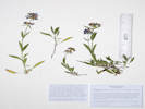
Penstemon rydbergii A. Nelson. Rydberg's Penstemon. CalPhotos. Jepson eFlora. SEINet Taxon.
- Unnamed Gulch on Forest Road 189,
Openings in aspen forest, mixed with patches of big sagebrush and willows.
Along Forest Road 189, about 1 km. west of County Road 18 “East Tennessee Road,” 7.37 km. north northwest of the GNIS location of Leadville.
Tom Schweich 2906.
21 Jul 2022.
(
KHD00078704‡
OBI183833‡
)
.
.
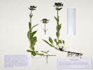
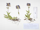
Penstemon whippleanus A. Gray. Whipples Penstemon. CalPhotos. Jepson eFlora. SEINet Taxon.
- Brumley, Brumley was a stage stop on the route across Independence Pass. Subalpine forest on a bank between the access road to the Sno-Tel station and the highway, about 11 road miles generally west on Colorado Highway 82 from the town of Twin Lakes, 175 km. southwest of Golden. Tom Schweich 2883. 20 Jul 2022. ( Undist. ) .
- Evans Gulch, Sunny open southeast-facing slope. One of the specimens has several insect galls. Middle section of Evans Gulch, near Conley Lakes and the Diamond Mine, 4.6 mi. by road east of the GNIS location of Leadville. Tom Schweich 3136. 20 Jul 2023. ( KHD ‡ ) .
- Lily Lake,
Lodgepole pine forest, also collected here, Trifolium parryi.
Northeast of Lily Lake, near the (current) end of the Pike-San Isabel Forest Road 131, 2.7 road miles west of US Highway 24, 140 km. southwest of the GNIS location of Golden.
Tom Schweich 2587.
13 Jul 2021.
(
COLO2706497‡
KHD00075211‡
OBI183716‡
)
.
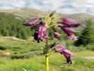
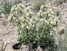
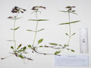
Polemoniaceae
Collomia linearis Nutt. Tiny Trumpet. CalPhotos. Jepson eFlora. SEINet Taxon.
Annual; Stem simple, unbranched; Leaves linear, 20-25 mm; Calyx membrane 0, lobes growing with capsule, becoming papery with age; Corolla white, 6-9 mm (Described from Coll. No. 713, 19 Nov 2011).
- Unnamed meadow on Forest Road 109, Approximate center of meadow, with Campanula parryi. Southern part of the ridge that includes Mount Zion and Buckeye Peak, about 2.7 road miles north of Leadville, access to Forest Road 109 from US Highway 24, 140 km. southwest of Golden. Tom Schweich 2599. 15 Jul 2021. ( OBI183703‡ ) .
- North Fork West Tennessee Creek, Dry rocky opening in lodgepole pine forest. Also collected here: Spergularia rubra and Androsace septentrionalis. One of six little annuals collected here. Appears to be first Lake County collection. About 300 m. east of Lily Lake, along Pike-San Isabel Forest Road 131, 2.6 road miles west of US Highway 24, 140 km. southwest of the GNIS location of Golden. Tom Schweich 2590.4 13 Jul 2021. ( KHD00075213‡ ) .
- Unnamed Gulch on Forest Road 189,
Growing in an outlet ditch that was freshly bladed in 2023, with Gayophytum racemosum, Polygonum douglasii, and P. polygaloides ssp. kelloggii.
Along Pike-San Isabel National Forest Road 189, about 1 km. east of County Road 18 “East Tennessee Road,” 7.37 km. north northwest of the GNIS location of Leadville. Openings in aspen forest, mixed with patches of big sagebrush and willows.
Tom Schweich 3337.
24 Jul 2024.
(
Undist.
)
.
.

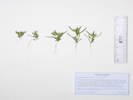
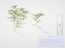
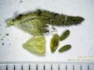
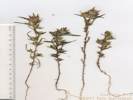
Leptosiphon nuttallii (Gray) J. M. Porter & L. A. Johnson ssp. nuttallii. (Syn: Gilia nuttallii A Gray , Leptodactylon nuttallii (Gray) Rydb. , Linanthus nuttallii (A. Gray) Greene ex Milliken , Linanthastrum nuttallii (A. Gray) Ewan ) Nuttall's Linanthus. CalPhotos. Jepson eFlora. SEINet Taxon.
Perennial herb, to 15 cm., woody at base; Leaves, well-developed, cauline, opposite, connate at base, 3-9-lobed, lobes 3-20 mm. × 0.5-1.08 mm. wide, soft, tip acute, some appearing spinulose; Inflorescence, dense head-like cluster, pedicels to 4 mm., not tomentose; Calyx, lobes, 7.5-8 mm. × 1.2-2.2 mm. wide, narrow hyaline sinuses ±½; Corolla, white, tube 7-8 mm. + lobes 5 mm. × 3 mm. wide, limb 11 mm. wide. (Described from Coll. No. 1470.1, 29 June 2016 and Coll. No. 1985, 23 July 2018.)
- Chalk Creek, Along Chalk Creek, National Forest Road 134, off Colorado Highway 91, 13.3 km. northeast of the GNIS location of Leadville. Tom Schweich 1985. 23 Jul 2018. ( KHD00069162‡ OBI158898‡ UCR ‡ ) .
- Evans Gulch, Southeast-facing open slope with mostly forbs. Mosquito Range, middle section of Evans Gulch, near Conley Lakes and the Diamond Mine, 4.6 mi. by road east of the GNIS location of Leadville. Tom Schweich 1470.1 29 Jun 2016. ( CAS EIU OBI83357‡ ) .
- Unnamed meadow on Forest Road 109, East end of meadow, near road. Southern part of the ridge that includes Mount Zion and Buckeye Peak, about 2.7 road miles north of Leadville, access to Forest Road 109 from US Highway 24, 140 km. southwest of Golden. Tom Schweich 2600. 15 Jul 2021. ( COLO2718385‡ KHD00075529‡ OBI183701‡ ) .
- Unnamed Gulch on Forest Road 189, Openings in aspen forest, mixed with patches of big sagebrush and willows. Along Forest Road 189, about 1 km. west of County Road 18 “East Tennessee Road,” 7.37 km. north northwest of the GNIS location of Leadville. Tom Schweich 2900. 21 Jul 2022. ( Undist. ) .
- West Tennessee Creek,
Edges of open forest, on slope above flood plain.
Distances measured from GNIS point features.
Along an old, closed forest road on the north side of West Tennessee Creek, 780 m. southwest of Lily Lake, and 16.0 km. north northwest of Leadville
Tom Schweich 2874.
19 Jul 2022.
(
Undist.
)
.
.
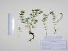
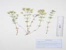
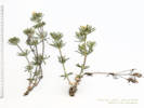
Polemonium viscosum Nuttall. Sticky Sky Pilot. CalPhotos. Jepson eFlora. SEINet Taxon.
- Evans Gulch,
Southeast-facing open slope with mostly forbs.
Mosquito Range, middle section of Evans Gulch, near Conley Lakes and the Diamond Mine, 4.6 mi. by road east of the GNIS location of Leadville.
Tom Schweich 1472.
29 Jun 2016.
(
EIU
OBI83356‡
)
.
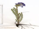
Polygonaceae
Bistorta bistortoides (Pursh) Small. (Syn: Polygonum bistortoides Pursh ) CalPhotos. Jepson eFlora. SEINet Taxon.
- Adelaide, Roadside in Stray Horse Gulch, along County Road 2A, just south of County Road 1, 3 km. east southeast of the GNIS location of Leadville. Tom Schweich 1480. 29 Jun 2016. ( CAS EIU OBI83350‡ UC UCR ‡ ) .
- Brumley, Full sun just inside the willow thicket above North Fork of Lake Creek. Near the site of the stagecoach stop of Brumley, about 11 miles generally west on CO State Highway 82 from the town of Twin Lakes, Lake County, 27.8 km. southwest of Leadville, 135 km. southwest of Golden. Tom Schweich 3327. 23 Jul 2024. ( Undist. ) .
- Lily Lake, Also collected here: Potentilla gracilis var. fastigiata, Arctostaphylos uva-ursi, Penstemon procerus, Erigeron glacialis. and Taraxacum officinale. North side of Lily Lake, at the edge of a wetland formed by North Fork West Tennessee Creek, near the end of the Pike-San Isabel Forest Road 131, 2.8 road miles west of US Highway 24, 140 km. southwest of the GNIS location of Golden. Tom Schweich 2583. 13 Jul 2021. ( KHD00075526‡ ) .
- Unnamed Gulch on Forest Road 189,
Muddy, wet place in willow thicket.
Along Forest Road 189, about 1 km. east of County Road 18 “East Tennessee Road,” 5.69 km. (geodesic) north northwest of the GNIS location of Leadville.
Tom Schweich 3122.
19 Jul 2023.
(
KHD ‡
)
.
.
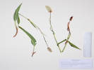
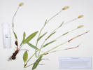

Bistorta vivipara (L.) Delarbre. Alpine Bistort. CalPhotos. Jepson eFlora. SEINet Taxon.
- Unnamed Gulch on Forest Road 189, Growing in moss on bank of creek in a willow thicket south of the road. Along Forest Road 189, about 1 km. east of County Road 18 “East Tennessee Road,” 5.69 km. (geodesic) north northwest of the GNIS location of Leadville. Tom Schweich 3130. 19 Jul 2023. ( Undist. ) Bank of small creek in willows, also here: Oxypolis fendleri and Cardamine cordifolia. About 100 m. southwest of Forest Road 189, about 1 km. west of County Road 18 “East Tennessee Road,” 7.37 km. north northwest of the GNIS location of Leadville. Openings in aspen forest, mixed with patches of big sagebrush and willows. Tom Schweich 3348.2 24 Jul 2024. ( Undist. ) .
- West Tennessee Creek,
Marshy place under forest trees., with Pedicularis groenlandica.
Distances measured from GNIS point features.
At the end of an old, closed forest road on the north side of West Tennessee Creek, 720 m. south of Lily Lake, 16.1 km. north northwest of Leadville.
Tom Schweich 2879.1
19 Jul 2022.
(
KHD00078232‡
)
.
.
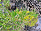
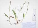
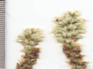
Eriogonum umbellatum Torrey, Ann. Lyceum Nat. Hist. New York. 2: 241. 1827. var. majus Hook. Subalpine Sulphur-Flower Buckwheat. CalPhotos. Jepson eFlora. SEINet Taxon.
- Brumley, Treeless slope (avalanche chute?) above the highway. About ½ mile north of Brumley on the east side of the road, about 12 road miles on Colorado Highway 82 generally west from Twin Lakes, Lake County, Colorado; 175 km. southwest of Golden. Tom Schweich 2886. 20 Jul 2022. ( KHD00078228‡ ) .
- Evans Gulch, Sunny open southeast-facing slope. Middle section of Evans Gulch, near Conley Lakes and the Diamond Mine, 4.6 mi. by road east of the GNIS location of Leadville. Tom Schweich 3141. 20 Jul 2023. ( Undist. ) .
- North Fork West Tennessee Creek, Dry rocky clearing in lodgepole pine forest. About 300 m. east of Lily Lake, along Pike-San Isabel Forest Road 131, 2.6 road miles west of US Highway 24, 140 km. southwest of the GNIS location of Golden. Tom Schweich 2588. 13 Jul 2021. ( COLO2706133‡ KHD00075212‡ OBI183709‡ ) .
- Unnamed Gulch on Forest Road 189, Openings in aspen forest, surrounded by big sagebrush and willows. Along Forest Road 189, about 1 km. west of County Road 18 “East Tennessee Road,” 7.37 km. north northwest of the GNIS location of Leadville. Tom Schweich 2895. 21 Jul 2022. ( KHD00078706‡ OBI183821‡ Undist. ) .
- West Tennessee Creek,
Open ground on edges of forest.
Distances measured from GNIS point features.
Along an old, closed forest road on the north side of West Tennessee Creek, 770 m. southeast of Lily Lake, 16.0 km. north northwest of Leadville.
Tom Schweich 2876.
19 Jul 2022.
(
Undist.
)
.
.
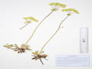

Polygonum aviculare L. Prostrate Knotweed. CalPhotos. Jepson eFlora. SEINet Taxon.
- North Fork West Tennessee Creek,
Dry rocky opening in lodgepole pine forest.
One of six little annuals collected here, others are Gayophytum decipiens, Androsace septentrionalis, Collomia linearis, and Spergularia rubra.
About 300 m. east of Lily Lake, along Pike-San Isabel Forest Road 131, 2.6 road miles west of US Highway 24, 140 km. southwest of the GNIS location of Golden.
Tom Schweich 2590.3
13 Jul 2021.
(
KHD00075214‡
)
.
.

Polygonum douglasii Greene. (Syn: Polygonum majus (Meisner) Piper ) Douglas Knotweed. CalPhotos. Jepson eFlora. SEINet Taxon.
Annual, to 35-40 cm., generally glabrous; Leaves, cauline, alternate, some sort of papery tissue at base of leaf that could be an ocrea, 20 mm. × 1 mm. wide, linear to narrowly lanceolate, adaxial sparsely pitted, margins revolute; Inflorescence, flowers borne singly in axils; Flowers, stipe-like base; Perianth, #5 (looked like 3 outer and 3 inner to me) 2.5 mm. × 1 mm. wide, outer, greenish with pink margins, inner, pink with green mid-vein; Stamens, #8 (I was able to count 6), 1.4 mm.; Filaments, winged below; Ovary, superior, 1 mm. × 0.6 mm. wide; Styles, #3, 0.3 mm.; Stigmas, 1 per style; Fruit, 2.5 mm., black. Described from Coll. No. 1718, 28 Jul 2017.
- Unnamed Gulch on Forest Road 189,
Growing in an outlet ditch that was freshly bladed in 2023, with Gayophytum racemosum, Collomia linearis, and Polygonum polygaloides ssp. kelloggii.
Along Pike-San Isabel National Forest Road 189, about 1 km. west of County Road 18 “East Tennessee Road,” 7.37 km. north northwest of the GNIS location of Leadville. Openings in aspen forest, mixed with patches of big sagebrush and willows.
Tom Schweich 3335.
24 Jul 2024.
(
Undist.
)
.
.
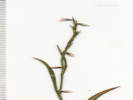
Polygonum polygaloides Meisn. ssp. kelloggii (Greene) J. C. Hickman. Kellogg's Knotweed. CalPhotos. Jepson eFlora. SEINet Taxon. Known from the Front Range of Colorado, west to the Sierra Nevada and Klamath Mountains, and into Oregon and Washington. Described by E. L. Greene from the Donner Lake region of the Sierra Nevada.
- Unnamed Gulch on Forest Road 189,
Growing in an outlet ditch that was freshly bladed in 2023, with Collomia linearis and Gayophytum racemosum.
Along Forest Road 189, about 1 km. west of County Road 18 “East Tennessee Road,” 7.37 km. north northwest of the GNIS location of Leadville. Openings in aspen forest, mixed with patches of big sagebrush and willows.
Tom Schweich 3334.
24 Jul 2024.
(
Undist.
)
.
.
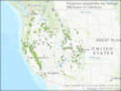
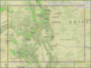
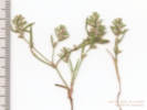
Rumex densiflorus Osterhout. Dense-Flower Dock. CalPhotos. Jepson eFlora. SEINet Taxon.
- North Fork West Tennessee Creek,
Mixed pine forest and abandoned beaver dams.
Tennesee Creek Basin, 8.2 mi. north of Leadville, then 2.4 mi. generally west on County Road 9 and Forest Road 131, not quite to Lily Lake, 12.5 km. north northeast of the GNIS location of Leadville.
Tom Schweich 2007.
25 Jul 2018.
(
OBI158424‡
UCR ‡
)
.
.
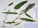
Rumex utahensis Rech. f. Utah Willow Dock. CalPhotos. Jepson eFlora. SEINet Taxon.
- Brumley,
Somewhat older and more vegetated portion of the sandy bar.
Brumley was a stage stop on the route across Independence Pass.
Sandy abandoned oxbow of the North Fork of Lake Creek, about 130 m. north of the Sno-Tel station road turnoff from the highway, about 11 road miles generally west on Colorado Highway 82 from the town of Twin Lakes, 175 km. southwest of Golden.
Tom Schweich 2729.
18 Aug 2021.
(
COLO2706596‡
KHD00075264‡
OBI183784‡
)
.

Primulaceae
Androsace septentrionalis L. (Syn: Androsace septentrionalis L. ssp. subumbellata (A. Nelson) G. T. Robbins ) Pygmyflower Rockjasmine. CalPhotos. Jepson eFlora. SEINet Taxon.
- Evans Gulch, Southeast-facing open slope with mostly forbs. Mosquito Range, middle section of Evans Gulch, near Conley Lakes and the Diamond Mine, 4.6 mi. by road east of the GNIS location of Leadville. Tom Schweich 1468. 29 Jun 2016. ( CAS EIU OBI83318‡ ) .
- North Fork West Tennessee Creek, Dry rocky opening in lodgepole pine forest. One of six little annuals collected here. About 300 m. east of Lily Lake, along Pike-San Isabel Forest Road 131, 2.6 road miles west of US Highway 24, 140 km. southwest of the GNIS location of Golden. Tom Schweich 2590.2 13 Jul 2021. ( KHD00075546‡ ) .
- Unnamed Gulch on Forest Road 189,
Edge of aspen forest, also nearby: Vicia americana var. americana and Anticlea elegans
Along Forest Road 189, about 1 km. west of County Road 18 “East Tennessee Road,” 7.37 km. north northwest of the GNIS location of Leadville. Openings in aspen forest, mixed with patches of big sagebrush and willows.
Tom Schweich 3336.
24 Jul 2024.
(
Undist.
)
.
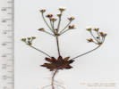
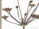
Ranunculaceae
Aconitum columbianum Nutt. Columbian Monkshood. CalPhotos. Jepson eFlora. SEINet Taxon.
- Brumley, On the bank of the creek, also collected here: Gentiana parryi, Chamerion angustifolium, and Mertensia ciliata. On the bank of Lake Creek, beside the access road to the Sno-Tel station, about 11 road miles generally west on Colorado Highway 82 from the town of Twin Lakes, 175 km. southwest of Golden. Tom Schweich 2885. 20 Jul 2022. ( KHD00078229‡ ) .
- North Fork West Tennessee Creek, Deep subalpine forest shade on bank of creek. About 385 m. northeast of Lily Lake, near the current end of Pike-San Isabel Forest Road 131, 2.6 road miles west of US Highway 24, 140 km. southwest of the GNIS location of Golden. Tom Schweich 2709. 17 Aug 2021. ( Golden ) .
- West Tennessee Creek,
Tom Schweich 2935.
7/19/2022.
.
.
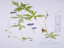
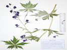
Anemone multifida Poir. Pacific Anemone. CalPhotos. Jepson eFlora. SEINet Taxon.
- Evans Gulch,
Southeast-facing open slope with mostly forbs.
Var. multifida if infraspecific taxa are to be recognized.
Mid-section of Evans Gulch, near Conley Lakes and the Diamond Mine, 4.6 mi. by road east of the GNIS location of Leadville.
Tom Schweich 1475.
29 Jun 2016.
(
CAS
EIU
OBI83352‡
)
.
.
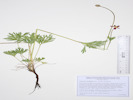
Anemone narcissiflora L. var. zephyra (A. Nelson) B. E. Dutton & Keener. Narcissis Anemone. CalPhotos. Jepson eFlora. SEINet Taxon.
Perennial herb, to 35 cm.; Stem, thick, 4 mm.; Leaves, basal, petiole, 150 mm. × 3 mm. wide + blade 60 mm. × 75 mm. wide, (ternately?) divided, margins incised, involucre, single series of stem leaves whorled around inflorescence, sessile; Flowers, actinomorphic, 1-4 per stem; Sepals, petaloid, 12-17 mm., not spurred, white, drying light yellow; Fruit, unknown (Described from Coll. No. 1478, 29 Jun 2016).
- Breece Hill,
Rocky forest floor.
Roadside of Lake County Road 1A, near the top of Breece Hill, about 4.1 mi. by road from the GNIS location of Leadville.
Tom Schweich 1478.
29 Jun 2016.
(
CAS
EIU
OBI83308‡
)
.
.
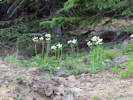
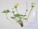
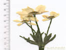
Aquilegia coerulea E. James. Colorado Blue Columbine. CalPhotos. Jepson eFlora. SEINet Taxon.
Collected by E. James, 1820, described 1823, holotype: NY.
- Brumley, About 60 m. above the highway on hummocky treeless slope that may be an avalanche chute. About ½ mile north of Brumley on the east side of the road, about 12 road miles on Colorado Highway 82 generally west from Twin Lakes, Lake County, Colorado; 175 km. southwest of Golden. Tom Schweich 2887. 20 Jul 2022. ( KHD00079101‡ ) .
- Unnamed Gulch on Forest Road 189,
South side of the gulch on the edges of an open aspen forest.
Along Forest Road 189, about 1 km. east of County Road 18 “East Tennessee Road,” 5.69 km. (geodesic) north northwest of the GNIS location of Leadville.
Tom Schweich 3127.
19 Jul 2023.
(
Undist.
)
.
.
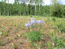
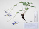
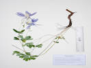
Caltha chionophila Greene. Marsh Marigold. CalPhotos. Jepson eFlora. SEINet Taxon.
- Brumley, Uncommon. Brumley was a stage stop on the route across Independence Pass. On bank of North Fork of Lake Creek, near the access road to the Sno-Tel station, about 11 road miles generally west on Colorado Highway 82 from the town of Twin Lakes, 175 km. southwest of Golden. Tom Schweich 2894. 20 Jul 2022. ( KHD00079751‡ ) Muddy side of former channel of North Fork of Lake Creek. Near the site of the stagecoach stop of Brumley, about 11 miles generally west on CO State Highway 82 from the town of Twin Lakes, Lake County, 27.8 km. southwest of Leadville, 135 km. southwest of Golden. Tom Schweich 3330. 23 Jul 2024. ( Undist. ) .
- West Tennessee Creek,
In a meadow just north of West Tennessee Creek, 580 m. southwest of Lily Lake, 12.6 km. northwest of the GNIS location of Leadville.
Tom Schweich 3106.
18 Jul 2023.
(
Undist.
)
.
.
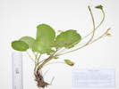
Caltha leptosepala DC. White Marsh Marigold. CalPhotos. Jepson eFlora. SEINet Taxon.
- West Tennessee Creek, Tom Schweich 2939. 7/19/2022. . .
Ranunculus cardiophyllus Hook. Showy Buttercup. CalPhotos. Jepson eFlora. SEINet Taxon.
- Unnamed meadow on Forest Road 109,
East end of meadow, shaded edges of the forest, also collected here: Astragalus alpinus, Vicia americana, Leptosiphon nuttallii, nearby: Campanula parryi, and Collomia linearis.
Southern part of the ridge that includes Mount Zion and Buckeye Peak, about 2.7 road miles north of Leadville, access to Forest Road 109 from US Highway 24, 140 km. southwest of Golden.
Tom Schweich 2605.
15 Jul 2021.
(
KHD00077102‡
)
.
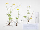
Rosaceae
Dasiphora fruticosa (L.) Rydb. (Syn: Potentilla fruticosa L. ) Shrubby Cinquefoil, Golden Hardtack. CalPhotos. Jepson eFlora. SEINet Taxon.
- North Fork West Tennessee Creek, Dry rocky opening in lodgepole pine forest. Also collected nearby: Eriogonum umbellatum var. majus, Androsace septentrionalis, Collomia linearis, and Solidago multiradiata. About 300 m. east of Lily Lake, along Pike-San Isabel Forest Road 131, 2.6 road miles west of US Highway 24, and 10.9 road miles north northwest of Leadville, 140 km. southwest of the GNIS location of Golden. Tom Schweich 2592. 13 Jul 2021. ( COLO2706117‡ KHD00075528‡ OBI183715‡ UCR294677‡ ) .
- Unnamed Gulch on Forest Road 189,
Openings in aspen forest, mixed with patches of big sagebrush and willows.
Along Forest Road 189, about 1 km. west of County Road 18 “East Tennessee Road,” 7.37 km. north northwest of the GNIS location of Leadville.
Tom Schweich 2898.
21 Jul 2022.
(
CS201806‡
)
.
.
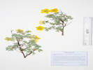
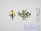
Fragaria virginiana Mill. Virginia Strawberry. CalPhotos. Jepson eFlora. SEINet Taxon.
- Evans Gulch, Southeast-facing open slope with mostly forbs. Mosquito Range, middle section of Evans Gulch, near Conley Lakes and the Diamond Mine, 4.6 mi. by road east of the GNIS location of Leadville. Tom Schweich 1473. 29 Jun 2016. ( CAS EIU OBI83355‡ ) .
- North Fork West Tennessee Creek,
Shaded area beside road, rocky soil, perhaps glacial till.
About 120 m. east of Lily Lake, at the current end of Pike-San Isabel Forest Road 131, 2.6 road miles west of US Highway 24, 140 km. southwest of the GNIS location of Golden.
Tom Schweich 2704.
17 Aug 2021.
(
COLO2992386‡
KHD00076201‡
)
.
.
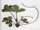
Geum macrophyllum Willd. var. perincisum (Rydb.) Raup. Large-leaf Avens. CalPhotos. Jepson eFlora. SEINet Taxon.
- Brumley,
Common on edge of slough (former channel of the creek).
Brumley was a stage stop on the route across Independence Pass.
Edge of slough beside the North Fork of Lake Creek, near the access road to the Sno-Tel station, about 11 road miles generally west on Colorado Highway 82 from the town of Twin Lakes, 175 km. southwest of Golden.
Tom Schweich 2893.
20 Jul 2022.
(
KHD00079750‡
OBI183831‡
)
.
.
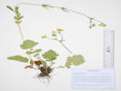
Geum triflorum Pursh. Old Man's Whiskers. CalPhotos. Jepson eFlora. SEINet Taxon.
- Brumley, Open spot among short (1 m.) willows, with Achillea millefolium, Taraxacum ceratophorum, and Phleum alpinum. Near the site of the stagecoach stop of Brumley, about 11 miles generally west on CO State Highway 82 from the town of Twin Lakes, Lake County, 135 km. southwest of Golden. Tom Schweich 3320. 23 Jul 2024. ( Undist. ) .
- Evans Gulch, Southeast-facing open slope with mostly forbs. Unclear as to variety if infraspecific taxa are to be recognized. Mosquito Range, middle section of Evans Gulch, near Conley Lakes and the Diamond Mine, 4.6 mi. by road east of the GNIS location of Leadville. Tom Schweich 1470. 29 Jun 2016. ( CAS EIU019418‡ OBI83358‡ ) .
- Unnamed meadow on Forest Road 109, Approximate center of meadow, also collected here: Campanula parryi, and Collomia linearis, nearby: Astragalus alpinus, Vicia americana, and Leptosiphon nuttallii. Southern part of the ridge that includes Mount Zion and Buckeye Peak, about 2.7 road miles north of Leadville, access to Forest Road 109 from US Highway 24, 140 km. southwest of Golden. Tom Schweich 2606. 15 Jul 2021. ( COLO2718450‡ KHD00075391‡ ) .
- Unnamed Gulch on Forest Road 189, in fruit Tom Schweich 3814. 7/24/2024. .
- West Tennessee Creek,
Open area, also collected here; Penstemon procerus, Caltha leptosepala, and Rhodiola rhodantha.
Distances measured from GNIS point features.
On a former oxbow of West Tennessee Creek, 830 m. southeast of Lily Lake, 15.9 km. north northwest of Loeadville.
Tom Schweich 2880.
19 Jul 2022.
(
KHD00078231‡
OBI183841‡
)
.
.
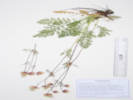
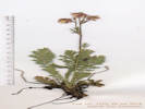
Potentilla glaucophylla Lehm. var. glaucophylla. Blue Leaf Cinquefoil. CalPhotos. Jepson eFlora. SEINet Taxon.
Perennial herb, to 25 cm.; Flowering stems, ascending, reddish; Leaves, basal, petiole, 50 mm., sparsely hairy, blade, palmate, 25 mm. × 35 mm. wide, 5-7 leaflets, leaflets, incised, distal ½, about half-way to mid-vein, adaxial, very sparse hairy, abaxial, hairy mostly on veins, margins hairy, cauline, much reduced to sessile, ternately lobed, 17 mm.; Sepals, 5 mm. × 3 mm. wide, green, purplish on veins or at tips; Petals, 7 mm. × 8 mm. wide, bright yellow; Stamens, #20; Anthers, 0.7 mm.; Style, 2 mm., slender throughout, attached mid-achene. (Described from Coll. No. 1477, 29 Jun 2016).
- Breece Hill,
Relatively less-disturbed full-sun meadow.
Near the top of Breece Hill, just west of the intersection of Lake County Roads 1A and 1B, 4.2 mi. by road from the GNIS location of Leadville.
Tom Schweich 1477.
29 Jun 2016.
(
CAS
EIU
OBI83309‡
UC
)
.
.
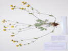
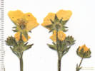
Potentilla gracilis Hook. var. fastigiata (Nutt.) S. Watson. Slender Cinquefoil. CalPhotos. Jepson eFlora. SEINet Taxon. Also collected in the Mono Lake Basin, California.
Perennial, herbaceous, to 50 cm.; Stolons 0; Stem ascending, hairs one length, spreading, not shaggy or cottony; Leaf palmately compound; Leaflets 5-7, 12 to 21-toothed to base of leaflet, ± half or less to mid-veins, top and bottom surfaces similarly hairy, hairs straight spreading (not shaggy or cottony hairy), Inflorescence in cymes, many-flowered; Sepals 5; Receptacle in fruit not enlarged; Petals 5, yellow, equal to or slightly longer than sepals; Hypanthium shallow; Stamens many, 13-18; Style jointed to achene at top, thickest at base, slightly tapered, neither warty nor hairy, 1.4-2.0 mm.; Achenes glabrous, not fleshy; (Described from Coll. No. 438.2 12 Nov 2012, Coll. No. 471 30 Nov 2011, and Coll. No. 852 21 Jun 2012).
- Lily Lake, Also collected here: Bistorta bistortoides, Arctostaphylos uva-ursi, Penstemon procerus, Erigeron glacialis, and Taraxacum officinale. North side of Lily Lake, on sloping ground down to North Fork West Tennessee Creek, near the end of the Pike-San Isabel Forest Road 131, 2.8 road miles west of US Highway 24, 140 km. southwest of the GNIS location of Golden. Tom Schweich 2581. 13 Jul 2021. ( COLO2706463‡ KHD00075208‡ OBI183717‡ ) .
- West Tennessee Creek,
Open forest.
Along an old, closed forest road on the north side of West Tennessee Creek, 810 m. southeast of Lily Lake, and 15.9 km. north northwest of Leadville.
Tom Schweich 2873.1
19 Jul 2022.
(
Undist.
)
Collected with Danthonia intermedia, and Phleum alpunum.
Former meander of West Tennessee Creek, 575 m. (geodesic) southeast of Lily Lake, 12.3 km. (geodesic) north northwest of Leadville.
Tom Schweich 3102.2
18 Jul 2023.
(
KHD87646‡
)
.
.

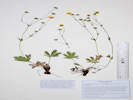
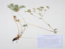
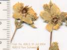
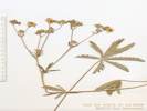
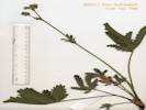
Potentilla hippiana Lehm. Wooly Cinquefoil. CalPhotos. Jepson eFlora. SEINet Taxon.
- Evans Gulch, Southeast-facing open slope with mostly forbs. Accidental collection. Mosquito Range, middle section of Evans Gulch, near Conley Lakes and the Diamond Mine, 4.6 mi. by road east of the GNIS location of Leadville. Tom Schweich 1473.1 29 Jun 2016. ( Discardrd ) . .
Potentilla hippiana Lehm. var. hippiana. Wooly Cinquefoil. CalPhotos. Jepson eFlora. SEINet Taxon.
Perennial herb, to 35 cm., woody caudex; Stem, unbranched, pilose; Leaves, basal and cauline, basal, 70 mm. × 24 mm. wide, pinnately compound, sericeous adaxially, tomentose and sericeous abaxially, distinctly bicolored or not, leaflets, #9, toothed along full length, cauline, reduced, stipules, 11 mm. × 3 mm. wide, lanceolate, entire, leaflets, #5, 24 mm. × 6 mm. wide, without decurrent bases, toothed along length; Inflorescence, cyme; Bractlets, ±same color as sepals; Petals, 5 mm. × 4.5 mm. wide, yellow; Styles, 2.7 mm., tapered from base, smooth (Described from Coll. No. 2182, 2902).
- Unnamed Gulch on Forest Road 189,
Openings in aspen forest, mixed with patches of big sagebrush and willows.
Along Forest Road 189, about 1 km. west of County Road 18 “East Tennessee Road,” 7.37 km. north northwest of the GNIS location of Leadville.
Tom Schweich 2902.
21 Jul 2022.
(
KHD00078710‡
OBI183839‡
)
.
.
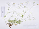
Potentilla hippiana × pulcherrima. Hybrid Potentilla. CalPhotos. Jepson eFlora. SEINet Taxon.
- Fremont Pass,
Mixed dry forest and open sagebrush.
By highway near summit Fremont Pass, near Climax.
Paul Green 294.
15 Jul 1952.
(
COLO705491‡
)
.
.
Potentilla pulcherrima Lehmann. (Syn: P. gracilis Douglas ex Hooker var. pulcherrina (Lehmann) Fernald ) Beautiful Cinquefoil. CalPhotos. Jepson eFlora. SEINet Taxon.
Perennial herb, to 40 cm.; Stems, erect, not rooting at nodes; Leaves, basal, compound, palmate, leaflets, #5 or 7 (never ternate), toothed ±entire length, #7-11 teeth, adaxial green, few long hairs, abaxial gray, densely tomentose; cauline, few (2-3); Inflorescence, #14 flowers, inconspicuous tiny red-tipped glands on sepals and epicalyx bractlets; Sepals, fused 1.5 mm. + free 5 mm. × 1.8 mm. wide, green, hirsute, glandular; Epicalyx bractlets, 4.5 mm. × 1.1 mm. wide, green, with reddish-brown tips; Petals, 8 mm. × 8 mm. wide, deltate, yellow; Styles, 2 mm., filiform, terminal. (Described from Coll. No. 1956, 20 June 2018.)
- Brumley, Grassy areas between the highway and willows above North Fork of Lake Creek, with Achillea millefolium, Symphyotrichum foliaceum var. apricum, Taraxacum ceratophorum, Geum triflorum, and Phleum alpinum. Near the site of the stagecoach stop of Brumley, about 11 miles generally west on CO State Highway 82 from the town of Twin Lakes, Lake County, 27.8 km. southwest of Leadville, 135 km. southwest of Golden. Tom Schweich 3326. 23 Jul 2024. ( Undist. ) .
- Chalk Creek,
Along Chalk Creek, National Forest Road 134, off Colorado Highway 91, 13.3 km. northeast of the GNIS location of Leadville.
Tom Schweich 1989.
23 Jul 2018.
(
KHD00069206‡
OBI158901‡
UCR ‡
)
.
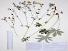
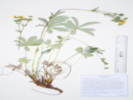
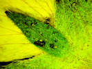
Salicaceae
Populus tremuloides Michx. Quaking Aspen. CalPhotos. Jepson eFlora. SEINet Taxon.
- Unnamed Gulch on Forest Road 189,
Openings in aspen forest, mixed with patches of big sagebrush and willows.
Along Forest Road 189, about 1 km. west of County Road 18 “East Tennessee Road,” 7.37 km. north northwest of the GNIS location of Leadville.
Tom Schweich 2899.
21 Jul 2022.
(
KHD00078708‡
OBI183834‡
)
.
.
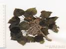
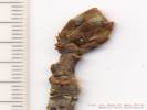
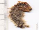
Salix . Willow. CalPhotos. Jepson eFlora. SEINet Taxon.
- Unnamed Gulch on Forest Road 189,
streamside
Tom Schweich 3118.
19 Jul 2023.
(
Undist.
)
.
.
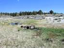
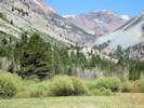
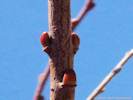
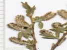
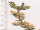
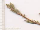
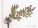
Salix glauca L. Gray Willow. CalPhotos. Jepson eFlora. SEINet Taxon.
- West Tennessee Creek,
Low shrub on floor of meander, also collected here: Pseudocymopterus montanus, Potentilla gracilis var. fastigiata, Danthonia intermedia, and Phleum alpinum.
Variety villosa Andersson, if infraspecific names are to be applied.
Former meander of West Tennessee Creek, 578 m. (geodesic) southeast of Lily Lake, 12.3 km. (geodesic) north northwest of Leadville.
Tom Schweich 3103.
18 Jul 2023.
(
CS202156‡
KHD87542‡
)
.
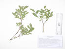
Saxifragaceae
Micranthes odontoloma (Piper) A. Heller. Brook Saxifrage. CalPhotos. Jepson eFlora. SEINet Taxon.
- North Fork West Tennessee Creek,
In a damp ephemeral stream channel, collected with Cardamine cordifolia.
Right bank of North Fork of West Tennessee Creek, 530 m. east northeast of Lily Lake, 12.7 km. north northwest of the GNIS location of Leadville.
Tom Schweich 3115.
18 Jul 2023.
(
KHD ‡
)
.
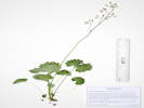
Undet.
Undetermined . CalPhotos. Jepson eFlora. SEINet Taxon.
- North Fork West Tennessee Creek,
Tom Schweich 2590.
13 Jul 2021.
(
Golden
)
.
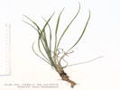
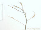
Violaceae
Viola adunca Sm. Hooked Spur Violet. CalPhotos. Jepson eFlora. SEINet Taxon.
- West Tennessee Creek,
With Veratrum californicum, Senecio triangularis in the meadow, and Pedicularis racemosa in the forest.
Edge of lodgepole pine forest beside a meadow between West Tennessee Creek and Lily Lake, 400 m. southwest of Lily Lake, 12.8 km. northwest of the GNIS location of Leadville.
Tom Schweich 3111.
18 Jul 2023.
(
KHD ‡
)
.
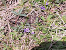
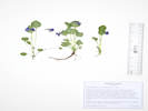
Juncaceae
Juncus mertensianus Bong. Merten's Rush. CalPhotos. Jepson eFlora. SEINet Taxon.
- Brumley,
In sand and gravel at creek level, sunny location with willows on shore.
Brumley was a stage stop on the route across Independence Pass.
Sandy shore of the North Fork of Lake Creek, near the Sno-Tel station, about 11 road miles generally west on Colorado Highway 82 from the town of Twin Lakes, 175 km. southwest of Golden.
Tom Schweich 2720.
18 Aug 2021.
(
COLO2706158‡
KHD00075354‡
OBI183790‡
)
.
.
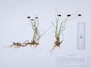
Luzula parviflora (Ehrh.) Desv. Small-Flower Wood-Rush. CalPhotos. Jepson eFlora. SEINet Taxon.
- North Fork West Tennessee Creek, Subalpine forest beside the creek, deep shade. About 250 m. northeast of Lily Lake, near the current end of Pike-San Isabel Forest Road 131, 2.6 road miles west of US Highway 24, 140 km. southwest of the GNIS location of Golden. Tom Schweich 2707.1 17 Aug 2021. ( KHD00075404‡ OBI183775‡ ) .
Liliaceae
Calochortus gunnisonii S. Watson. Gunnison's Mariposa Lily. CalPhotos. Jepson eFlora. SEINet Taxon.
- Evans Gulch, Sunny open southeast-facing slope. Middle section of Evans Gulch, near Conley Lakes and the Diamond Mine, 4.6 mi. by road east of the GNIS location of Leadville. Tom Schweich 3140. 20 Jul 2023. ( Undist. ) .
- Unnamed Gulch on Forest Road 189,
Openings in aspen forest, mixed with patches of big sagebrush and willows.
Along Forest Road 189, about 1 km. west of County Road 18 “East Tennessee Road,” 7.37 km. north northwest of the GNIS location of Leadville.
Tom Schweich 2901.
21 Jul 2022.
(
KHD00078709‡
OBI183838‡
)
.
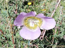
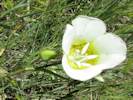
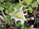
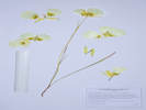
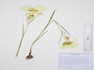
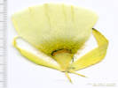
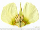

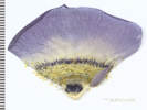
Melanthiaceae
Anticlea elegans (Pursh) Rydb. (Syn: Zigadenus elegans Pursh ) Mountain Death Camas. CalPhotos. Jepson eFlora. SEINet Taxon.
- North Fork West Tennessee Creek, Mixed pine forest and abandoned beaver dams. Tennesee Creek Basin, 8.2 mi. north of Leadville, then 2.4 mi. generally west on County Road 9 and Forest Road 131, not quite to Lily Lake, 12.5 km. north northeast of the GNIS location of Leadville. Tom Schweich 2001. 25 Jul 2018. ( KHD00069128‡ OBI ‡ UC UCR ‡ ) .
- Unnamed Gulch on Forest Road 189, Meadow on edge of aspens, with Vicia americana var. americana. Specimens with multiple bulbs were dug out as a unit. Along Pike-San Isabel National Forest Road 189, about 1 km. east of County Road 18 “East Tennessee Road,” 7.37 km. north northwest of the GNIS location of Leadville. Openings in aspen forest, mixed with patches of big sagebrush and willows. Tom Schweich 3338. 24 Jul 2024. ( Undist. ) .
- West Tennessee Creek,
Open forest.
Along an old, closed forest road on the north side of West Tennessee Creek, 810 m. southeast of Lily Lake, and 15.9 km. north northwest of Leadville.
Tom Schweich 2873.
19 Jul 2022.
(
Undist.
)
.
.
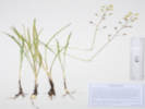
Veratrum californicum Durand. Helleborine, Corn Lily. CalPhotos. Jepson eFlora. SEINet Taxon.
- West Tennessee Creek, Filling the floor of this little valley, also collected here: Senecio triangularis, Pedicularis racemosa, and Viola sp. Meadow in a small valley between West Tennessee Creek and Lily Lake, 400 m. southwest of Lily Lake, 12.8 km. northwest of the GNIS location of Leadville. Tom Schweich 3108. 18 Jul 2023. ( KHD ‡ ) .
Orchidaceae
Platanthera aquilonis Sheviak. Northern Green Orchid. CalPhotos. Jepson eFlora. SEINet Taxon.
- Brumley,
Common on edge of slough (former channel of the creek).
Brumley was a stage stop on the route across Independence Pass.
Edge of slough beside the North Fork of Lake Creek, near the access road to the Sno-Tel station, about 11 road miles generally west on Colorado Highway 82 from the town of Twin Lakes, 175 km. southwest of Golden.
Tom Schweich 2892.
20 Jul 2022.
(
KHD00079749‡
)
.
.
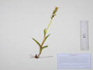
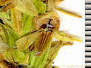
Platanthera dilatata (Pursh) Lindl. ex Beck var. albiflora (Cham.) Ledeb. Sierra Bog Orchid. CalPhotos. Jepson eFlora. SEINet Taxon.
- Tennessee Pass,
Drainage ditch along D&RGW right of way, about 250 m. south of the south portal of the tunnel, access by way of County Road 21A from US Highway 24, 9.5 road miles north of Leadville, 134 km. southwest of Golden.
Tom Schweich 2597.
13 Jul 2021.
(
COLO2718393‡
KHD00076687‡
OBI183714‡
)
.
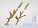
Poaceae
Agrostis scabra Willd. Rough Bentgrass. CalPhotos. Jepson eFlora. SEINet Taxon.
Perennial grass, 40 cm., rhizomes not seen; Leaves, sheath, 30 mm., open, distally retrorsely scabrous, ligule, membranous, 2 mm., auricles, absent, blade, 35 mm. × 0.8 mm. wide, flat, margins, scabrous; Inflorescence, 1 per culm, >leaves, open panicle with ascending branches, 140 mm. × 80 mm. wide; Rachis, not extended; Spikelets, many, 2 mm. × 0.6 mm. wide, similar, borne singly, pedicels 1.7-3.5 mm, scabrous; Compression, lateral; Disarticulation, above the glumes; Glumes, lower, 2.5 mm., keeled, scabrous on keel, veins, #1, upper, 2.4 mm., >lowest floret, keeled, scabrous on keel, veins, 1, awns, 0; Florets, 1 per spikelet, fertile; Lemma, 1.5 mm., <glumes, rolled, glabrous, translucent, veins, ?, tip, obtuse, awns, 0; Palea, 0.3 mm., membranous, colorless; Anthers, 0.5 mm.; Achene, 1 mm., green, glabrous. (Described from Coll. No. 2700.1, 17 Aug 2021).
- Brumley, Same as Coll. No. 2700.1, 17 Aug 2021 on N. Fk. W. Tennessee Ck. Brumley was a stage stop on the route across Independence Pass. Subalpine forest on a bank between the access road to the Sno-Tel station and the highway, about 11 road miles generally west on Colorado Highway 82 from the town of Twin Lakes, 175 km. southwest of Golden. Tom Schweich 2716. 18 Aug 2021. ( COLO2718401‡ ) .
- North Fork West Tennessee Creek, About 150 m. northeast of Lily Lake, at the current end of Pike-San Isabel Forest Road 131, 2.6 road miles west of US Highway 24, 140 km. southwest of the GNIS location of Golden. Tom Schweich 2700.1 17 Aug 2021. ( KHD00075377‡ OBI183702‡ ) .
- Unnamed Gulch on Forest Road 189,
Damp openings in willow thicket, south of the road and the creek.
Along Forest Road 189, about 1 km. east of County Road 18 “East Tennessee Road,” 5.69 km. (geodesic) north northwest of the GNIS location of Leadville.
Tom Schweich 3124.
19 Jul 2023.
(
KHD ‡
)
.
.
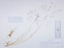
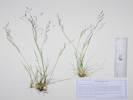
Bromus ciliatus L. Fringed Brome. CalPhotos. Jepson eFlora. SEINet Taxon.
Perennial grass, 85-90 cm., caespitose; Sheath, closed, basal sheath retrorsely pilose; Ligule, membranous, 1 mm., auricles 0; Blade, 200 mm. × 4 mm. wide, flat, barely scabrous; Inflorescence, 1 per culm, >leaves, open panicle, 90 mm. × 25 mm. wide, 1-3 branches; Rachis, not extended, scabrous; Spikelets, 10-14, 20 mm. × 6 mm. wide, similar, borne singly, pedicels 20-25 mm.; Glumes, lower, 8 mm., veins, 1, somewhat keeled, upper, 9 mm., <lowest floret, veins, 3, keeled, sparsely pilose toward left margin, awns, 0; Florets, 6 per spikelet, #1 is bisexual; Callus, hairs, 0; Lemma, 11.5 mm., body > glumes, lanceolate, membranous, not strongly keeled, veins, 5, tip, entire, awns, 1, 3.8 mm., straight, attached, end, pilose, hairs concentrated proximally and towards the margins, true for upper lemmas; Palea, 10.5 mm., membranous, veins, green, ciliate; Anthers, 1.3 mm.; Achene, 7-8 mm., green, adhering to lemma. (Described from Coll. No. 2638, 5 Aug 2021.)
- Brumley,
Brumley was a stage stop on the route across Independence Pass.
On a terrace beside the North Fork of Lake Creek, between Twin Lakes and Independence Pass, about 11 mi. generally west on Colorado Highway 82 from the town of Twin Lakes.
Tom Schweich 1993.
24 Jul 2018.
(
KHD00069364‡
OBI158905‡
UCR ‡
)
.
.
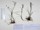
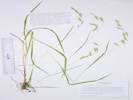
Bromus porteri (J.M. Coult.) Nash. Nodding Brome. CalPhotos. Jepson eFlora. SEINet Taxon.
Perennial grass, 45 cm., caespitose; Leaves, sheath, 130 mm., open about ½-way; collar minutely hairy, ligule, 2 mm., blade, 130 mm. × 4 mm. wide, flat, scabrous; Inflorescence, nodding, 1 per culm, panicle; Rachis, ascending hairy, not quite appressed; Spikelets, many, 23 mm. × 2.8 mm. wide, similar, pedicels, 44 mm.; Compression, unremarkable; Glumes, soft spreading hairy, lower, 7.5 mm., veins, 3, upper 8.5 mm., < lowest floret, veins, 3, converging, awns, 0, but mid-vein goes strongly right to the tip; Florets, 8 per spikelet; Callus, few short hairs; Lemma, 10.5 mm., > glumes, rolled, hairy. veins, 5, convergent, awns, 1, 1 mm., subterminal, straight; Palea, 9.5 mm., < lemma, membranous, ciliate, tip rounded; Stamens, 3; Anthers, 2.2 mm. (Described from Coll. No. 2860, 18 July 2022.)
- Brumley,
Partially shaded.
Brumley was a stage stop on the route across Independence Pass.
Along the bank of the North Fork of Lake Creek, between the creek and the road to the Sno-Tel station, about 11 road miles generally west on Colorado Highway 82 from the town of Twin Lakes, 175 km. southwest of Golden.
Tom Schweich 2712.
18 Aug 2021.
(
KHD00075618‡
OBI183791‡
)
.
.
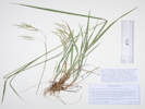
Bromus richardsonii Link. Richardson's Brome. CalPhotos. Jepson eFlora. SEINet Taxon.
- North Fork West Tennessee Creek, Beside the road in open shade, soil is probably glacial till. About 425 m. northeast of Lily Lake, near the current end of Pike-San Isabel Forest Road 131, 2.6 road miles west of US Highway 24, 140 km. southwest of the GNIS location of Golden. Tom Schweich 2710. 17 Aug 2021. ( Golden ) . .
Calamagrostis canadensis (Michx.) P. Beauv. Bluejoint. CalPhotos. Jepson eFlora. SEINet Taxon.
Perennial grass, to 90 cm., rhizomes unknown; Leaves, sheath, 90 mm., open, ligule, membranous, 3-5 mm., collar, minutely hairy, blade, 150 mm. × 6.5 mm. wide, scabrous; Inflorescence, 1 per culm, >leaves, 135 mm. × 25 mm. wide; Spikelets, many, 3 mm. × 1 mm. wide, similar, borne singly; Compression, ±lateral; Disarticulation, above the glumes; Glumes, lower, 3.5 mm., veins, 1, scabrous, purple to brown, upper, 3.0 mm., >lowest floret, scabrous, veins, 3, rounded, purple to brown; Florets, 1 per spikelet; Callus, straight white hairs, 2.5 mm.; Lemma, 2.5-3.0 mm., body < glumes, tip, 2-forked, awns, 1, 2.5 mm., straight, attached middle, included; Palea, 2 mm., <lemma, membranous (Described from Coll. No. 2700, 17 August 2021).
- North Fork West Tennessee Creek,
About 150 m. northeast of Lily Lake, at the current end of Pike-San Isabel Forest Road 131, 2.6 road miles west of US Highway 24, 140 km. southwest of the GNIS location of Golden.
Tom Schweich 2700.
17 Aug 2021.
(
COLO2992378‡
KHD00075378‡
OBI183706‡
)
.
.
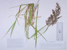
Calamagrostis stricta (Timm) Koeler. Northern Reedgrass. CalPhotos. Jepson eFlora. SEINet Taxon.
Perennial grass, 90-100 cm., rhizomatous; Leaves, sheath, 120 mm., open, minutely scabrous; ligule, membranous, 4 mm., auricles, absent, collar, minutely hairy; blade, 160 mm. × 3.2 mm. wide, scabrous; Inflorescence, 1 per culm, >leaves, contracted panicle, 150 mm. × 15 mm. wide; Spikelets, many, 3.8 mm. × 0.8 mm. wide, similar, 1 per node; Compression, ±lateral; Disarticulation, above the glumes; Glumes, lower, 3.8 mm., veins, #1, upper, 3.2 mm., >lowest floret, veins, #3, keeled proximally, keels scabrous, awns, #0; Florets, 1 per spikelet; Callus, straight white hairs, 2.5 mm., ≤lemma; Lemma, 3 mm., <glumes, tip, 2-forked; awns, #1, 2.5 mm., straight, attached below middle; Palea, 1.9 mm., <lemma, membranous. (Described from Coll. No. 2011, 25 July 2018.)
- North Fork West Tennessee Creek,
Mixed pine forest and abandoned beaver dams.
Probably subspecies stricta if infraspecific names are to be applied.
Tennesee Creek Basin, 8.2 mi. north of Leadville, then 2.4 mi. generally west on County Road 9 and Forest Road 131, not quite to Lily Lake, 12.5 km. north northeast of the GNIS location of Leadville.
Tom Schweich 2011.
25 Jul 2018.
(
KHD00069366‡
OBI158892‡
UCR ‡
)
.
.
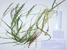
Danthonia intermedia Vasey. Timber Oatgrass. CalPhotos. Jepson eFlora. SEINet Taxon.
- North Fork West Tennessee Creek, Open shade next to a wetland formed by the creek. About 150 m. northeast of Lily Lake, at the current end of Pike-San Isabel Forest Road 131, 2.6 road miles west of US Highway 24, 140 km. southwest of the GNIS location of Golden. Tom Schweich 2703. 17 Aug 2021. ( KHD75376‡ ) .
- West Tennessee Creek,
Open forest, also collected here: Potentilla gracilis and Anticlea elegans.
Along an old, closed forest road on the north side of West Tennessee Creek, 810 m. southeast of Lily Lake, and 15.9 km. north northwest of Leadville.
Tom Schweich 2873.2
19 Jul 2022.
(
OBI183824‡
)
Collected with Phleum alpina.
Former meander of West Tennessee Creek, 575 m. (geodesic) southeast of Lily Lake, 12.3 km. (geodesic) north northwest of Leadville.
Tom Schweich 3102.1
18 Jul 2023.
(
CS202155‡
)
.
.
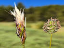
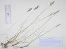

Elymus trachycaulus (Link) Gould ex Shinners. Slender Wheatgrass. CalPhotos. Jepson eFlora. SEINet Taxon.
Perennial grass, 75-100 cm., probably not rhizomatous, generally glabrous except as noted; Leaves, sheath, 130 mm., open, ligule, membraneous, auricles, small, 0-1 mm., blade, 25-200 mm. × 3.5 mm. wide, green, flat, scabrous; Inflorescence, 1 per culm, bi-lateral spike, 110 mm × 6 mm. wide; Rachis, internode 4.5 mm.; Spikelets, many, mostly 1 per node, about 1/3 have 2 per node, 17-21 mm. × 2.5-3.5 mm. wide, exclusive of awns, compression, weakly lateral; Disarticulation, between the florets; Glumes, #2, ±equal, lower, 11 mm. × 1.5 mm. wide + awns 2.0-2.5 mm., not quite straight, thick, tough, not keeled, veins, 5, prominent, margins, widest at middle, upper, 13 mm. × 1.8 mm. wide + awn 1.8 mm., veins, 7, >lowest floret; Florets, #4-8, lower bisexual, uppermost sterile; Callus, short straight white hairs; Lemma, rolled, 9-10 mm. + awn 3-22 mm., slightly curved, attached, end, longitudinally symetric, tip, bifid; Palea, 9 mm., <lemma, white except veins green and ciliate, tip, bifid, veins, ciliate; Anthers, 3 mm. or shriveled; Achene, 4 mm., green (Described from Coll. No. 1528, 5 August 2016, and Coll. No. 2647, 5 August 2022. See also #3309, 19 July 2024.)
- Brumley, Brumley was a stage stop on the route across Independence Pass. On a terrace beside the North Fork of Lake Creek, between Twin Lakes and Independence Pass, about 11 mi. generally west on Colorado Highway 82 from the town of Twin Lakes. Tom Schweich 1999. 24 Jul 2018. ( OBI148143‡ UCR ‡ ) Variety trachycaulis if infraspecific names are to be applied, though not universally accepted by Colorado authors. Brumley was a stage stop on the route across Independence Pass. Above the North Fork of Lake Creek, on a bank beside the access road to the Sno-Tel station, about 11 road miles generally west on Colorado Highway 82 from the town of Twin Lakes, 175 km. southwest of Golden. Tom Schweich 2714. 18 Aug 2021. ( COLO2718534‡ KHD00075614‡ ) .
- North Fork West Tennessee Creek,
Open shade next to a wetland formed by the creek.
Variety trachycaulus if infraspecific names are to be applied, though not universally accepted by Colorado authors.
About 150 m. northeast of Lily Lake, at the current end of Pike-San Isabel Forest Road 131, 2.6 road miles west of US Highway 24, 140 km. southwest of the GNIS location of Golden.
Tom Schweich 2702.
17 Aug 2021.
(
Golden
)
.
.

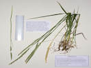
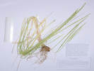
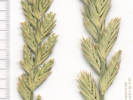
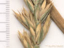
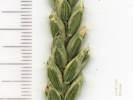
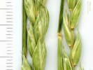
Eriocoma lettermanii (Vasey) Romansch. (Syn: Achnatherum lettermanii (Vasey) Barkworth ) Letterman's Needlegrass. CalPhotos. Jepson eFlora. SEINet Taxon.
Perennial, to 70 cm., clumped; Leaves, sheath, 80 mm., open, glabrous, ligule, membranous, 1 mm., auricles, absent, blade, 150 mm. × 1.7 mm. wide, revolute, sparsely scabrous; Inflorescence, 1 per culm, >leaves, panicle, 100 mm. × 12 mm. wide, spikelets, many; Axis, not extended, glabrous; Spikelets, many, 6 mm. × 1 mm. wide, excluding awn, similar, borne singly, pedicels, 1.2-6.0 mm., 1-flowered; Compression, unremarkable; Disarticulation, above the glumes; Glumes, subequal, lower, 7 mm. × 1 mm. wide, veins, #1, upper, 6.5 mm. × 1.3 mm. wide, = lowest floret, veins, #3, rounded, membranous, tip, extended sharp soft point, not really an awn; Florets, 1 per spikelet, bisexual; Callus, 0.5 mm., pointed, but not sharp like other cogeners, short, straight, white hairs; Lemma, 4 mm., ≤glumes, ovate, color, tan, stiff but not hard, hairs, slightly longer and more dense distally than proximally, straight, longest 1.2 mm., color white, veins, #3, parallel, then converging at awn, tip, 2-forked, awns, #1, 17 mm., attached at end of lemma, scabrous, bent twice, twisted, terminal segment straight; Palea, 3.5 mm., <lemma, 87% length of lemma, membranous, hairy, hairs extending beyond tip, tip, entire, color, tan; Anthers, 1.4 mm.; Achene, 3 mm., green. (Described from Coll. No. 1998, 24 July 2018. See also Coll. No. 3343.1.)
- Brumley, Brumley was a stage stop on the route across Independence Pass. On a terrace beside the North Fork of Lake Creek, between Twin Lakes and Independence Pass, about 11 mi. generally west on Colorado Highway 82 from the town of Twin Lakes. Tom Schweich 1998. 24 Jul 2018. ( KHD00068997‡ OBI124863‡ UCR ‡ ) .
- Unnamed Gulch on Forest Road 189,
Between the road and the creek to the south, open shrubland with Agoseris glauca var. dasycephala, Artemisia tridentata, Eriogonum umbellatum, and Dasiophora fruticosa.
Along Forest Road 189, about 1 km. east of County Road 18 “East Tennessee Road,” 5.69 km. (geodesic) north northwest of the GNIS location of Leadville.
Tom Schweich 3117.
19 Jul 2023.
(
KHD87642‡
)
Collected with Artemisia tridentata, Taraxacum ceratophorum, and Festuca idahoensis.
About 50 m. southwest of Forest Road 189, about 1 km. west of County Road 18 “East Tennessee Road,” 7.37 km. north northwest of the GNIS location of Leadville. Openings in aspen forest, mixed with patches of big sagebrush and willows.
Tom Schweich 3343.1
24 Jul 2024.
(
Undist.
)
.
.
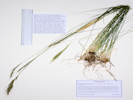

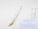
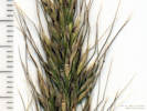
Festuca calligera (Piper) Rydb. Callused Fescue. CalPhotos. Jepson eFlora. SEINet Taxon.
- Evans Gulch, Sunny open southeast-facing slope. Middle section of Evans Gulch, near Conley Lakes and the Diamond Mine, 4.6 mi. by road east of the GNIS location of Leadville. Tom Schweich 3134. 20 Jul 2023. ( KHD ‡ ) .
- Unnamed Gulch on Forest Road 189,
South side of the gulch on the edges of an open aspen forest.
Along Forest Road 189, about 1 km. east of County Road 18 “East Tennessee Road,” 5.69 km. (geodesic) north northwest of the GNIS location of Leadville.
Tom Schweich 3125.
19 Jul 2023.
(
KHD ‡
)
.
.

Festuca idahoensis Elmer. Idaho Fescue. CalPhotos. Jepson eFlora. SEINet Taxon.
Perennial, to 50 cm, distinctly tufted or clumped; Roots fibrous; Stem herbaceous; Internodes hollow; Leaf blade and sheath differentiated, soft; Sheath open; Ligule membraneous, 0.5 mm.; Blade narrow, rolled inward; Inflorescence 1-2, 8-9 cm., > leaves, branching evident, panicle, spikelets many; Spikelets similar, 1/node, 1° and 2° branches, many flowered, 10 mm.; Florets, 4-6 per spikelet, bisexual (1-2 staminate, 3-4 staminate and pistillate, 5-6 staminate and ?pistillate); Glumes lower 4.5 mm, upper 3.0 mm, lower < lowest floret, veins 3-9, awns 0; Axis sparsely hairy, not extended beyond upper floret; Lemma 5 mm., rolled, veins 5, outer faint, tip entire, awns 1, 2.0-2.5 mm, straight, attached at tip; Palea < lemma, keel glabrous, margin glabrous, Anthers 3, 2 mm.; Ovary glabrous (Described from Coll. No. 822, 30 May 2012. See also TAS #3343.).
- Unnamed Gulch on Forest Road 189,
Collected with Artemisia tridentata and Taraxacum ceratophorum.
About 50 m. southwest of Forest Road 189, about 1 km. west of County Road 18 “East Tennessee Road,” 7.37 km. north northwest of the GNIS location of Leadville. Openings in aspen forest, mixed with patches of big sagebrush and willows.
Tom Schweich 3343.
24 Jul 2024.
(
Undist.
)
.
.
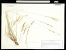
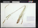
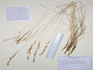
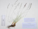
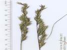
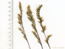
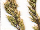
Festuca thurberi Vasey. Thurber's Fescue. CalPhotos. Jepson eFlora. SEINet Taxon.
- Unnamed Gulch on Forest Road 189,
Between patches of Artemisia tridentata, with Agoseris aurantiaca, Taraxacum ceratophorum, Geum triflorum, Eriocoma lettermanii, and Festuca idahoensis.
About 55 m. southwest of Forest Road 189, about 1 km. west of County Road 18 “East Tennessee Road,” 7.37 km. north northwest of the GNIS location of Leadville. Openings in aspen forest, mixed with patches of big sagebrush and willows.
Tom Schweich 3345.
24 Jul 2024.
(
Undist.
)
.
.
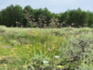
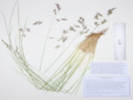
Koeleria macrantha (Ledeb.) Schult. Prairie Junegrass. CalPhotos. Jepson eFlora. SEINet Taxon.
Perennial bunch grass, to 45-55 cm., non-rhizomatous; Leaves, mostly basal or lowest cauline, cauline, sheath, 90 mm., open, ligule, <1-1.5 mm., membraneous, auricles, 0, blade, 40 mm., tip prow-shaped or merely constricted; Inflorescence, panicle, 60 mm. × 9 mm., shiny in anthesis due to exposure of translucent palae, short branches, branches short soft hairy; Spikelets, 5 mm., 1 per node on 1°-3° or indistinct panicle branches; Glumes, lower, 3 mm., veins 1, upper, 4 mm., veins 3; Florets, 3, #1 and #2 pistillate, #3 staminate, or variously mixed bisexual and pistillate, open, i.e., palea separated from lemma; Disarticulation, between florets; Rachilla hairy, extends nearly 1 mm. above upper floret (or not); extension undecorated; Lemma, 4.5 mm., veins 5, short hairy throughout, awn, 0-0.5 mm., short, soft; Palea, =lemma, translucent or colorless, exposed, i.e., outside lemma.; Stamens, 3, 1.8 mm. Described from Coll. No. 1131, 9 June 2015, and Coll. No. 1144, 15 Jun 2015.
- Unnamed Gulch on Forest Road 189,
Openings in aspen forest, surrounded by big sagebrush and willows.
Along Forest Road 189, about 1 km. west of County Road 18 “East Tennessee Road,” 7.37 km. north northwest of the GNIS location of Leadville.
Tom Schweich 2897.
21 Jul 2022.
(
OBI183837‡
)
.
.
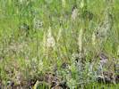
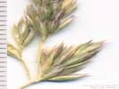
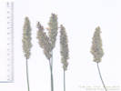
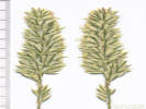
Phleum alpinum L. Alpine Timothy. CalPhotos. Jepson eFlora. SEINet Taxon.
- Brumley, Nearly bare ground beside a clump of willows, with Achillea millefolium, Symphyotrichum foliaceum var. apricum, Taraxacum ceratophorum, and Geum triflorum. Near the site of the stagecoach stop of Brumley, about 11 miles generally west on CO State Highway 82 from the town of Twin Lakes, Lake County, 135 km. southwest of Golden. Tom Schweich 3323. 23 Jul 2024. ( Undist. ) .
- West Tennessee Creek,
Collected with Danthonia intermedia.
Former meander of West Tennessee Creek, 575 m. (geodesic) southeast of Lily Lake, 12.3 km. (geodesic) north northwest of Leadville.
Tom Schweich 3102.
18 Jul 2023.
(
KHD 87387‡
)
.
.

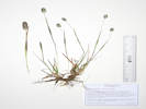
Trisetum spicatum (L.) K. Richt. Spike Trisetum. CalPhotos. Jepson eFlora. SEINet Taxon.
Perennial, 13cm; Stem, herbaceous, soft hairy; Leaf sheath and blade differentiated, sheath open, blade soft, soft hairy; Ligule ciliate, 1 mm.; Inflorescence spike-like panicle 4.5 cm., barely exceeding leaves, purple interior; Compression lateral; Spikelets similar, 2-8 per node on 1° and 2° branches, Florets 4± per spikelet, bisexual; Glumes, lanceolate, lower 3.5 mm < upper 4.5 mm.; Lemma 4 mm., veins 3+, awns 1 attached to back (Desccribed from Coll. No. 833, 18 Jun 2012).
- Brumley, Brumley was a stage stop on the route across Independence Pass. On a terrace beside the North Fork of Lake Creek, between Twin Lakes and Independence Pass, about 11 mi. generally west on Colorado Highway 82 from the town of Twin Lakes. Tom Schweich 1994. 24 Jul 2018. ( OBI158906‡ UCR ‡ ) .
| Total number of taxa: | 157 |
| Native Taxa: (serif, italic, bold) | 146 |
| Exotic Taxa: (sans-serif, italic) | 7 |
| Nativity Undetermined: (default font, italic) | 4 |
| Listed Weeds: Identified as Weed | 1 |
Notes:
† -- Data provided by the participants of the Consortium of California Herbaria (ucjeps.berkeley.edu/consortium/).
‡ -- Southwest Environmental Information Network, SEINet. 2009-2014. http//:swbiodiversity.org/seinet/index.php. Accessed from July 2009 to September 2014.
Locations Included in This Area
If you have a question or a comment you may write to me at: . I sometimes post interesting questions in my FAQ, but I never disclose your full name or address.
[Home Page] [Site Map]
Date and time this article was prepared: 4/21/2025 8:36:58 PM.