
Eastern Mojave Vegetation
By Tom Schweich
|
Eastern Mojave Vegetation | Images -- Geography - Central Mojave |
|
By Tom Schweich |
|

Unclassified Geography - Idaho Geography - Park County, CO Geography - Summit County, CO Geography - Arizona Geography - British Columbia Geography - California Geography - California's Colorado Desert Alaska Geography - Mono Lake Basin, California Geography - Mono County, California Geography - San Luis Obispo County, California Geography - Marin County, California Geography - Santa Clara County Alameda Garden Geography - Central Mojave Geography - New Mexico Geography - Eastern Mojave Geography - Northern Mojave Geography - Colorado Geography - Alamosa County, CO Geography - Boulder County, CO Geography - Clear Creek County, CO Geography - Chaffee County, CO Geography - Douglas County, CO Geography - Gilpin County, CO Geography - Golden, Colorado Geography - Weld County, CO Geography - Hinsdale County, CO Geography - Jefferson County, CO Geography - North Table Mountain, Jefferson Cty, CO Geography - Lake County, CO Geography - Larimer County, CO Geography - Nevada Geography - Oregon Geography - Utah Geography - Virginia Geography - Washington Geography - Wyoming Spain - Andalucia Spain - Castilla y Leon Spain - Castilla-La Mancha Spain - Extremadura Spain - Galicia Spain - Madrid Portugal Geology Economic Geology Climatology Botany Salvia dorrii Frasera albomarginata Species Species - Polygonaceae Species - Brassicaceae Species - Brassicaceae, Physaria vitulifera Species - Rosaceae Species - Fabaceae Species - Onagraceae Species - Polemoniaceae Species - Boraginaceae Species - Plantaginaceae Species - Asteraceae Species - Poaceae Zoology Ecology Archeology Customer Satisfaction General Arizona California Kansas Missouri Nebraska New York Christmas 2002 Family Photos Family Documents Family Photos 2003 Art of Lydia Schweich Portraits Railroad Geography - Germany |
Images are organized by the topics listed at left. Click on a topic name to see images with that topic. Would you like to use these photographs in your school term paper or report? License is hereby granted for non-commercial use of the images contained herein provided that the images are reproduced with the copyright notice intact. This means that we give you our permission to use the photographs and information you find here in your school term papers and reports. You may resize the photograph to fit your needs, but you may not remove the copyright. Your term paper should note that the photographs are reproduced with permission and it should have a reference to this web site, such as: "Photograph �1999 Tom Schweich. Used by permission, http://www.schweich.com" If you have a comment or a question about a photograph you may write to me at tas4@schweich.com I will answer you as soon as I can. I sometimes post interesting questions in my FAQ, but I will not disclose your full name or address.
| 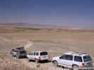
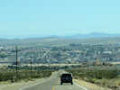
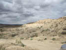
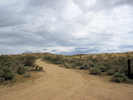
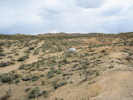
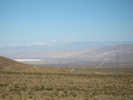
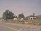
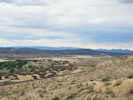
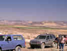
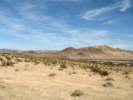
US I-15 as seen from Harvard Hill. |
Location records that use this photograph:
Article records that use this photograph:
images/1339_3153_1142_06sm.jpg
| Afton Canyon
| 
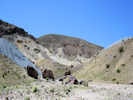
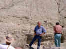
"Norms Nook," a slot canyon tributary to Afton Canyon | This slot canyon shows the rapid incision that has occurred since Afton Canyon formed. This tributary has incised in response to the rapidly lowered base level of Afton Canyon. Vertical incision occurred first, and the meandering of the stream from side to side is responsible for the overhangs. When the stream reaches a reasonable longitudinal gradient, a significant widening of the channel develops. Eventually the overhangs break off and the channel walls become vertical (Reynolds & Reynolds, 2000).
Article records that use this photograph:
images/1440-19.jpg
| 
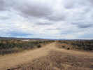
Field trip stop in Afton Canyon |
Location records that use this photograph:
Article records that use this photograph:
images/1440-18.jpg
| 
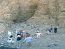
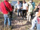
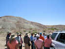
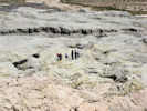
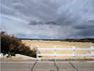
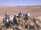
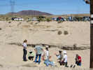
Field trip stop on the shore of Lake Manix | Norman Meek discusses the history of Pleistocene Lake Manix at this field trip stop on the 1780 ft. shoreline of the former lake.
Location records that use this photograph:
Article records that use this photograph:
images/1440-17.jpg
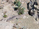
| Almond Mountain
| 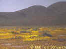
Wildflowers at Almond Mountain. |
Location records that use this photograph:
Article records that use this photograph:
images/3221-85.jpg
| Atolia
| 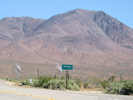
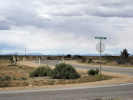
Sign for Atolia |
Location records that use this photograph:
Article records that use this photograph:
images/IMG01559sm.jpg
| Barstow
| 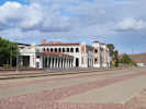
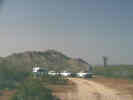
The Barstow Depot. | Photograph taken 21 April 2010.
Location records that use this photograph:
Article records that use this photograph:
images/IMG20375sm.jpg
| 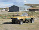
Welding project beside the road. | Photograph taken 21 April 2010.
Location records that use this photograph:
Article records that use this photograph:
images/IMG20379sm.jpg
| 
Barstow as seen from Irwin Road | Photograph taken 24 April 2010.
Location records that use this photograph:
Article records that use this photograph:
images/IMG20473sm.jpg
| Barstow Syncline
| 
Jean Miller & Dan Rosen at the Barstow Syncline. | Photographed in March 1991.
Location records that use this photograph:
Article records that use this photograph:
images/1991-04-1-19-img262sm.jpg
| Blackwater Well
| 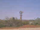
Blackwater Well. |
Location records that use this photograph:
Article records that use this photograph:
images/3221-86.jpg
| 
Blackwater Well with Almond Mountain in the background. |
Location records that use this photograph:
Article records that use this photograph:
images/3221-87.jpg
| Boron
| 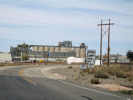
US Borax Plant at Boron. | Photograph taken 30-Apr-07.
Location records that use this photograph:
Article records that use this photograph:
images/IMG_1391sm.jpg
| Buwalda Ridge
| 
Buwalda Ridge from Afton Road | Photograph taken 23 April 2010.
Location records that use this photograph:
Article records that use this photograph:
images/IMG20388sm.jpg
| 
The Mojave River flows past Buwalda Ridge. | Photograph taken 23 April 2010.
Location records that use this photograph:
Article records that use this photograph:
images/IMG20414sm.jpg
| 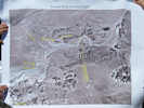
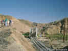
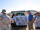
Air Photo showing Buwalda Ridge and Manix Wash | Photograph taken 23 April 2010. This map was brought by Marith Reheis, and was also used on other field trips to this area. We are at the location marked Day 2 Stop 2.
Location records that use this photograph:
Article records that use this photograph:
images/IMG20408sm.jpg
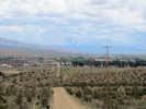
| Central Mojave Desert
| 
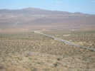
Near Field Trip Stop P-3 | Photograph taken 21 April 2010.
Article records that use this photograph:
images/IMG20367sm.jpg
| 
Near Field Trip Stop P-3 | Photograph taken 21 April 2010.
Article records that use this photograph:
images/IMG20368sm.jpg
| 
Road along the Union Pacific tracks. | Photograph taken 21 April 2010.
Article records that use this photograph:
images/IMG20365sm.jpg
| 
Indian Trail Road off of Old US Hwy 66 | Photograph taken 21 April 2010.
Article records that use this photograph:
images/IMG20359sm.jpg
| 
Helendale Road, near the north end at CA Hwy 58 | Photograph taken 21 April 2010.
Article records that use this photograph:
images/IMG20334sm.jpg
| 
The route north. | Photograph taken 21 April 2010. The route through these little hills, as described in Reynolds & Miller (2010) is from north to south. I did it from south to north, so I went down this little canyon, If you're following the field trip guide, you'll come up the little canyon.
Article records that use this photograph:
images/IMG20354sm.jpg
| 
Road up to the top of the bluff. | Photograph taken 21 April 2010.
Article records that use this photograph:
images/IMG20366sm.jpg
| 
Helendale, as seen from the north. | Photograph taken 21 April 2010.
Article records that use this photograph:
images/IMG20340sm.jpg
| 
Road Junction; National Trails Highway and unknown road. | Photograph taken 21 April 2010.
Article records that use this photograph:
images/IMG20347sm.jpg
| 
Field Trip Stop P-5 | Photograph taken 21 April 2010.
Article records that use this photograph:
images/IMG20349sm.jpg
| 
Approximate Location of Field Trip Stop P-4 | Photograph taken 21 April 2010.
Article records that use this photograph:
images/IMG20355sm.jpg
| 
Take the middle road. | Photograph taken 21 April 2010. If you're following the route in reverse order, i.e., from south to north, it can be hard to find the route down off the bluff. There are three routes north. The westernmost dead ends at a fine viewpoint. The easternmost goes into the housing development. Take the middle route shown here.
Article records that use this photograph:
images/IMG20369sm.jpg
| Cronese Basin
| 
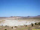
Cronese Basin with Cave Mountain. | The Cronese Basin with Cave Mountain on the south (left) side. The Basin Road overpass over U. S. Interstate 15 can be seen at the extreme left.
Article records that use this photograph:
images/3201-19.jpg
| Daggett Ridge
| 
Outcrop of Peach Spring Tuff | Photograph taken 23 April 2010.
Article records that use this photograph:
images/IMG20442sm.jpg
| 
Field Trip Stop M-12 | Photograph taken 24 April 2010.
Location records that use this photograph:
Article records that use this photograph:
images/IMG20485sm.jpg
| 
Field Trip Stop M-12 | Photograph taken 24 April 2010.
Location records that use this photograph:
Article records that use this photograph:
images/IMG20484sm.jpg
| 
Looking north from Daggett Ridge | Photograph taken 24 April 2010.
Location records that use this photograph:
Article records that use this photograph:
images/IMG20483sm.jpg
| 
Stromatolitic limestone | Photograph taken 24 April 2010.
Article records that use this photograph:
images/IMG20477sm.jpg
| 
Overturned section of Barstow Formation at Columbus/Gem Mine | Photograph taken 23 April 2010.
Location records that use this photograph:
Article records that use this photograph:
images/IMG20440sm.jpg
| Desert Tortoise Natural Area
| 
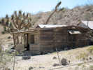
Matt and Scott at the entrance. | Photographed in April 1981.
Location records that use this photograph:
Article records that use this photograph:
images/1981-04-4-25-img216sm.jpg
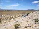
| Drinkwater Valley
| 
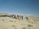
Field trip stop on Irwin Road. | During a field trip stop in the Drinkwater Valley, Terry Pavlis of the University of New Orleans discusses the evidence for 90 degrees of clockwise rotation of the Avawatz Mountains in the late Cenozoic (Pavlis et al., 1998).
Article records that use this photograph:
images/3902-21.jpg
| Emerald Basin
| 
Getting the explanation of Emerald Basin. | Photograph taken 24 April 2010.
Article records that use this photograph:
images/IMG20451sm.jpg
| 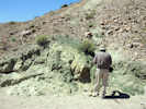
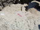
Emerald bed in the Barstow Formation | Photograph taken 24 April 2010. The mineral making the green color is Celadonite, a greenish mineral of hydrated iron, magnesium, potassium silicate containing small amounts of aluminum, calcium, sodium, and numerous trace elements.
Article records that use this photograph:
images/IMG20453sm.jpg
| 
What we saw in the Emerald Basin. | Photograph taken 24 April 2010.
Article records that use this photograph:
images/IMG20450sm.jpg
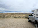
| Fremont Valley
| 
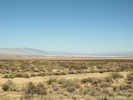
Goler Road crosses Fremont Valley. | Koehn Dry Lake in the left middleground.
Location records that use this photograph:
Article records that use this photograph:
images/IMG01562sm.jpg
| 
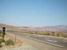
US Hwy 395 crosses Fremont Valley | This is the extreme east end of Fremont Valley.
Location records that use this photograph:
Article records that use this photograph:
images/IMG01561sm.jpg
| 
Fremont Valley from the mouth of Pine Tree Canyon | Photograph taken April 17, 2008.
Location records that use this photograph:
Article records that use this photograph:
images/IMG10509sm.jpg
| 
CA Hwy 14 at Pine Tree Canyon | Photograph taken April 17, 2008. The mouth of Jawbone Canyon is in the distance.
Location records that use this photograph:
Article records that use this photograph:
images/IMG10513sm.jpg
| Garlock
| 
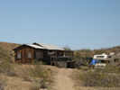
Remains of the town of Garlock. | Garlock flourished in the late 1800s when gold was discovered in Goler Gulch. Photograph taken in May, 1998.
Location records that use this photograph:
Article records that use this photograph:
images/3221-76.jpg
| Garlock Fault
| 
Cabin near Goler Heights | Photograph taken April 25, 2009.
Article records that use this photograph:
images/IMG01570sm.jpg
| 
Dispersed camping at Goler Gulch | Photograph taken April 25, 2009.
Article records that use this photograph:
images/IMG01566sm.jpg
| 
Escarpment of El Paso Mountains | Photograph taken April 25, 2009.
Article records that use this photograph:
images/IMG01564sm.jpg
| 
Overview of Eastern California Shear Zone. | Photograph taken April 25, 2009.
Article records that use this photograph:
images/IMG01568sm.jpg
| 
Cabin near Goler Heights | Photograph taken April 25, 2009.
Article records that use this photograph:
images/IMG01569sm.jpg
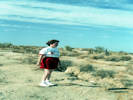
| 
"Art by Kristal" alongside Garlock Road. | Photograph taken April 25, 2009. I also stopped and talked with Ricky Ricardo for a few minutes.
Article records that use this photograph:
images/IMG01571sm.jpg
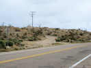
| Harvard Hill
| 
Structure of south Harvard Hill | Photograph taken 23 April 2010.
Location records that use this photograph:
Article records that use this photograph:
images/IMG20429sm.jpg
| 
David Miller shows the location of the thrust fault. | Photograph taken 23 April 2010.
Location records that use this photograph:
Article records that use this photograph:
images/IMG20433sm.jpg
| Harvard Maze
| 
View west across a portion of the Harvard Maze | Photograph taken April 23, 2011.
Article records that use this photograph:
images/IMG_1629sm.jpg
| Kramer Junction
| 
Present Day Kramer Station. | Annie Alexander and Louise Kellogg collected here on April 19, 1940. Photograph taken May 27, 2001. The nearby cemetary was erected in late 1920, for the workers who died while building the railroad.
Article records that use this photograph:
images/0022_3291_2725_49.jpg
| Lake Manix
| 
Field discussion of the history of Lake Manix | Photograph taken 23 April 2010.
Article records that use this photograph:
images/IMG20412sm.jpg
| 
Field Trip Stop: Dunn Wash Gravel Quarry. | Photograph taken 23 April 2010.
Article records that use this photograph:
images/IMG20391sm.jpg
| 
Discussion of the depositional environment of the Lake Manix sediments. | Photograph taken 23 April 2010. Mojave River in the background.
Location records that use this photograph:
Article records that use this photograph:
images/IMG20427sm.jpg
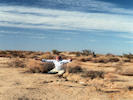
| 
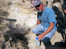
Two fossil bones weathered out of Lake Manix sediments. | Photograph taken 23 April 2010.
Article records that use this photograph:
images/IMG20425sm.jpg
| 
Field Trip Stop on the shores of Lake Manix | Photograph taken 23 April 2010.
Article records that use this photograph:
images/IMG20384sm.jpg
| 
Field discussion of the source of the Manix Ash in the Lake anix sediments | Photograph taken 23 April 2010.
Article records that use this photograph:
images/IMG20418sm.jpg
| 
Desert Iguana (Dipsosaurus dorsalis) in Lake Manix deposits. | Photograph taken 23 April 2010.
Article records that use this photograph:
images/IMG20395sm.jpg
| Landers
| 
Christina at a surface rupture of the Landers earthquake. | Photographed 5 July 1992. Scanned 28 November 2020.
Article records that use this photograph:
images/19920705_Landers_img101sm.jpg
| 
Trying to escape from the rupture of the Landers earthquake. | Photographed 5 July 1992. Scanned 28 November 2020.
Article records that use this photograph:
images/19920705_Landers_img102sm.jpg
| Lime Hill
| 
Looking at bedded limestone on Lime Hill | Photograph taken April 23, 2011, on Lime Hill, San Bernardino County, California.
Location records that use this photograph:
Article records that use this photograph:
images/IMG_1628sm.jpg
| 
Field discussion of the geology in today's field trip. | Photograph taken April 23, 2011, near Lime Hill, San Bernardino County, California.
Location records that use this photograph:
Article records that use this photograph:
images/IMG_1626sm.jpg
| Little Borate
| 
General view of Little Borate | Photograph taken 24 April 2010.
Article records that use this photograph:
images/IMG20454sm.jpg
| 
Chevron folds in Barstow Formation at Little Borate | Photograph taken 24 April 2010.
Article records that use this photograph:
images/IMG20455sm.jpg
| Mojave River
| 
The Mojave River and Helendale. | Photograph taken 21 April 2010.
Location records that use this photograph:
Article records that use this photograph:
images/IMG20351sm.jpg
| 
The Mojave River looking toward Wild Crossing | Photograph taken 21 April 2010.
Location records that use this photograph:
Article records that use this photograph:
images/IMG20352sm.jpg
| 
The Mojave River at Wild Crossing | Photograph taken 21 April 2010.
Location records that use this photograph:
Article records that use this photograph:
images/IMG20362sm.jpg
| 
The Mojave River at Hinkley Road | Photograph taken 21 April 2010.
Location records that use this photograph:
Article records that use this photograph:
images/IMG20372sm.jpg
| Mojave Valley
| 
View north from Columbus/Gem mine. | Photograph taken 23 April 2010.
Location records that use this photograph:
Article records that use this photograph:
images/IMG20436sm.jpg
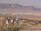
| 
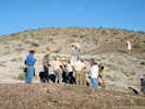
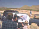
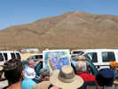
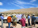
Who is this guy? Why does he keep showing up in my Mojave Desert photos? | At Field Trip Stop 1-1, we are looking at mid-Pleistocene Lake Manix. Here tufa was deposited by blue-green algae on alluvial fan deposits in clear water. (The person in the photograph is Bob Reynolds, leader of the field trip, and prime instigator of the annual Desert Research Symposium.)
Article records that use this photograph:
images/1339_3153_1142_03sm.jpg
| 
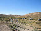
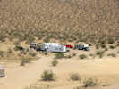
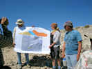
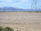
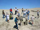
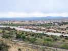
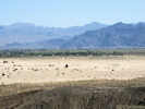
Agriculture in the Central Mojave. | This photograph looks east from Harvard Hill across the Mojave River to the Cady Mountains. The large green circle is one of several alfalfa fields in this area. Ground water is pumped into huge sprinkler systems to irrigate the alfalfa. The combination of soil disturbance and declining water tables has destabilized the landscape resulting in increased sand movement and dust storms that have been blamed for fatal highway accidents. The cars and people are participating in the 2002 Desert Research Symposium field trip and are here in Harvard Hill to review marker beds in the Miocene Barstow Formation..
Location records that use this photograph:
Article records that use this photograph:
images/1339_3153_1142_04sm.jpg
| 
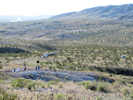
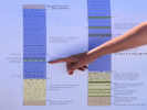
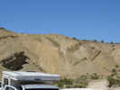
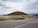
Field trip discussion of the Miocene Barstow Basin. | Small hill capped by resistant silicified algal limestone (MSL). The algal mats preserved here are the deep water facies of the MSL marker unit.
Article records that use this photograph:
images/1339_3153_1142_07sm.jpg
| 
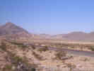
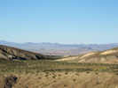
View of Mojave Valley from Dagget Ridge | US Interstate 40 crosses the photograph in the middle ground. In the right middle ground is the Solar One solar power generation station. US Interstate 15 passes through Yermo in the near background, behind which are the Calico Mountains. Alvord Mountain is seen behind the Calico mountains.
Article records that use this photograph:
images/1339_3153_1142_08sm.jpg
| 
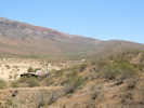
View south across Mojave River from Harvard Hill. | Photograph taken 23 April 2010. Newberry Springs to the south at the base of the hills.
Location records that use this photograph:
Article records that use this photograph:
images/IMG20435sm.jpg
| 
Vicinity of Camp Cady on the Mojave River. | Photograph taken 20-April-06
Location records that use this photograph:
Article records that use this photograph:
images/IMG_0271.jpg
| New Dunn
| 
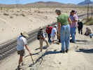
Field Trip Stop at New Dunn | Photograph taken 23 April 2010. Photograph looks across the Union Pacific tracks hidden in the cut through Lake Manix sediments.
Location records that use this photograph:
Article records that use this photograph:
images/IMG20407sm.jpg
| 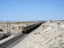
Union Pacific passes the site of Dunn. | Photograph taken 23 April 2010.
Location records that use this photograph:
Article records that use this photograph:
images/IMG20401sm.jpg
| 
Looking at root casts high in the section of the Afton Arm of Lake Manix | Photograph taken 23 April 2010.
Location records that use this photograph:
Article records that use this photograph:
images/IMG20405sm.jpg
| | ||||||||||||||||||||||||||||