
Eastern Mojave Vegetation
By Tom Schweich
|
Eastern Mojave Vegetation | Images -- Geography - Mono Lake Basin, California |
|
By Tom Schweich |
|

Unclassified Geography - Idaho Geography - Park County, CO Geography - Summit County, CO Geography - Arizona Geography - British Columbia Geography - California Geography - California's Colorado Desert Alaska Geography - Mono Lake Basin, California Geography - Mono County, California Geography - San Luis Obispo County, California Geography - Marin County, California Geography - Santa Clara County Alameda Garden Geography - Central Mojave Geography - New Mexico Geography - Eastern Mojave Geography - Northern Mojave Geography - Colorado Geography - Alamosa County, CO Geography - Boulder County, CO Geography - Clear Creek County, CO Geography - Chaffee County, CO Geography - Douglas County, CO Geography - Gilpin County, CO Geography - Golden, Colorado Geography - Weld County, CO Geography - Hinsdale County, CO Geography - Jefferson County, CO Geography - North Table Mountain, Jefferson Cty, CO Geography - Lake County, CO Geography - Larimer County, CO Geography - Nevada Geography - Oregon Geography - Utah Geography - Virginia Geography - Washington Geography - Wyoming Spain - Andalucia Spain - Castilla y Leon Spain - Castilla-La Mancha Spain - Extremadura Spain - Galicia Spain - Madrid Portugal Geology Economic Geology Climatology Botany Salvia dorrii Frasera albomarginata Species Species - Polygonaceae Species - Brassicaceae Species - Brassicaceae, Physaria vitulifera Species - Rosaceae Species - Fabaceae Species - Onagraceae Species - Polemoniaceae Species - Boraginaceae Species - Plantaginaceae Species - Asteraceae Species - Poaceae Zoology Ecology Archeology Customer Satisfaction General Arizona California Kansas Missouri Nebraska New York Christmas 2002 Family Photos Family Documents Family Photos 2003 Art of Lydia Schweich Portraits Railroad Geography - Germany |
Images are organized by the topics listed at left. Click on a topic name to see images with that topic. Would you like to use these photographs in your school term paper or report? License is hereby granted for non-commercial use of the images contained herein provided that the images are reproduced with the copyright notice intact. This means that we give you our permission to use the photographs and information you find here in your school term papers and reports. You may resize the photograph to fit your needs, but you may not remove the copyright. Your term paper should note that the photographs are reproduced with permission and it should have a reference to this web site, such as: "Photograph �1999 Tom Schweich. Used by permission, http://www.schweich.com" If you have a comment or a question about a photograph you may write to me at tas4@schweich.com I will answer you as soon as I can. I sometimes post interesting questions in my FAQ, but I will not disclose your full name or address.
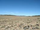
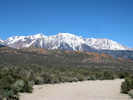
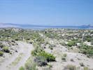
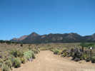
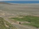
| Adobe Hills
| 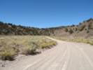
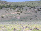
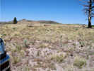
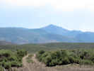
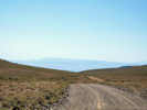
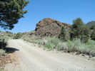
Look ahead on Dobie Meadows Road | Photograph taken 23-Sep-06.
Article records that use this photograph: images/IMG_0767sm.jpg
| 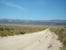
Looking north, north of the Adobe Hills. | Photograph taken 23-Sep-06.
Article records that use this photograph:
images/IMG_0778sm.jpg
| Adobe Hills Spillway
| 
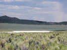
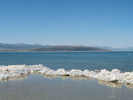
View north from Adobe Hills Spillway | Photograph taken July 7, 2009. The uppermost sediments of Pleistocene Lake Russell (ancestral Mono Lake) were quarried here to aid in construction of Dobie Meadows Road.
Location records that use this photograph:
Article records that use this photograph:
images/IMG01970sm.jpg
| 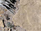
Snail shells in sediments | Photograph taken July 7, 2009.
Location records that use this photograph:
Article records that use this photograph:
images/IMG01969sm.jpg
| 
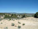
Adobe Hills Spillway from a distance. | Photograph taken 23-Sep-06. Water from Lake Russell (Mono Lake) would flow over the spillway toward to viewer.
Location records that use this photograph:
Article records that use this photograph:
images/IMG_0769sm.jpg
| 
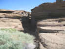
View to south of the spillway. | Photograph taken July 7, 2009. This photograph was taken from the little promontory just north of the spillway. I had lunch here, and it could be a place to camp. The uppermost lake sediments can be seen in the approximate center of the photograph.
Location records that use this photograph:
Article records that use this photograph:
images/IMG01977sm.jpg
| 
Looking north across the spillway. | Photograph taken 23-Sep-06. The car is parked at the highest point. Water from Lake Russell (Mono Lake) would flow over the spillway toward the viewer.
Location records that use this photograph:
Article records that use this photograph:
images/IMG_0776sm.jpg
| 
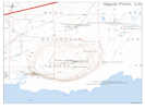
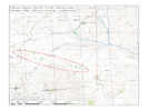
Location of Adobe Hills Spillway | http://terraserver-usa.com/image.aspx?T=2&S=12&Z=11&X=431&Y=5266&W=3
Location records that use this photograph:
Article records that use this photograph:
images/AdobeHillsSpillway.jpg
| 
Collecting Location near the Adobe Hills Spillway. | Photograph taken July 7, 2009.
Article records that use this photograph:
images/IMG01967sm.jpg
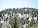
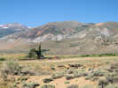
| Aeolian Buttes
| 
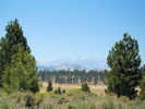
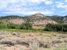
Aeolian Buttes | Photograph taken 23-Sep-06. Mono Craters in the background. This is photograph number 2000 on this web site.
Location records that use this photograph:
Article records that use this photograph:
images/IMG_0744sm.jpg
| 
Rock outcrop on edge of Aeolian Buttes | Photograph taken 15 June 2011.
Location records that use this photograph:
Article records that use this photograph:
images/IMG_1879sm.jpg
| 
Rock outcrop on edge of Aeolian Buttes | Photograph taken 15 June 2011.
Location records that use this photograph:
Article records that use this photograph:
images/IMG_1884sm.jpg
| 
Looking northwest over the Aeolian Buttes to Mt. Gibb | Photograph taken 15 June 2011.
Location records that use this photograph:
Article records that use this photograph:
images/IMG_1878sm.jpg
| Alameda Well
| 
Alameda Well and buildings, from outside the fence. | Photograph taken 23-Sep-06.
Location records that use this photograph:
Article records that use this photograph:
images/IMG_0779sm.jpg
| Alger Creek
| 
Alger Creek as seen from Silver Lake Campground | Photographed 3 October 2013.
Location records that use this photograph:
Article records that use this photograph:
images/IMG_1674sm.jpg
| Alkali Valley
| 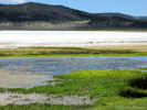
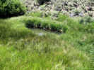
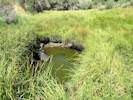
Three little ducks, probably shovelers, in a spring beside Alkali Lake. | Photograph taken 28 June 2010.
Location records that use this photograph:
Article records that use this photograph:
images/IMG_0952sm.jpg
| 
The descent into Alkali Valley | Photograph taken 29 June 2010. This grade can be a little rough, and is worth taking some extra time.
Location records that use this photograph:
Article records that use this photograph:
images/IMGP0240sm.jpg
| 
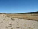
Looking north toward the playa in Alkali Valley. | Photograph taken 29 June 2010. The old road can be seen at extreme right.
Location records that use this photograph:
Article records that use this photograph:
images/IMGP0239sm.jpg
| Andy Thompson Creek
| 
Delta of Andy Thompson Creek. | Photographed 19 Jun 2013. The plateau barely highlighted in the right middleground looks to me like a former delta of Andy Thompson Creek built during a higher stand of Mono Lake.
Location records that use this photograph:
Article records that use this photograph:
images/IMG_1501sm.jpg
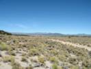
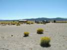
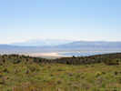
| Big Sand Flat
| 
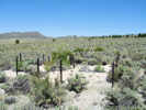
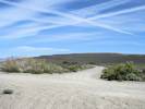
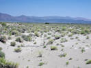
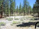
Eastern portion of Big Sand Flat after sheep grazing. | Photograph taken 2 September 2010.
Article records that use this photograph:
images/IMG_1398sm.jpg
| 
Collection locality northwest of Big Sand Flat | Photograph taken 25-Jun-07. This area burned several years ago.
Article records that use this photograph:
images/IMG_1780sm.jpg
| 
Big Sand Flat, from the southwest. | Photograph taken 23-Sep-06. The road at right is Pilot Spring Road.
Location records that use this photograph:
Article records that use this photograph:
images/IMG_0757sm.jpg
| 
Looking southwest through Big Sand Flat | Photograph taken 5 July 2010 in Big Sand Flat.
Location records that use this photograph:
Article records that use this photograph:
images/IMGP9360sm.jpg
| 
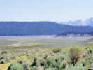
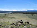
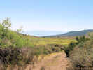
Big Sand Flat, looking into the Mono Basin from near Sagehen Summit. | Photograph taken 23-Sep-06.
Location records that use this photograph:
Article records that use this photograph:
images/IMG_0760sm.jpg
| 
Lunch-time view near Big Sand Flat | Photograph taken 25-Jun-07. I think the highest peak in the distance is Parker Peak.
Location records that use this photograph:
Article records that use this photograph:
images/IMG_1776sm.jpg
| 
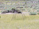
Odd structure near Big Sand Flat | Photograph taken 25-Jun-07. This looks like some kind of water collection device, such as a Guzzler. However, the water collection pan looks small relative to the storage pit.
Article records that use this photograph:
images/IMG_1778sm.jpg
| 
Collection location on the edge of Big Sand Flat | Photograph taken 25-Jun-07.
Location records that use this photograph:
Article records that use this photograph:
images/IMG_1779sm.jpg
| 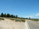
Intersection of CA Highway 120 and "120 Cutoff Road," F. R. 1S06. | Photograph taken August 13, 2008.
Article records that use this photograph:
images/IMG01303sm.jpg
| 
View southwest from the "Sand" marker. | Photograph taken 21 June 2010. Big Sand Flat can be seen at left. Forest Road 1S19A can be seen left of center. The vegetation change is the result of a fire.
Article records that use this photograph:
images/IMG_0909sm.jpg
| 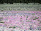
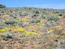
Wildflowers at Big Sand Flat. | Photograph taken July 7, 2009. The magenta-colored flowers are Skunky Monkey Flower (Diplacus mephiticus (Greene) G. L. Nesom) and the blue flowers are Mono Lake Lupine (Lupinus duranii Eastw.).
Location records that use this photograph:
Article records that use this photograph:
images/IMG01983sm.jpg
| 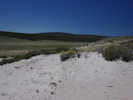
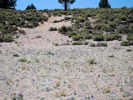
Sand dunes on the edge of Big Sand Flat. | Photograph taken 17 June 2010.
Location records that use this photograph:
Article records that use this photograph:
images/IMGP0150sm.jpg
| 
Wildlife exclosure (?) in Big Sand Flat. | Photograph taken 5 July 2010 in Big Sand Flat. I also saw something similar to this in Alkali Valley.
Location records that use this photograph:
Article records that use this photograph:
images/IMGP9361sm.jpg
| 
Marker at "Sand" | Photograph taken 21 June 2010.
Article records that use this photograph:
images/IMG_0910sm.jpg
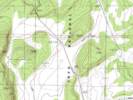
| Black Point
| 
Black Point | Photograph taken July 7, 2009.
Location records that use this photograph:
Article records that use this photograph:
images/IMG01938sm.jpg
| 
Entrance to the Fissure | Photograph taken July 8, 2009.
Location records that use this photograph:
Article records that use this photograph:
images/IMG02016sm.jpg
| 
Map of Black Point | Base: Negit Island Quadrangle.
Location records that use this photograph:
images/CAMnoBlackPoint.jpg
| 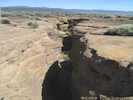
Top of the Fissure | Photograph taken July 8, 2009.
Location records that use this photograph:
Article records that use this photograph:
images/IMG02017sm.jpg
| 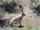
Jack Rabbit on Black Point | Photograph taken July 8, 2009.
Article records that use this photograph:
images/IMG02022sm.jpg
| 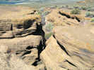
Top of the Fissure | Photograph taken July 8, 2009.
Location records that use this photograph:
Article records that use this photograph:
images/IMG02009sm.jpg
| 
Location of Collection No. 586, Eriastrum wilcoxii | Photograph taken July 8, 2009.
Location records that use this photograph:
Article records that use this photograph:
images/IMG02007sm.jpg
| 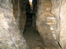
Inside the Fissure | Photograph taken July 8, 2009.
Location records that use this photograph:
Article records that use this photograph:
images/IMG02015sm.jpg
| 
Beginning of F. R. 02N42 on Cemetery Road | Photographed 22 May 2013.
Article records that use this photograph:
images/IMG_1470sm.jpg
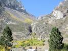
| Bloody Canyon
| 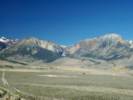
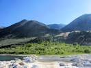
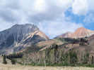
Bloody Canyon | Photograph taken 23-Sep-06. There are two valleys formed by moraines that can be seen exiting Bloody Canyon. Walker Lake and Walker Creek are in the largest valley that exits to the right. Moraines forming this valley have been dated as Tahoe, Tenaya, and Tioga age. Exiting to the left is the older moraine that defines Sawmill Canyon. This moraine has been dated as Mono Basin age by Sampson and Smith (2006). The peak on the left is Mount Lewis, and the peak on the right is Mount Gibbs.
Location records that use this photograph:
Article records that use this photograph:
images/IMGP2477sm.jpg
| Bodie & Benton
| 
Bodie and Benton roadbed looking north. | Photographed 24 June 2015.
Article records that use this photograph:
images/IMGQ1066sm.jpg
| 
Bodie and Benton roadbed looking south. | Photographed 24 June 2015.
Article records that use this photograph:
images/IMGQ1069sm.jpg
| Bodie and Benton Railway
| 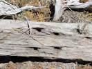
Spike pattern in railroad tie. | Photographed 20 Jun 2013.
Article records that use this photograph:
images/IMG31516sm.jpg
| 
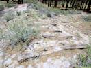
Bodie and Benton Railway roadbed. | Photographed 20 Jun 2013.
Article records that use this photograph:
images/IMG_1512sm.jpg
| 
Bodie and Benton Railway roadbed south of Mono Mills | Photographed 20 Jun 2013.
Article records that use this photograph:
images/IMG_1515sm.jpg
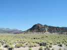
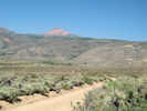
| Bodie Hills
| 
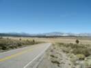
Looking east into the Mono Basin. | Photograph taken 25 July 2010.
Article records that use this photograph:
images/IMG_1096sm.jpg
| 
Small road north of Mt. Biedeman | Map prepared 30 July 2010.
Article records that use this photograph:
images/cahtnfunk12_Routel_20100730.jpg
| 
Looking south toward Mt. Biedeman | Photograph taken 25 July 2010. Mats of Lupinus lepidus var. lobbii are in the center foreground.
Article records that use this photograph:
images/IMG_1097sm.jpg
| 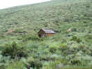
Miners cabin in Cottonwood Canyon. | Photograph taken 25 July 2010 in the Bodie Hills, about midway through Cottonwood Canyon.
Location records that use this photograph:
Article records that use this photograph:
images/IMG_1107sm.jpg
| 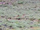
Antelope in the Bodie Hills | Photograph taken 25 July 2010 in the Bodie Hills, northeast of Mt. Biedeman and south of California Highway 270.
Article records that use this photograph:
images/IMGP0644sm.jpg
| 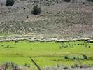
Sheep in lower Mormon Meadow | Photographed 21 June 2012.
Location records that use this photograph:
Article records that use this photograph:
images/IMG30338sm.jpg
| 
Coyote Springs Road descends to Mormon Meadow | Photographed 24 August 2012.
Location records that use this photograph:
Article records that use this photograph:
images/IMG30635sm.jpg
| 
Descending into Mormon Meadow from Bridgeport Canyon | Photographed 21 June 2012.
Location records that use this photograph:
Article records that use this photograph:
images/IMG30337sm.jpg
| Bohler Canyon
| 
My collecting locality in Bohler Canyon | Photograph taken August 2, 2007. Photograph looks north from the south side of the canyon, across Bohler Creek.
Location records that use this photograph:
Article records that use this photograph:
images/IMG_1930sm.jpg
| 
Arborglyph beside Bohler Creek. | Photograph taken 18 June 2010.
Location records that use this photograph:
Article records that use this photograph:
images/IMG_0863sm.jpg
| 
Looking up Bohler Canyon | Photograph taken August 2, 2007. I think it's Mount Gibbs on the left, and Mount Dana on the right.
Location records that use this photograph:
Article records that use this photograph:
images/IMG_1933sm.jpg
| 
View east from Bohler Canyon | Photograph taken 18 June 2010.
Location records that use this photograph:
Article records that use this photograph:
images/IMG_0868sm.jpg
| 
Second collecting locality in Bohler Canyon. | Photograph taken August 2, 2007. This is the place where a small road crosses the creek. There is also a broken down cabin here.
Location records that use this photograph:
Article records that use this photograph:
images/IMG_1932sm.jpg
| 
Bohler Creek just below Farrington Siphon | Photographed 20 May 2013. The GNIS does not recognize a “Bohler Creek.” Regardless, this is the creek draining from Bohler Canyon, which the GNIS does recognize.
Article records that use this photograph:
images/IMG_1420sm.jpg
| Bridgeport Canyon
| 
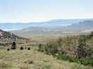
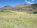
View across Mono Basin to Cowtrack Mountain | Photograph taken 26-Jun-07. This photo looks southeast from the pass in Bridgeport Canyon, the northwest edge of the Mono Basin, to Cowtrack Mountain, on the southeast edge of the Mono Basin.
Location records that use this photograph:
Article records that use this photograph:
images/IMG_1815sm.jpg
| 
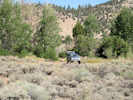
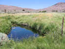
Coyote Spring in Bridgeport Canyon | Photograph taken 26-Jun-07.
Location records that use this photograph:
Article records that use this photograph:
images/IMG_1806sm.jpg
| 
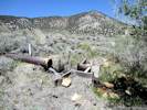
Mudflow breccia in Bridgeport Canyon | Photograph taken 26-Jun-07.
Location records that use this photograph:
Article records that use this photograph:
images/IMG_1805sm.jpg
| 
Coyote Spring in Bridgeport Canyon | Photograph taken 26-Jun-07.
Location records that use this photograph:
Article records that use this photograph:
images/IMG_1807sm.jpg
| 
Meadow in upper Bridgeport Canyon | Photograph taken 26-Jun-07. This meadow was watered by a fairly large spring that does not appear to be named.
Location records that use this photograph:
Article records that use this photograph:
images/IMG_1816sm.jpg
| 
Unnamed spring in Bridgeport Canyon | Photograph taken 26-Jun-07.
Article records that use this photograph:
images/IMG_1808sm.jpg
| 
Lower end of Bridgeport Canyon | Photograph taken 26-Jun-07 from Goat Ranch Cutoff.
Location records that use this photograph:
Article records that use this photograph:
images/IMG_1804sm.jpg
| 
Mono Lake, Cowtrack Mountain, and the White Mountains from Bridgeport Canyon. | Photograph taken 20 June 2010.
Article records that use this photograph:
images/IMG_0891sm.jpg
| 
Meadow cleaned out by sheep. | Photographed 24 August 2012. Note that the Iris is still there; eventually it will take over.
Location records that use this photograph:
Article records that use this photograph:
images/IMG30639sm.jpg
| 
Natural rock garden in Bridgeport Canyon. | Photographed 22 May 2013.
Location records that use this photograph:
Article records that use this photograph:
images/IMG31465sm.jpg
| 
Low water level in the pool at Coyote Spring. | Photographed 24 August 2012. It looked like the water had been pumped out; for sheep?
Location records that use this photograph:
Article records that use this photograph:
images/IMG30640sm.jpg
| 
Plants collected in one spot in Bridgeport Canyon. | Date of Collections: 22 May 2013.
Location records that use this photograph:
Article records that use this photograph:
images/MLF_V1_42.jpg
| Carl Sharsmith
| 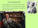
Carl Sharsmith |
Article records that use this photograph:
images/MLF_V1_Slide_8.jpg
| Cedar Hill
| 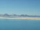
View of Cedar Hill acress Mono Lake. | Photograph taken 23-Sep-06. Cedar Hill is in the middleground from center to right of center. The peak on the skyline left of center is Mount Hicks. The peak at back left is Aurora Peak. Both of these peaks are in Nevada.
Location records that use this photograph:
Article records that use this photograph:
images/IMGP2487sm.jpg
| 
Shorelines on Cedar Hill | Photograph taken July 7, 2009.
Location records that use this photograph:
Article records that use this photograph:
images/IMG01948sm.jpg
| Chesnut and Drew
| 
Chesnut and Drew in the Mono Lake basin, 1889. |
Article records that use this photograph:
images/MLF_V1_Slide_10.jpg
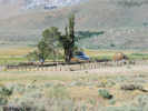
| Conway Ranch
| 
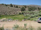
General view towards Conway Ranch | Photograph taken 26-Jun-07. Dunderberg Peak in the background.
Location records that use this photograph:
Article records that use this photograph:
images/IMG_1802sm.jpg
| 
Conway Ranch | Photograph taken 26-Jun-07.
Location records that use this photograph:
Article records that use this photograph:
images/IMGP2698sm.jpg
| 
Conway Ranch from US Highway 395 | Photograph taken 4-Jun-06.
Location records that use this photograph:
Article records that use this photograph:
images/IMG_0463sm.jpg
| 
Conway Ranch | Photograph taken 26-Jun-07.
Location records that use this photograph:
Article records that use this photograph:
images/IMG_1787sm.jpg
| | |||||||||||||||||||