
Eastern Mojave Vegetation
By Tom Schweich
|
Eastern Mojave Vegetation | Images -- Geography - Jefferson County, CO |
|
By Tom Schweich |
|

Unclassified Geography - Idaho Geography - Park County, CO Geography - Summit County, CO Geography - Arizona Geography - British Columbia Geography - California Geography - California's Colorado Desert Alaska Geography - Mono Lake Basin, California Geography - Mono County, California Geography - San Luis Obispo County, California Geography - Marin County, California Geography - Santa Clara County Alameda Garden Geography - Central Mojave Geography - New Mexico Geography - Eastern Mojave Geography - Northern Mojave Geography - Colorado Geography - Alamosa County, CO Geography - Boulder County, CO Geography - Clear Creek County, CO Geography - Chaffee County, CO Geography - Douglas County, CO Geography - Gilpin County, CO Geography - Golden, Colorado Geography - Weld County, CO Geography - Hinsdale County, CO Geography - Jefferson County, CO Geography - North Table Mountain, Jefferson Cty, CO Geography - Lake County, CO Geography - Larimer County, CO Geography - Nevada Geography - Oregon Geography - Utah Geography - Virginia Geography - Washington Geography - Wyoming Spain - Andalucia Spain - Castilla y Leon Spain - Castilla-La Mancha Spain - Extremadura Spain - Galicia Spain - Madrid Portugal Geology Economic Geology Climatology Botany Salvia dorrii Frasera albomarginata Species Species - Polygonaceae Species - Brassicaceae Species - Brassicaceae, Physaria vitulifera Species - Rosaceae Species - Fabaceae Species - Onagraceae Species - Polemoniaceae Species - Boraginaceae Species - Plantaginaceae Species - Asteraceae Species - Poaceae Zoology Ecology Archeology Customer Satisfaction General Arizona California Kansas Missouri Nebraska New York Christmas 2002 Family Photos Family Documents Family Photos 2003 Art of Lydia Schweich Portraits Railroad Geography - Germany |
Images are organized by the topics listed at left. Click on a topic name to see images with that topic. Would you like to use these photographs in your school term paper or report? License is hereby granted for non-commercial use of the images contained herein provided that the images are reproduced with the copyright notice intact. This means that we give you our permission to use the photographs and information you find here in your school term papers and reports. You may resize the photograph to fit your needs, but you may not remove the copyright. Your term paper should note that the photographs are reproduced with permission and it should have a reference to this web site, such as: "Photograph �1999 Tom Schweich. Used by permission, http://www.schweich.com" If you have a comment or a question about a photograph you may write to me at tas4@schweich.com I will answer you as soon as I can. I sometimes post interesting questions in my FAQ, but I will not disclose your full name or address.
| 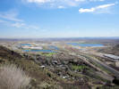
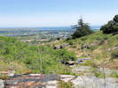
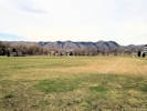
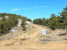
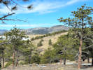
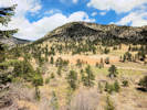
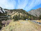
Valley of Clear Creek opens onto the plains; Denver in right distance. | Photographed 12 April 2016.
Article records that use this photograph:
images/IMGQ2328sm.jpg
| 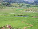
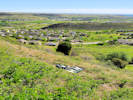
Ramstetter Reservoir from slope of North Table Mountain. | Photographed 1 June 2016.
Location records that use this photograph:
Article records that use this photograph:
images/IMGQ2661sm.jpg
| Apex Park
| 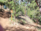
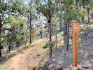
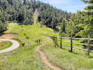
Grubstake Trail at its west junction of the Bonanza Trail. | Photographed 6 May 2020
Location records that use this photograph:
Article records that use this photograph:
images/20200506_094526sm.jpg
| 
Corner of Apex Park. | Photographed 6 May 2020
Location records that use this photograph:
Article records that use this photograph:
images/20200506_114131sm.jpg
| 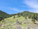
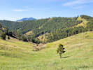
Gentle upper slopes of Apex Park. | Photographed 6 May 2020
Location records that use this photograph:
Article records that use this photograph:
images/20200506_113131sm.jpg
| 
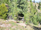
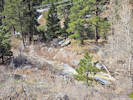
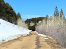
My day pack and field press on the old road, now an elk trail. | Photographed 26 May 2020.
Location records that use this photograph:
Article records that use this photograph:
images/20200526_095028sm.jpg
| 
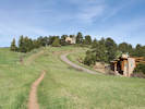
West end of Bonanza Trail at the Grubstake Trail. | Photographed 6 May 2020
Location records that use this photograph:
Article records that use this photograph:
images/20200506_094514sm.jpg
| 
Looking toward Parkview Avenue from social trail. | Photographed 6 May 2020. The visible road at right is Enchanted Road, a private road. Parkview Avenue is near the top of the slope.
Article records that use this photograph:
images/20200506_093520sm.jpg
| 
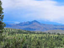
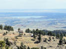
Looking south in Apex Park. | Photographed 6 May 2020. Photograph taked from the social trail that connects Parkview Avenue with the Pick-N-Sledge and Sluicebox Trails. The trails in the left middleground are the Sluicebox and Hardscrabble Trails. Mount Morrison is in the distance.
Location records that use this photograph:
Article records that use this photograph:
images/20200506_093515sm.jpg
| 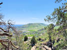
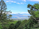
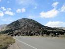
Green Mountain from Apex Open Space Park. | Photographed 26 May 2020.
Location records that use this photograph:
Article records that use this photograph:
images/20200526_113700sm.jpg
| 
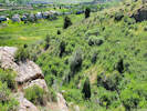
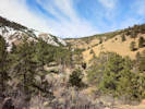
View down Deadman Gulch. | Photographed 26 May 2020. My truck circled at left, downtown Denver in the top distance.
Location records that use this photograph:
Article records that use this photograph:
images/20200526_110723sm.jpg
| 
West end of social trail. | Photographed 6 May 2020. Photograph taken from Parkview Avenue, looking east. The social trail goes to the junction of the Pick-N-Sledge and Sluicebox Trails. The Grubstake Trail is seen in the forest opening in the distance.
Location records that use this photograph:
Article records that use this photograph:
images/20200506_093251sm.jpg
| 
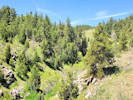
Deadman Gulch in Apex Park. | Photographed 6 May 2020
Location records that use this photograph:
Article records that use this photograph:
images/20200506_122829sm.jpg
| 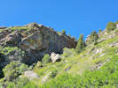
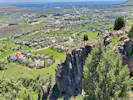
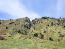
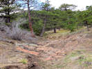
Cliff on the south side of Deadman Gulch. | Photographed 26 May 2020.
Location records that use this photograph:
Article records that use this photograph:
images/20200526_093704sm.jpg
| 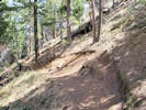
Widened Grubstake Trail. | Photographed 25 April 2020.
Article records that use this photograph:
images/20200425_111044sm.jpg
| 
View through Apex Park and Stonebridge to Green Mountain. | Photographed 10 Jun 2020.
Location records that use this photograph:
Article records that use this photograph:
images/20200610_105739sm.jpg
| 
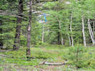
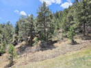
Elk Trail through chokecherry on an old overgrown road. | Photographed 26 May 2020.
Location records that use this photograph:
Article records that use this photograph:
images/20200526_093516sm.jpg
| 
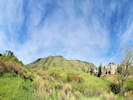
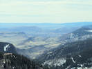
Panorama of today's objective. | Photographed 26 May 2020. I'm wondering if I can make it to the top of the ridge to the right of Deadman Gulch.
Location records that use this photograph:
Article records that use this photograph:
images/20200526_084323sm.jpg
| 
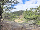
Unnamed gulch in Apex Park. | Photographed 10 Jun 2020.
Location records that use this photograph:
Article records that use this photograph:
images/20200610_111400sm.jpg
| 
Unnamed gulch in the north part of Apex Park, | Photographed 7 July 2021.
Location records that use this photograph:
Article records that use this photograph:
images/20210707_101417sm.jpg
| 
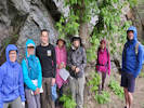
Dodecatheon pulchellum and Prunus americana in Apex Park. | Photographed 10 May 2022.
Location records that use this photograph:
Article records that use this photograph:
images/20220510_090427sm.jpg
| 
Unnamed gulch in Apex Park. | Photographed 10 Jun 2020.
Location records that use this photograph:
Article records that use this photograph:
images/20200610_111405sm.jpg
| 
Looking down an unnamed gulch in the north part of Apex Park, | Photographed 7 July 2021.
Location records that use this photograph:
Article records that use this photograph:
images/20210707_114913sm.jpg
| 
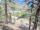
Upper part of Deadman Gulch | Photographed 26 May 2020.
Location records that use this photograph:
Article records that use this photograph:
images/20200526_110623sm.jpg
| 
Panorama from northeast corner of srudy area. | Photographed 18 May 2020.
Location records that use this photograph:
Article records that use this photograph:
images/20200518_091854sm.jpg
| 
Panorama from up near the water tank, the southeast corner of study area. | Photographed 18 May 2020.
Location records that use this photograph:
Article records that use this photograph:
images/20200518_102723sm.jpg
| 
Enchanted Forest trailhead to Apex Park. | Photographed 25 May 2015.
Location records that use this photograph:
Article records that use this photograph:
images/IMGQ0566sm.jpg
| Buffalo Creek Recreation Area
| 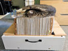
Solny (short for Solnyshka) knowsn what a press full of new collections on the dryer is good for. | Photographed 10 July 2023.
Article records that use this photograph:
images/20230710_155442sm.jpg
| 
Another view of Thunder Butte and Pikes Peak; this one after the hail storm. | Photographed 10 July 2023.
Location records that use this photograph:
Article records that use this photograph:
images/20230710_125919sm.jpg
| 
View to the southeast from Little Scraggy Trail to Thunder Butte and Pikes Peak. | Photographed 10 July 2023.
Location records that use this photograph:
Article records that use this photograph:
images/20230710_090020sm.jpg
| 
Horse trail markings at the head of Morrison Creek. | Photographed 10 July 2023.
Location records that use this photograph:
Article records that use this photograph:
images/20230710_091437sm.jpg
| 
Annual visit with Santa. | Photographed 7 December 2019.
Article records that use this photograph:
images/20191207_Smokey.jpg
| Camp George West Park
| 
Sports field at Camp George West Park. | Photographed 9 April 2019.
Article records that use this photograph:
images/20190409_093025sm.jpg
| 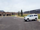
Recently paved parking lot at Camp George West Park. | Photographed 9 April 2019.
Article records that use this photograph:
images/20190409_092543sm.jpg
| Centennial Cone Park
| 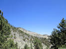
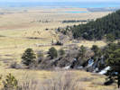
Upper reaches of Mayhem Gulch drainage. | Photographed 27 April 2018. Elk Meadow Trail visible in left middle ground.
Location records that use this photograph:
Article records that use this photograph:
images/IMG50111sm.jpg
| 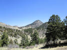
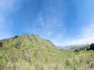
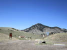
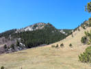
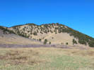
Centennial Cone, as seen from the West Trailhead. | Photographed 27 April 2018. Elk Meadow Trail crosses the left middle ground to the saddle in the distance.
Location records that use this photograph:
Article records that use this photograph:
images/IMG50113sm.jpg
| 
Douglas Mountain from the North Trailhead of Centennial Cone Park. | Photographed 27 April 2018.
Location records that use this photograph:
Article records that use this photograph:
images/IMG50123sm.jpg
| 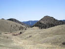
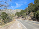
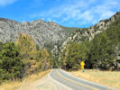
Travois Trail headed southeast from the North Trailhead | Photographed 27 April 2018. Lookout Mountain in the distance left of center.
Location records that use this photograph:
Article records that use this photograph:
images/IMG50124sm.jpg
| Clear Creek Canyon
| 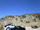
Mayhem Gulch Parking Lot and Trailhead | Photographed 27 April 2018.
Location records that use this photograph:
Article records that use this photograph:
images/IMG50110sm.jpg
| Clear Creek Canyon Park
| 
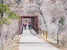
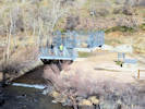
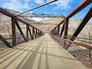
Welch Ditch suspension bridge. | Photographed 29 March 2024.
Location records that use this photograph:
Article records that use this photograph:
images/20240329_102214sm.jpg
| 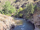
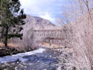
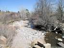
View of Clear Creek downstream of the Welch Ditch Suspension Bridge. | Photographed 14 September 2021.
Location records that use this photograph:
Article records that use this photograph:
images/20210914_101900sm.jpg
| 
West end of Grant Terry Bridge. | Photographed 29 March 2024.
Article records that use this photograph:
images/20240329_110517sm.jpg
| 
Flat on the west side of the Grant Terry Bridge. | Photographed 29 March 2024.
Location records that use this photograph:
Article records that use this photograph:
images/20240329_095117sm.jpg
| 
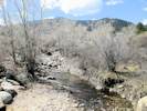
View of Clear Creek upstream of the Welch Ditch Suspension Bridge. | Photographed 14 September 2021.
Location records that use this photograph:
Article records that use this photograph:
images/20210914_101853sm.jpg
| 
Head gate of the Church Ditch. | Photographed 29 March 2024.
Location records that use this photograph:
Article records that use this photograph:
images/20240329_095659sm.jpg
| 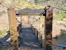
Welch Ditch Bridge | Photographed 14 September 2021.
Article records that use this photograph:
images/20210914_102154sm.jpg
| 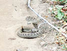
Rattlesnake in the Welch Ditch. | Photographed 23 September 2021.
Location records that use this photograph:
Article records that use this photograph:
images/20210923_131343sm.jpg
| 
Pedestrian bridge over Clear Creek. | Photographed 9 March 2021.
Article records that use this photograph:
images/20210309_120258sm.jpg
| 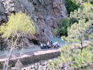
Rock climbing class. | Photographed 23 September 2021 from the Welch Ditch.
Location records that use this photograph:
Article records that use this photograph:
images/20210923_120711sm.jpg
| 
The east end of the Grant Terry Bridge. | Photographed 29 March 2024.
Location records that use this photograph:
Article records that use this photograph:
images/20240329_094918sm.jpg
| 
Stairs between Peaks to Plains Trail and the Welch Ditch. | Photographed 29 March 2024.
Article records that use this photograph:
images/20240329_104839sm.jpg
| 
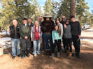
Field trip waits out a shower. | Photographed 29 May 2022.
Article records that use this photograph:
images/20220529_121054sm.jpg
| 
Junk car along the ditch. | Photographed 29 March 2024.
Location records that use this photograph:
Article records that use this photograph:
images/20240329_103207sm.jpg
| Coal Creek
| 
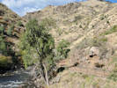
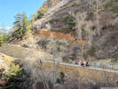
Terrace of Coal Creek in Jefferson County. | Photographed 15 June 2022.
Location records that use this photograph:
Article records that use this photograph:
images/20220615_102223sm.jpg
| 
Coal Creek downstream from Plainview Road. | Photographed 23 March 2015.
Location records that use this photograph:
Article records that use this photograph:
images/IMG40921sm.jpg
| 
Coal Creek upstream from Plainview Road. | Photographed 23 March 2015.
Location records that use this photograph:
Article records that use this photograph:
images/IMG40920sm.jpg
| Coal Creek Canyon
| 
Brumm Trail up on the ridge. | Photographed 5 April 2024.
Article records that use this photograph:
images/20240405_110336sm.jpg
| 
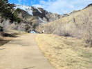
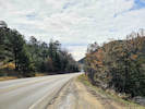
Looking east from parking area. | Photographed 5 April 2024.
Location records that use this photograph:
Article records that use this photograph:
images/20240405_100420sm.jpg
| 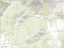
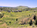
Coal Creek Canyon Study Area, 12 April 2024. | Exported 14 April 2024.
Location records that use this photograph:
Article records that use this photograph:
images/Coal_Ck_8400_20240414.jpg
| 
View from drainage S2 towards Fire Station 3. | Photographed 12 April 2024
Location records that use this photograph:
Article records that use this photograph:
images/20240412_110028sm.jpg
| 
Looking west in the direction of Blue Mountain. | Photographed 5 April 2024.
Article records that use this photograph:
images/20240405_111457sm.jpg
| 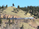
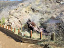
California Zephyr climbs the Moffat Route across the canyon. | Photographed 12 April 2024
Article records that use this photograph:
images/20240412_095250sm.jpg
| 
Drainage S2 from the low hill. | Photographed 12 April 2024
Location records that use this photograph:
Article records that use this photograph:
images/20240412_111853sm.jpg
| 
Smashed picnic table beside Coal Creek. | Photographed 5 April 2024.
Location records that use this photograph:
Article records that use this photograph:
images/20240405_100818sm.jpg
| 
Brumm Trail near the top of the ridge. | Photographed 5 April 2024.
Article records that use this photograph:
images/20240405_112450sm.jpg
| 
View west (up canyon) from pullout. | Photographed 5 April 2024.
Location records that use this photograph:
Article records that use this photograph:
images/20240405_100830sm.jpg
| 
View south from Brumm Trail. | Photographed 5 April 2024.
Article records that use this photograph:
images/20240405_113208sm.jpg
| 
Drainage S2 in the Lacey parcel of Coal Creek Canyon Study Area. | Photographed 12 April 2024
Article records that use this photograph:
images/20240412_093017sm.jpg
| 
View across Coal Creek Canyon. | Photographed 24 April 2024.
Location records that use this photograph:
Article records that use this photograph:
images/20240424_120016sm.jpg
| 
View of canyon to the southwest. | Photographed 5 April 2024. Designated Canyon 2.
Location records that use this photograph:
Article records that use this photograph:
images/20240405_101646sm.jpg
| 
View east from Brumm Trail. | Photographed 5 April 2024.
Article records that use this photograph:
images/20240405_113828sm.jpg
| 
View back across upper part of small gulch (S2.2). | Photographed 24 April 2024. This is indicated as gulch S2.2 on my map of the Lacey parcel.
Location records that use this photograph:
Article records that use this photograph:
images/20240424_121645sm.jpg
| 
Looking west from parking area. | Photographed 5 April 2024.
Location records that use this photograph:
Article records that use this photograph:
images/20240405_100414sm.jpg
| 
Upper part of small gulch S2.2. | Photographed 24 April 2024. This is indicated as gulch S2.2 on my map of the Lacey parcel.
Location records that use this photograph:
Article records that use this photograph:
images/20240424_121307sm.jpg
| 
Wide-angle view of Canyon 2 on left and Coal Creek Canyon on right. | Photographed 5 April 2024.
Location records that use this photograph:
Article records that use this photograph:
images/20240405_102231sm.jpg
| 
View east (down canyon) in Coal Creek Canyon. | Photographed 5 April 2024.
Location records that use this photograph:
Article records that use this photograph:
images/20240405_100838sm.jpg
| 
View out of the canyon to the east. | Photographed 5 April 2024.
Location records that use this photograph:
Article records that use this photograph:
images/20240405_101943sm.jpg
| 
Small gulch above Coal Creek (S2.2) | Photographed 24 April 2024. This is indicated as gulch S2.2 on my map of the Lacey parcel.
Location records that use this photograph:
Article records that use this photograph:
images/20240424_110321sm.jpg
| 
View from the low hill in the northeast corner of the Lacey parcel. | Photographed 24 April 2024.
Location records that use this photograph:
Article records that use this photograph:
images/20240424_102818sm.jpg
| 
View up canyon from the mouth of Coal Creek Canyon. | Photographed 5 April 2024.
Location records that use this photograph:
Article records that use this photograph:
images/20240405_102015sm.jpg
| 
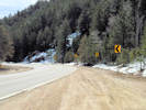
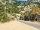
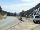
Looking west on CO Hwy 72, Coal Creek Canyon Road. | Photographed 23 March 2015.
Location records that use this photograph:
Article records that use this photograph:
images/IMG40931sm.jpg
| Colorado Railroad Museum
| 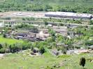
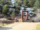
Colorado Railroad Museum from North Table Mountain | Photographed 9 June 2015.
Article records that use this photograph:
images/IMGQ0778sm.jpg
| | ||||||||||