
Eastern Mojave Vegetation
By Tom Schweich
|
Eastern Mojave Vegetation | Images -- Geography - North Table Mountain, Jefferson Cty, CO |
|
By Tom Schweich |
|

Unclassified Geography - Idaho Geography - Park County, CO Geography - Summit County, CO Geography - Arizona Geography - British Columbia Geography - California Geography - California's Colorado Desert Alaska Geography - Mono Lake Basin, California Geography - Mono County, California Geography - San Luis Obispo County, California Geography - Marin County, California Geography - Santa Clara County Alameda Garden Geography - Central Mojave Geography - New Mexico Geography - Eastern Mojave Geography - Northern Mojave Geography - Colorado Geography - Alamosa County, CO Geography - Boulder County, CO Geography - Clear Creek County, CO Geography - Chaffee County, CO Geography - Douglas County, CO Geography - Gilpin County, CO Geography - Golden, Colorado Geography - Weld County, CO Geography - Hinsdale County, CO Geography - Jefferson County, CO Geography - North Table Mountain, Jefferson Cty, CO Geography - Lake County, CO Geography - Larimer County, CO Geography - Nevada Geography - Oregon Geography - Utah Geography - Virginia Geography - Washington Geography - Wyoming Spain - Andalucia Spain - Castilla y Leon Spain - Castilla-La Mancha Spain - Extremadura Spain - Galicia Spain - Madrid Portugal Geology Economic Geology Climatology Botany Salvia dorrii Frasera albomarginata Species Species - Polygonaceae Species - Brassicaceae Species - Brassicaceae, Physaria vitulifera Species - Rosaceae Species - Fabaceae Species - Onagraceae Species - Polemoniaceae Species - Boraginaceae Species - Plantaginaceae Species - Asteraceae Species - Poaceae Zoology Ecology Archeology Customer Satisfaction General Arizona California Kansas Missouri Nebraska New York Christmas 2002 Family Photos Family Documents Family Photos 2003 Art of Lydia Schweich Portraits Railroad Geography - Germany |
Images are organized by the topics listed at left. Click on a topic name to see images with that topic. Would you like to use these photographs in your school term paper or report? License is hereby granted for non-commercial use of the images contained herein provided that the images are reproduced with the copyright notice intact. This means that we give you our permission to use the photographs and information you find here in your school term papers and reports. You may resize the photograph to fit your needs, but you may not remove the copyright. Your term paper should note that the photographs are reproduced with permission and it should have a reference to this web site, such as: "Photograph �1999 Tom Schweich. Used by permission, http://www.schweich.com" If you have a comment or a question about a photograph you may write to me at tas4@schweich.com I will answer you as soon as I can. I sometimes post interesting questions in my FAQ, but I will not disclose your full name or address.
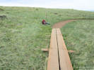
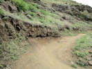
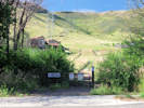
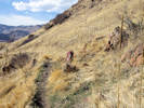
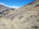
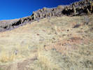
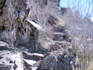
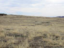
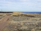
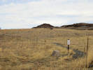
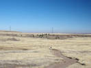
| Cottonwood Canyon Trail
| 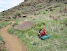
Location of Coll. No. 1806, Carex praegracilis | Photographed 7 May 2018.
Article records that use this photograph:
images/IMG50151sm.jpg
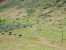
| Crappy Park Users
| 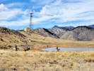
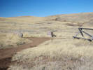
Horsepeople riding in the closed area at Vaca Lake. | Photographed 16 March 2019.
Location records that use this photograph:
Article records that use this photograph:
images/20200316_113343sm.jpg
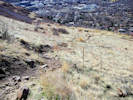
| Damage Repair
| 
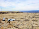
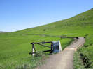
Open Space trail crew trying to repair damage by Xcel trucks. | Photographed 16 March 2019.
Article records that use this photograph:
images/20200316_114530sm.jpg
| 
Open Space trail crew trying to repair damage by Xcel trucks. | Photographed 16 March 2019.
Article records that use this photograph:
images/20200316_115210sm.jpg
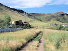
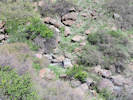
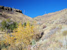
| Mesa Top Trail
| 
Location of Coll. No. 1804, Juncus sp. | Photographed 7 May 2018.
Article records that use this photograph:
images/IMG50150sm.jpg
| 
Mesa Top Trail where it was formerly washed out. | Photographed 7 May 2018.
Article records that use this photograph:
images/IMG50148sm.jpg
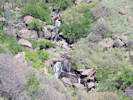
| 
Waterfall beside Mesa Top Trail. | Photographed 7 May 2018.
Location records that use this photograph:
Article records that use this photograph:
images/IMGS0149sm.jpg
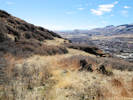
| North Golden
| 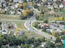
Intersection of Iowa Drive with Colorado Highway 93 | Photographed 8 October 2014. Iowa Street would be found slightly east, towards the observer.
Article records that use this photograph:
images/IMG40570sm.jpg
| 
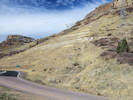
Intersection of Washington Avenue with Colorado Highway 93 | Photographed 8 October 2014.
Article records that use this photograph:
images/IMG40571sm.jpg
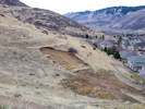
| 
View down the southwest face of North Table Mountain | Photographed 8 October 2014.
Article records that use this photograph:
images/IMG40572sm.jpg
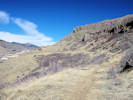
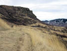
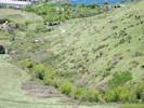
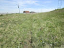
| North Table Loop
| 
Base of lava flow along North Table Loop. | Photographed 7 May 2018.
Location records that use this photograph:
Article records that use this photograph:
images/IMG50157sm.jpg
| 
Base of lava flow along North Table Loop. | Photographed 7 May 2018.
Location records that use this photograph:
Article records that use this photograph:
images/IMG50156sm.jpg
| 
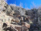
Two of many bolts just below the North Table Loop. | Photographed 7 May 2018.
Location records that use this photograph:
Article records that use this photograph:
images/IMG50155sm.jpg
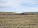
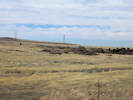
| North Table Mountain
| 
North Table Mountain from W. 58th Street | Photographed 22 July 2016, from Crestone Street near W. 58th Avenue.
Location records that use this photograph:
Article records that use this photograph:
images/IMGQ2972sm.jpg
| 
Ephemeral stream crosses trail | Photographed 10 March 2017. The stream crosses the trail at the location of the backpack. Note the cattails (Typha sp.) just above the trail.
Article records that use this photograph:
images/IMGQ3604sm.jpg
| 
Trace of tramway above Deer Springs Lane | Photographed on Winter Solstice, 21 December 2014. Bushes to the left of the trace are Rhus. I think the reddish tinge to the right of the trace is another willow. Should have been paying better attention.
Location records that use this photograph:
Article records that use this photograph:
images/IMG40746sm.jpg
| 
Trailhead of Mesa Spur Trail. | Photographed 22 July 2016, on W. 58th Avenue, near Crestone Street.
Location records that use this photograph:
Article records that use this photograph:
images/IMGQ2973sm.jpg
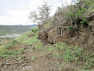
| 
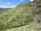
Landslide below North Table Mountain Trail | Photographed 3 March 2016.
Article records that use this photograph:
images/IMGQ2032sm.jpg
| 
Switchback to rim of North Table Mountain | Photographed 8 October 2014.
Article records that use this photograph:
images/IMG40589sm.jpg
| 
Mesa Spur Trail | Photographed 22 July 2016.
Location records that use this photograph:
Article records that use this photograph:
images/IMGQ2976sm.jpg
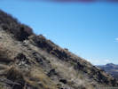
| 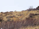
Deer above spring, southwest slopes of North Table Mountain. | Photographed March 16, 2017.
Article records that use this photograph:
images/IMGQ3606sm.jpg
| 
View from small hill near North Table Loop. | Photographed 22 July 2016.
Location records that use this photograph:
Article records that use this photograph:
images/IMGQ2988sm.jpg
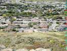
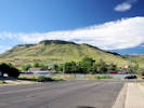
| 
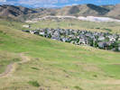
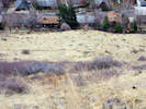
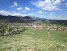
View of Golden to the south. | Photographed 18 February 2016.
Article records that use this photograph:
images/IMGQ1935sm.jpg
| 
Trace of tramway above Deer Springs Lane | Photographed on Winter Solstice, 21 December 2014.
Location records that use this photograph:
Article records that use this photograph:
images/IMG40750sm.jpg
| 
North Table Mountain from an unnamed hogback to the west. | Photographed 6 April 2017.
Article records that use this photograph:
images/IMGQ3680sm.jpg
| 
Social trail to Golden Cliffs Trailhead. | Photographed 18 February 2016.
Article records that use this photograph:
images/IMGQ1933sm.jpg
| 
Downhill view from the spring. | Photographed March 16, 2017. The water course runs from the lower right corner across to the left middleground, through the thicket, then back to the right, passing just to the right of the couple and their dog.
Article records that use this photograph:
images/IMGQ3614sm.jpg
| 
Spring improvements (steel drum set in watercourse). | Photographed March 16, 2017.
Article records that use this photograph:
images/IMGQ3612sm.jpg
| 
Spring improvements, plastic pipe south down the hill. | Photographed March 16, 2017.
Article records that use this photograph:
images/IMGQ3609sm.jpg
| 
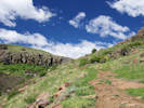
Hikers on the North Table Mountain Trail | Photographed 30 July 2015.
Location records that use this photograph:
Article records that use this photograph:
images/IMGQ1450sm.jpg
| 
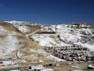
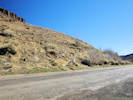
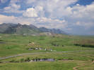
North Table Mountain from Table Mountain Parkway | Photographed 15 August 2014.
Location records that use this photograph:
Article records that use this photograph:
images/IMG40359sm.jpg
| 
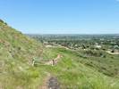
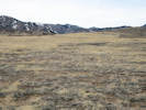
View from small hill, south east to Denver. | Photographed 22 July 2016.
Location records that use this photograph:
Article records that use this photograph:
images/IMGQ2993sm.jpg
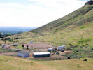
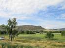
| 
The private pasture at left is a source of weeds bleeding into the adjacent open space. | Photographed 22 July 2016.
Location records that use this photograph:
Article records that use this photograph:
images/IMGQ2994sm.jpg
| 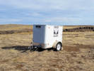
Front Range Climbing Stewards trailer at top of Golden Cliffs Trail | Photographed 10 February 2017. I assume that Front Range Climbing Stewards is at least in part responsible for reconstructing the Golden Cliffs Trail where it passes through the rim of the mesa.
Location records that use this photograph:
Article records that use this photograph:
images/20170210_100902sm.jpg
| 
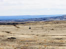
North Table Mountain to the southwest. | Photographed 13 August 2014.
Location records that use this photograph:
Article records that use this photograph:
images/IMG40354sm.jpg
| 
Ephemeral stream crosses trail | Photographed 10 March 2017.
Article records that use this photograph:
images/IMGQ3603sm.jpg
| 
Start of social trail at Easley Road. | Photographed 27 February 2016. The “trail” climbs to the fourth highway bench along a route just right of center.
Article records that use this photograph:
images/IMGQ1988sm.jpg
| 
Old social trail. | Photographed 18 February 2016.
Article records that use this photograph:
images/IMGQ1985sm.jpg
| 
Peery Drive trailhead of North Table Mountain Trail. | Photographed 18 February 2016.
Article records that use this photograph:
images/IMGQ1928sm.jpg
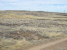
| 
Lower end of North Table Mountain | Photographed 9 June 2015.
Location records that use this photograph:
Article records that use this photograph:
images/20150609_120953sm.jpg
| 
Southern end of North Table Mountain Trail. | Photographed 18 February 2016.
Article records that use this photograph:
images/IMGQ1934sm.jpg
| 
Social trail below the rim. | Photographed 18 February 2016.
Article records that use this photograph:
images/IMGQ1966sm.jpg
| 
North Table Mountain Trail follows an old road. | Photographed 18 February 2016.
Article records that use this photograph:
images/IMGQ1964sm.jpg
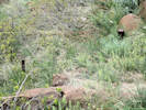
| 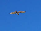
Bird | Photographed 18 February 2016.
Article records that use this photograph:
images/IMGQ1953crop.jpg
| 
Social trail to rim of mesa. | Photographed 18 February 2016.
Article records that use this photograph:
images/IMGQ1944sm.jpg
| 
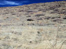
Flat area on flank of North Table Mountain | Photographed 18 February 2016.
Article records that use this photograph:
images/IMGQ1942sm.jpg
| 
The trail up from the switchback. | Photographed 18 February 2016.
Article records that use this photograph:
images/IMGQ1938sm.jpg
| 
North end of Social Trail. | Photographed 3 March 2016.
Article records that use this photograph:
images/IMGQ2034sm.jpg
| 
Social trail at the base of the rim. | Photographed 18 February 2016.
Article records that use this photograph:
images/IMGQ1971sm.jpg
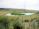
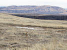
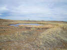
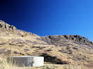
| North Table Mountain Park
| 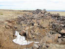
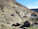
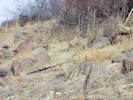
Pit and debris pile at prospect. | Photographed 3 March 2016.
Article records that use this photograph:
images/IMGQ2057sm.jpg
| 
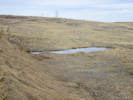
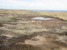
Ephemeral pool from south; artificial dam highlighted. | Photographed 3 March 2016.
Article records that use this photograph:
images/IMGQ2048sm.jpg
| 
North Table Loop from the Mesa Top Trail | Photographed 22 May 2017.
Location records that use this photograph:
Article records that use this photograph:
images/IMGQ3955sm.jpg
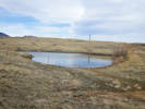
| 
Artificial ephemeral pond; dam in right middleground. | Photographed 3 March 2016.
Article records that use this photograph:
images/IMGQ2045sm.jpg
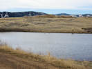
| 
Pond near Mesa Top Trail. | Photographed 20 July 2015.
Location records that use this photograph:
Article records that use this photograph:
images/IMGQ1280sm.jpg
| 
Debris pile of prospect. | Photographed 3 March 2016.
Article records that use this photograph:
images/IMGQ2052sm.jpg
| 
Ephemeral pond beside trail. | Photographed 3 March 2016.
Article records that use this photograph:
images/IMGQ2059sm.jpg
| 
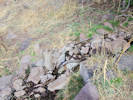
Pond below dam, evidence of leakage. | Photographed 3 March 2016.
Article records that use this photograph:
images/IMGQ2060sm.jpg
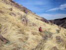
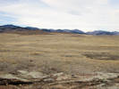
| 
Some things that can be seen from North Table Mountain. | Photographed 5 June 2017. Taken from a small promontory about half way up the northwest face of North Table Mountain, from fore- to background, Ramstetter Reservoir in it eponymously named creek (Jefferson County Open Space land), Colorado Highway 93 from Golden to Boulder, the quarry in the basalt of the Ralston dike (source of the basalt flows capping North and South Table Mountains, the Flatirons near Boulder, Colorado.
Article records that use this photograph:
images/IMGQ3991sm.jpg
| 
View along Neighborhood Access Trail | Photographed 8 November 2015.
images/IMGQ1824sm.jpg
| 
Old road on the side of North Table Mountain. | Photographed 22 May 2017. I made a few collections along this road.
Location records that use this photograph:
Article records that use this photograph:
images/IMGQ3954sm.jpg
| 
Mesa Top Trail, on east side of North Table Mountain. | Photographed 22 May 2017.
Location records that use this photograph:
Article records that use this photograph:
images/IMGQ3953sm.jpg
| 
Small stream on east side of North Table Mountain. | Photographed 22 May 2017.
Location records that use this photograph:
Article records that use this photograph:
images/IMGQ3952sm.jpg
| 
Spray-painted graffiti on North Table Mountain. | Photographed 22 May 2017.
Location records that use this photograph:
Article records that use this photograph:
images/IMGQ3951sm.jpg
| 
Ephemeral pond near Tilting Mesa Trail. | Photographed 3 March 2016.
Article records that use this photograph:
images/IMGQ2064sm.jpg
| 
Northern part of scrapped area; spoils pile in left middleground. | Photographed 3 March 2016.
Article records that use this photograph:
images/IMGQ2065sm.jpg
| 
Spoils piles in scrapped area. | Photographed 3 March 2016.
Article records that use this photograph:
images/IMGQ2066sm.jpg
| 
Small ephemeral pond in disturbed area. | Photographed 3 March 2016.
Article records that use this photograph:
images/IMGQ2067sm.jpg
| 
Pond beside Tilting Mesa Trail. | Photographed 3 March 2016.
Article records that use this photograph:
images/IMGQ2073sm.jpg
| 
Prospect near Tilting Mesa Trail. | Photographed 3 March 2016.
Article records that use this photograph:
images/IMGQ2061sm.jpg
| 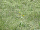
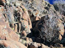
Senecio and Taraxacum for sure, but can you see the Boechera? | Photographed 10 May 2018.
Article records that use this photograph:
images/IMG50166sm.jpg
| 
Junction of Cottonwood Canyon Trail with Mesa Top Trail | Photographed 8 November 2015.
Article records that use this photograph:
images/IMGQ1840sm.jpg
| 
Scrapped area, south side, looking west. | Photographed 3 March 2016.
Article records that use this photograph:
images/IMGQ2043sm.jpg
| 
Small artificial ephemeral pool along south edge of scrapped area. | Photographed 3 March 2016.
Article records that use this photograph:
images/IMGQ2042sm.jpg
| 
Lichen Peak Trail | Photographed 3 March 2016.
Article records that use this photograph:
images/IMGQ2041sm.jpg
| 
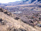
View northwest up Cottonwood Canyon | Photographed 8 November 2015.
Location records that use this photograph:
Article records that use this photograph:
images/IMGQ1822sm.jpg
| 
Old Quarry Road, now part of North Table Loop. | Photographed 8 November 2015.
Article records that use this photograph:
images/IMGQ1869sm.jpg
| 
Location of Collections 1809 to 1812.1 | Photographed 10 May 2018.
Article records that use this photograph:
images/IMG50165sm.jpg
| 
Junipers where Cottonwood Canyon Trail reaches top of the mesa. | Photographed 8 November 2015.
Article records that use this photograph:
images/IMGQ1866sm.jpg
| 
North slope, junction of North Table Loop and Mesa Spur Trail in foreground. | Photographed 10 May 2018.
Location records that use this photograph:
Article records that use this photograph:
images/IMG50170sm.jpg
| 
Easy part of rock scramble. | Photographed 18 February 2016.
Article records that use this photograph:
images/IMGQ1976sm.jpg
| 
Two to three foot steps. | Photographed 18 February 2016.
Article records that use this photograph:
images/IMGQ1973sm.jpg
| 
Rebuilt trail on North Table Loop. | Photographed 24 May 2018.
Location records that use this photograph:
Article records that use this photograph:
images/IMG50238sm.jpg
| | ||||||||