
Eastern Mojave Vegetation
By Tom Schweich
|
Eastern Mojave Vegetation | Images -- Geography - Nevada |
|
By Tom Schweich |
|

Unclassified Geography - Idaho Geography - Park County, CO Geography - Summit County, CO Geography - Arizona Geography - British Columbia Geography - California Geography - California's Colorado Desert Alaska Geography - Mono Lake Basin, California Geography - Mono County, California Geography - San Luis Obispo County, California Geography - Marin County, California Geography - Santa Clara County Alameda Garden Geography - Central Mojave Geography - New Mexico Geography - Eastern Mojave Geography - Northern Mojave Geography - Colorado Geography - Alamosa County, CO Geography - Boulder County, CO Geography - Clear Creek County, CO Geography - Chaffee County, CO Geography - Douglas County, CO Geography - Gilpin County, CO Geography - Golden, Colorado Geography - Weld County, CO Geography - Hinsdale County, CO Geography - Jefferson County, CO Geography - North Table Mountain, Jefferson Cty, CO Geography - Lake County, CO Geography - Larimer County, CO Geography - Nevada Geography - Oregon Geography - Utah Geography - Virginia Geography - Washington Geography - Wyoming Spain - Andalucia Spain - Castilla y Leon Spain - Castilla-La Mancha Spain - Extremadura Spain - Galicia Spain - Madrid Portugal Geology Economic Geology Climatology Botany Salvia dorrii Frasera albomarginata Species Species - Polygonaceae Species - Brassicaceae Species - Brassicaceae, Physaria vitulifera Species - Rosaceae Species - Fabaceae Species - Onagraceae Species - Polemoniaceae Species - Boraginaceae Species - Plantaginaceae Species - Asteraceae Species - Poaceae Zoology Ecology Archeology Customer Satisfaction General Arizona California Kansas Missouri Nebraska New York Christmas 2002 Family Photos Family Documents Family Photos 2003 Art of Lydia Schweich Portraits Railroad Geography - Germany |
Images are organized by the topics listed at left. Click on a topic name to see images with that topic. Would you like to use these photographs in your school term paper or report? License is hereby granted for non-commercial use of the images contained herein provided that the images are reproduced with the copyright notice intact. This means that we give you our permission to use the photographs and information you find here in your school term papers and reports. You may resize the photograph to fit your needs, but you may not remove the copyright. Your term paper should note that the photographs are reproduced with permission and it should have a reference to this web site, such as: "Photograph �1999 Tom Schweich. Used by permission, http://www.schweich.com" If you have a comment or a question about a photograph you may write to me at tas4@schweich.com I will answer you as soon as I can. I sometimes post interesting questions in my FAQ, but I will not disclose your full name or address.
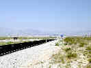
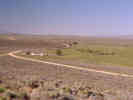
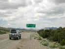
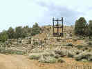
| Caliente
| 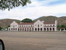
Union Pacific Depot in Caliente, Nevada | Photograph taken June 4, 2009.
Location records that use this photograph:
Article records that use this photograph:
images/IMG01859sm.jpg
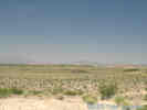
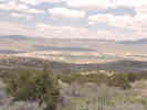
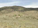
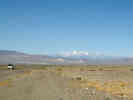
| Churchill County
| 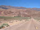
Eastgate in Nevada 772 with Desatoya Mountains in background. |
Location records that use this photograph:
Article records that use this photograph:
images/1340_3152_4275_47sm.jpg
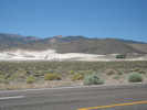
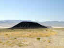
| 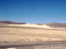
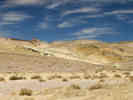
Sand Mountain, as seen from US. Highway 50 | Sand Mountain is a large sand dune a half-mile north of U. S. Highway 50, about 26 miles east of Fallon, Nevada. Sand Mountain is 2 miles long, a mile wide and more than 600 feet high. This perfect hill of fine bleached sand has blown into a box canyon over thousands of years from the flats of Lake Lahontan, an ancient sea now dry. The huge pile of sand is available to ATV enthusiasts who buzz up and down the dune, with the constant winds covering the tracks in short order. About 10,000 years ago glaciers filled many of the valleys in the Sierra Nevada to the west. The cool, wet climate and runoff from these glaciers had created an immense inland lake now known as Lake Lahontan, covered some 8,500 square miles including most of northern and central Nevada and parts of Oregon, Utah, California and Idaho. But as the climate grew warmer and the glaciers retreated, the lake slowly started to dry up. About 4000 years ago the lake level dropped below where Sand Mountain now stands. All that remains are Pyramid and Walker lakes and a handful f dry lake beds such as the Humboldt and Carson sinks, the Black Rock Desert and Winnemucca Lake, near Pyramid Lake. Meanwhile quartz particles, which the glaciers had ground away from the hard Sierra granite, were washed down the Walker River and deposited in the river's delta. As the wind blew across the delta this sand was picked up and carried high into the air. More than thirty miles to the northeast, the wind was slowed by a large basin on the southwest flank of the Stillwater Range. With its force broken by the mountain, the wind's burden of sand would fall into this natural trap. Over the centuries Sand Mountain grew until it reached its present height of almost 600 feet. The wind is constantly changing the shape of Sand Mountain and sometimes the shifting of the sand will produce a soft rustling, or even an eerie booming sound. This unique characteristic has earned Sand Mountain its nickname of "Singing Mountain". The Sand Mountain blue butterfly (Euphilotes pallescens arenamontana) inhabits only this single sand dune in Churchill County.
Location records that use this photograph:
Article records that use this photograph:
images/1340_3152_4275_48sm.jpg
| 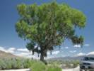
The Shoe Tree | Photograph taken June 2, 2005.
Article records that use this photograph:
images/IMGP1421sm.jpg
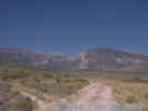
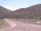
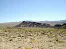
| Churchill County, Fairview Peak
| 
View from the top of the earthquake fault scarp. | Photograph taken June 2, 2005. I was standing on the top of the scarp. Cheryl is at the bottom of the scarp.
Location records that use this photograph:
Article records that use this photograph: images/IMGP1429sm.jpg
| 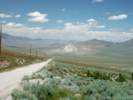
View north from Fairview Peak Road. | Photograph taken June 2, 2005. The little hill in the middleground is Chalk Mountain. The mountain range on the left is the Stillwater Range, with Dixie Valley below them. To the right is the very southern end of the Clan Alpine Mountains.
Location records that use this photograph:
Article records that use this photograph:
images/IMGP1441sm.jpg
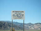
| 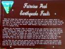
BLM sign at the earthquake faults. | Photograph taken June 2, 2005. When the energy from pressure built up underneath the Earth's thin crust is suddenly released, an earthquake occurs. At first the crust may just bend, But if the stress is great enough, the rocks will break and "snap" to a new position. This usually happens along fractures in the earth known as faults. If the fault lies close to the surface it may become visible following a large earthquake -- the area directly in front of you is an example of this. Between July and December 1954, six earthquakes and two major aftershocks rocked western Nevada and eastern California. The largest of these, measuring 7.3 on the Richter Scale, was centered seven miles west of here and happened on December 16th. These quakes were felt as far away as Elko, NV and Sacramento, CA. More than to miles of faulting were exposed on Fairview Peak and in the Stillwater Range to the northwest. In a matter of moments, the mountains lifted up an average of six feet relative to the surrounding valleys. In some places the mountains rose more than 20 feet! Try to imagine what it must have felt like, and how you would have reacted if you had been camping in this area that day. If you follow this road south, the exposed fault line is clearly visible in several places. Interpretive signs along the road provide more information. About four miles from here a short side road leads to a parking area next to the fault itself. Four-wheel drive vehicles are not usually required to reach this area, however buses and motor homes should stay on the main road.
Location records that use this photograph:
Article records that use this photograph:
images/IMGP1425sm.jpg
| 
Main scarp at Fairview Peak earthquake fault. | Photograph taken June 2, 2005.
Location records that use this photograph:
Article records that use this photograph: images/IMGP1427sm.jpg
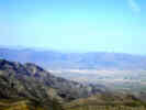
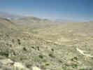
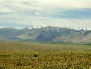
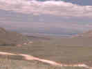
| Clark County
| 
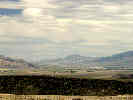
Sandy Valley, looking east from the margin of the Mesquite Mountains. | Looking east, the Spring Mountains in the distance. Potosi Mountain in the distant left.
Location records that use this photograph:
Article records that use this photograph:
images/DSCN0956sm.jpg
| 
Looking west through Columbia Pass. | Photograph taken 27-May-2003. This is photograph number 1700 on my web site.
Location records that use this photograph:
Article records that use this photograph:
images/DSCN0954sm.jpg
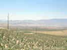
| 
Sandy Valley and the Mesquite Mountains. | This photo was taken from the radio towers near Potosi Mountains. The road through the middle of the photo is Kingston Road.
Location records that use this photograph:
Article records that use this photograph:
images/DSCN0950sm.jpg
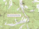
| Clark County, Crystal Pass
| 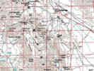
Location of Crystal Pass, Nevada | Type locality of the Crystal Pass Limestone member of the Sultan Limestone.
Location records that use this photograph:
images/nvcrystalpass.jpg
| Clark County, Goodsprings
| 
Goodsprings, Nevada |
Location records that use this photograph:
Article records that use this photograph:
images/0072_3301_0700_39.jpg
| Clark County, Monte Cristo Mine
| 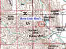
Approximate Location of the Monte Cristo Mine. | The USGS Quadrangle maps don't show the location of the Monte Cristo Mine, but the GNIS gives a latitude and longitude for it.
Location records that use this photograph:
Article records that use this photograph:
images/nvmontecristomine.jpg
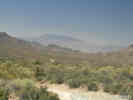
| Clark County, Pahrump Valley
| 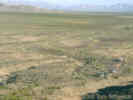
Cross country in southern Pahrump Valley. | Sandy Valley in the distance. Black Butte in the left middle ground, Potosi Mountain in left distance.
Article records that use this photograph:
images/1440-63.jpg
| 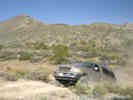
Climbing out of Lovell Wash |
Article records that use this photograph:
images/1440-61.jpg
| 
Pahrump, as seen from the west. | Photograph taken May 24, 2004. We were heading west on Nevada 372 to Shoshone, pulled off the road, and followed a small track to the top of a hill.
Location records that use this photograph:
Article records that use this photograph:
images/IMGP0494sm.jpg
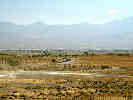
| 
Pahrump, as seen from the south. | Photograph taken May 24, 2004.
Location records that use this photograph:
Article records that use this photograph:
images/IMGP0493sm.jpg
| 
Field trip stop in Pahrump Valley |
Article records that use this photograph:
images/1440-53.jpg
| 
View of Pahrump Valley, looking northwest. |
Article records that use this photograph:
images/1440-55.jpg
| 
Black Butte, Clark County, Nevada |
Location records that use this photograph:
Article records that use this photograph:
images/1440-58.jpg
| Clark County, Potosi Mountain
| 
Potosi Mountain from Nevada Highway 160. |
images/0072_3301_0700_33.jpg
| 
View looking south in Potosi Valley. |
Article records that use this photograph:
images/0072_3301_0700_35.jpg
| 
Kingston Road north of Wilson Pass. |
Article records that use this photograph:
images/0072_3301_0700_37.jpg
| 
Kingston Road south of Wilson Pass. |
Article records that use this photograph:
images/0072_3301_0700_38.jpg
| 
Northern Potosi Valley. |
Article records that use this photograph:
images/0072_3301_0700_36.jpg
| Clark County, Primm
| 
Primm, Nevada, as seen from the northeast slopes of Clark Mountain. |
Location records that use this photograph:
Article records that use this photograph:
images/2907-48.jpg
| Clark County, Sheep Range
| 
View of the Sheep Range from Kyle Canyon Road. |
Location records that use this photograph:
Article records that use this photograph:
images/3201-40.jpg
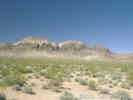
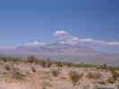
| Clark County, Spring Mountains
| 
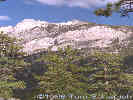
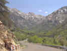
Mt Charleston in the Spring Mountains, Nevada. | Photograph taken in September 1998, from near Kyle Canyon Road.
Article records that use this photograph:
images/3201-56.jpg
| 
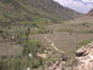
Along the trail in the Spring Mountains. | Looking back at Mount Charleston, from the south side of Lee Canyon.
Article records that use this photograph:
images/3201-50.jpg
| 
Along the trail in the Spring Mountains. | This view of the nearly sheer wall of limestone is seen from the trail at the head of Lee Canyon.
Article records that use this photograph:
images/3201-49.jpg
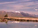
| Clark County, Stump Spring
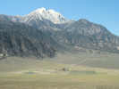
| 
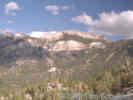
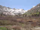
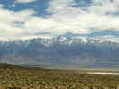
Stump Spring | Mount Charleston, with snow, and the Spring Mountains in the background.
Location records that use this photograph:
Article records that use this photograph:
images/1440-57.jpg
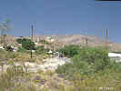
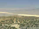
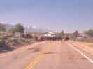
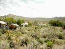
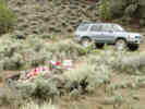
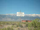
| Coyote Springs
| 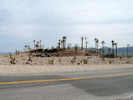
Coyote Springs, home of the palm tree | Photograph taken June 4, 2009.
Article records that use this photograph:
images/IMG01850sm.jpg
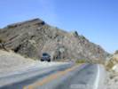
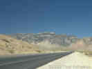
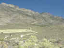
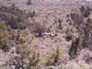
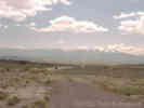
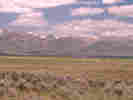
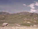
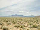
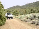
| Delamar Mountains
| 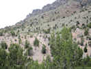
No Frasera albomarginata here. | Photograph taken June 4, 2009.
Article records that use this photograph:
images/IMG01858sm.jpg
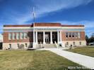
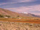
| Douglas County
| 
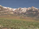
Antelope Valley and the Sierra Nevada | Photograph taken May 26, 2004.
Article records that use this photograph:
images/IMGP0618sm.jpg
| 
Carson Valley Museum and Cultural Center | Photographed 7 March 2014. Stopped here to ask about information about William M. Maule.
Location records that use this photograph:
Article records that use this photograph:
images/IMG_0200sm.jpg
| 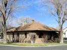
Maule House | Photographed 7 March 2014.
Location records that use this photograph:
Article records that use this photograph: images/IMG_0205sm.jpg
| Elko County
| 
Wild horses in Overland Pass |
Article records that use this photograph:
images/1340_3152_4275_64sm.jpg
| 
View of Elko from Elko Summit |
Location records that use this photograph:
Article records that use this photograph:
images/1340_3152_4275_17sm.jpg
| 
Gallagher State Fish Hatchery in Ruby Valley |
Article records that use this photograph:
images/1340_3152_4275_51sm.jpg
| 
View northeast of Ruby Mountains from Ruby Lake National Wildlife Refuge. |
Article records that use this photograph:
images/1340_3152_4275_52sm.jpg
| 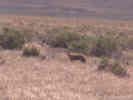
Coyote at Ruby Lake National Wildlife Refuge. | When I drove out on the Brown Dike to the eastern side of the Ruby Lake National Wildlife Refuge I saw this coyote who, while keeping an eye on me, did not seem to be particularly concerned.
Article records that use this photograph:
images/1340_3152_4275_55sm.jpg
| 
Sign showing route of Pony Express trail at south end of Ruby Mountains. |
Article records that use this photograph:
images/1340_3152_4275_63sm.jpg
| 
Settlement of Ruby Valley |
Location records that use this photograph:
Article records that use this photograph:
images/1340_3152_4275_25sm.jpg
| 
Larkspur (Delphinium) near Twin Bridges. |
Article records that use this photograph:
images/1340_3152_4275_67sm.jpg
| 
View south of Smith Creek and Mound Valley. | Stopped just north of Jiggs specifically to take this photograph, of a view I noticed yesterday. The dirt road in the foreground follows Huntington Creek to Twin Bridges. This is the other end of the road where I saw the Larkspurs yesterday. After taking the photograph and driving down to the ranch, I saw the ranchers herding a few cows back into their fields. I assumed that a few of their cows had escaped from pastures in the night.
Article records that use this photograph:
images/1340_3152_4275_68sm.jpg
| 
Traffic jam in Jiggs, Nevada. | As I came around the bend into Jiggs, it became readily apparent why the road was littered with cow poop. The cowboys were using the road to move cows from pasture to pasture. I waited here a few minutes while they finished herding the cows into a field at right, then continued on my way. My car, of course, had a nice aromatic layer of cow poop in the wheel wells and on the rocker panels.
Location records that use this photograph:
Article records that use this photograph:
images/1340_3152_4275_69sm.jpg
| 
Cows along Nevada County Route 788. |
Article records that use this photograph:
images/1340_3152_4275_58sm.jpg
| Elko County, Ruby Mountains
| 
View of Ruby Mountains from Elko Summit. |
Location records that use this photograph:
Article records that use this photograph:
images/1340_3152_4275_16sm.jpg
| 
View up Lamoille Canyon. |
Location records that use this photograph:
Article records that use this photograph:
images/1340_3152_4275_18sm.jpg
| 
View down Lamoille Canyon |
Location records that use this photograph:
Article records that use this photograph:
images/1340_3152_4275_19sm.jpg
| 
Upper reaches of Lamoille Canyon. | Beaver ponds in foreground.
Location records that use this photograph:
Article records that use this photograph:
images/1340_3152_4275_20sm.jpg
| 
Canyon on east side of Ruby Mountains | I think this may be Colonel Moore Canyon because I seem to remember stopping and backing up to this spot just before I passed Ruby Valley School.
Location records that use this photograph:
Article records that use this photograph:
images/1340_3152_4275_24sm.jpg
| 
Smith Creek drainage, west side central Ruby Mountains. |
Article records that use this photograph:
images/1340_3152_4275_65sm.jpg
| 
Wind-clipped vegetation in Harrison Pass. |
Location records that use this photograph:
Article records that use this photograph:
images/1340_3152_4275_62sm.jpg
| 
Looking West from Harrison Pass. |
Location records that use this photograph:
Article records that use this photograph:
images/1340_3152_4275_60sm.jpg
| 
Harrison Pass Road. |
Article records that use this photograph:
images/1340_3152_4275_59sm.jpg
| 
Looking north along Ruby Crest from Harrison Pass. |
Location records that use this photograph:
Article records that use this photograph:
images/1340_3152_4275_61sm.jpg
| 
View of Ruby Mountains from US I-80. | The little bit of orange color in the lower right was a Sphaeralcea.
Location records that use this photograph:
Article records that use this photograph:
images/1340_3152_4275_21sm.jpg
| Esmeralda County
| 
Scene at Fish Lake Hot Well | Photograph taken June 12, 2008.
Location records that use this photograph:
Article records that use this photograph:
images/IMG01062sm.jpg
| 
Fish Lake Hot Well | Photograph taken June 12, 2008.
Location records that use this photograph:
Article records that use this photograph:
images/IMG01063sm.jpg
| 
Postcard of The Crater near Blair, Nevada | Diane Bailey sent me this image of a postcard her great uncle sent from Blair, Nevada.
Location records that use this photograph: Article records that use this photograph:
images/blairpostcard.jpg
| 
Grefco Diatomaceous Earth Mine. | Photograph taken June 12, 2008.
Article records that use this photograph:
images/IMG01064sm.jpg
| 
Queen Valley and White Mountains | Photograph taken June 12, 2008.
Location records that use this photograph:
Article records that use this photograph:
images/IMG01066sm.jpg
| 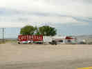
Cottontail Ranch brothel at Lida Junction. | Photograph taken May 25, 2004.
Article records that use this photograph:
images/IMGP0543sm.jpg
| 
Magruder Mountain from the east. | Photograph taken May 25, 2004. This photograph was taken from near the intersection of Nevada Highway 266 and Nevada Highway 774, the road to Gold Point. Magruder Mountain in the right center. The range in right center are the Palmetto Mountains. Lida is in the valley between Magruder Mountain and the Palmetto Mountains.
Location records that use this photograph:
Article records that use this photograph:
images/IMGP0544sm.jpg
| 
Lida | Photograph taken May 25, 2004.
Location records that use this photograph:
Article records that use this photograph:
images/IMGP0545sm.jpg
| 
Lida | Photograph taken May 25, 2004.
Location records that use this photograph:
Article records that use this photograph:
images/IMGP0546sm.jpg
| 
Lida Summit | Photograph taken May 25, 2004. Photograph looking west, as a storm was coming in. The distant mountains with snow are probably the southern end of the White Mountains.
Article records that use this photograph:
images/IMGP0547sm.jpg
| 
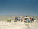
Ecotone between Pinyon forest and Sagebrush | Photograph taken May 25, 2004. This is where I made collections numbered 386 to 398.
Article records that use this photograph:
images/IMGP0551sm.jpg
| 
Nancy Walker grave near Pigeon Spring Mill | Photograph taken May 25, 2004. This is where I made collections numbered 404 to 407.
Article records that use this photograph:
images/IMGP0556sm.jpg
| 
View of Tonopah from the west. | Photograph taken 5-Jun-06.
Location records that use this photograph:
Article records that use this photograph:
images/IMG_0523sm.jpg
| 
Streambed on Palmetto Wash | Photograph taken May 25, 2004.
Article records that use this photograph:
images/IMGP0560sm.jpg
| 
Pigeon Stamp Mill | Photograph taken May 25, 2004.
Location records that use this photograph:
Article records that use this photograph:
images/IMGP0558sm.jpg
| 
White Mountains in California seen from US Hwy95 near Tonopah, Nevada | Photograph taken May 25, 2004. I think the mountain in left center is Mount Barcroft, with Boundary Peak the last high peak to the right.
Location records that use this photograph:
Article records that use this photograph:
images/IMGP0568sm.jpg
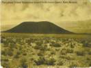
| 
The Crater, a cinder cone in Clayton Valley. | Photograph taken May 25, 2004.
Article records that use this photograph:
images/IMGP0569sm.jpg
| 
The Monocline, basalt-capped fanglomerate. | Photograph taken May 25, 2004.
Article records that use this photograph:
images/IMGP0571sm.jpg
| 
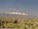
Fish Lake Valley and the White Mountains | Photograph taken May 25, 2004.
Location records that use this photograph:
Article records that use this photograph:
images/IMGP0591sm.jpg
| 
The Sump, Esmeralda County, Nevada | Photograph taken May 25, 2004. Frank DeCourten in The Broken Land: Adventures in Great Basin Geology University of Utah Press, 2003, waxes poetic about a night spent at the Sump with his students. It's a place of clear skies and majestic views in addtion to the many fossils in the mid-Cenozoic graveyard.
Location records that use this photograph:
Article records that use this photograph:
images/IMGP0594sm.jpg
| 
Faulted lake beds in The Sump. | Photograph taken May 25, 2004. The faulting is roughly parallel to the strike of the lake beds.
Location records that use this photograph:
Article records that use this photograph:
images/IMGP0595sm.jpg
| 
Fish Lake Valley from the north. | Photograph taken May 25, 2004.
Location records that use this photograph:
Article records that use this photograph:
images/IMGP0597sm.jpg
| 
Location of Collections 409-417 near Pigeon Spring, Nevada. |
Location records that use this photograph:
Article records that use this photograph:
images/NVEsmPigeonSpr.jpg
| 
Scene at Fish Lake Hot Well | Photograph taken June 12, 2008.
Location records that use this photograph:
Article records that use this photograph:
images/IMG01061sm.jpg
| | |||||||||||||||||||||||